Fullerton Ne Topo Map Nebraska
To zoom in, hover over the map of Fullerton Ne
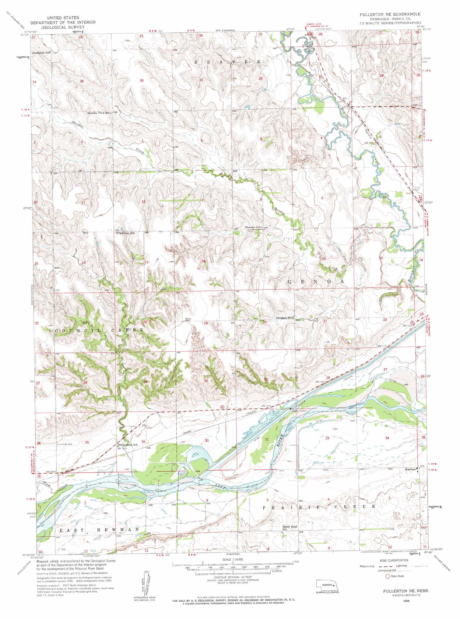
USGS Topo Quad 41097d7 - 1:24,000 scale
| Topo Map Name: | Fullerton Ne |
| USGS Topo Quad ID: | 41097d7 |
| Print Size: | ca. 21 1/4" wide x 27" high |
| Southeast Coordinates: | 41.375° N latitude / 97.75° W longitude |
| Map Center Coordinates: | 41.4375° N latitude / 97.8125° W longitude |
| U.S. State: | NE |
| Filename: | O41097D7.jpg |
| Download Map JPG Image: | Fullerton Ne topo map 1:24,000 scale |
| Map Type: | Topographic |
| Topo Series: | 7.5´ |
| Map Scale: | 1:24,000 |
| Source of Map Images: | United States Geological Survey (USGS) |
| Alternate Map Versions: |
Fullerton NE NE 1958, updated 1959 Download PDF Buy paper map Fullerton NE NE 2011 Download PDF Buy paper map Fullerton NE NE 2014 Download PDF Buy paper map |
1:24,000 Topo Quads surrounding Fullerton Ne
Albion West |
Albion East |
Newman Grove |
Lindsay |
Cornlea |
Cedar Rapids Se |
Saint Edward Sw |
Saint Edward |
Lindsay Sw |
Tarnov |
Belgrade |
Merchiston |
Fullerton Ne |
Genoa |
Monroe |
Belgrade Se |
Fullerton |
Havens |
Silver Creek |
Silver Creek Se |
Hord |
Polk Nw |
Clarks |
Swedehome |
Osceola |
> Back to 41097a1 at 1:100,000 scale
> Back to 41096a1 at 1:250,000 scale
> Back to U.S. Topo Maps home
Fullerton Ne topo map: Gazetteer
Fullerton Ne: Dams
Loup Diversion Dam elevation 481m 1578′Fullerton Ne: Parks
Headworks Park elevation 479m 1571′Loup Lands State Wildlife Management Area elevation 478m 1568′
Fullerton Ne: Populated Places
Krakow elevation 482m 1581′Fullerton Ne: Streams
Council Creek elevation 482m 1581′Plum Creek elevation 483m 1584′
Skeedee Creek elevation 479m 1571′
Fullerton Ne digital topo map on disk
Buy this Fullerton Ne topo map showing relief, roads, GPS coordinates and other geographical features, as a high-resolution digital map file on DVD: