Clarkson Se Topo Map Nebraska
To zoom in, hover over the map of Clarkson Se
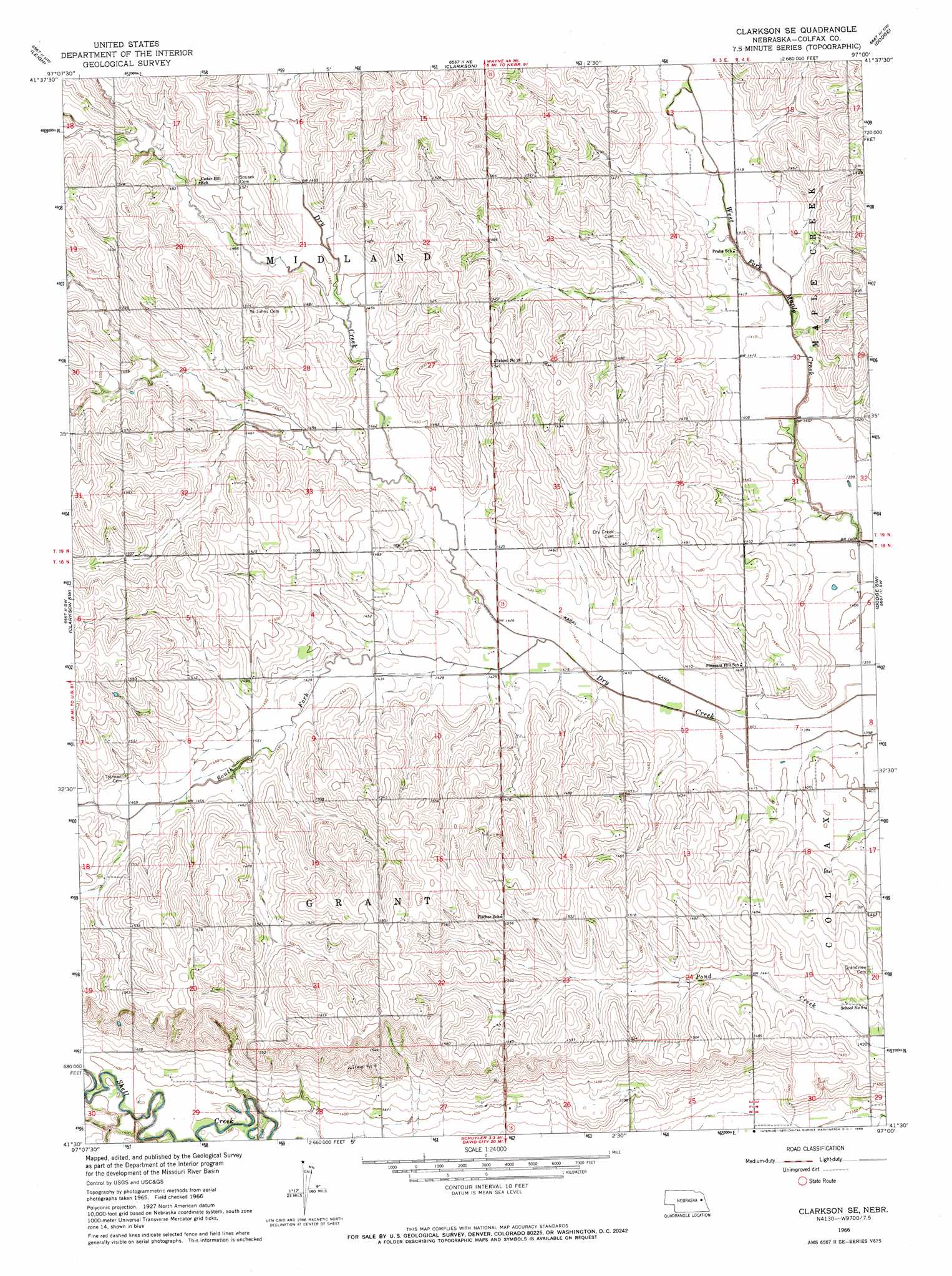
USGS Topo Quad 41097e1 - 1:24,000 scale
| Topo Map Name: | Clarkson Se |
| USGS Topo Quad ID: | 41097e1 |
| Print Size: | ca. 21 1/4" wide x 27" high |
| Southeast Coordinates: | 41.5° N latitude / 97° W longitude |
| Map Center Coordinates: | 41.5625° N latitude / 97.0625° W longitude |
| U.S. State: | NE |
| Filename: | O41097E1.jpg |
| Download Map JPG Image: | Clarkson Se topo map 1:24,000 scale |
| Map Type: | Topographic |
| Topo Series: | 7.5´ |
| Map Scale: | 1:24,000 |
| Source of Map Images: | United States Geological Survey (USGS) |
| Alternate Map Versions: |
Clarkson SE NE 1966, updated 1968 Download PDF Buy paper map Clarkson SE NE 2011 Download PDF Buy paper map Clarkson SE NE 2014 Download PDF Buy paper map |
1:24,000 Topo Quads surrounding Clarkson Se
Madison Se |
Stanton Sw |
Stanton Se |
Aloys |
Monterey |
Creston |
Leigh |
Clarkson |
Dodge |
Snyder |
Humphrey Se |
Clarkson Sw |
Clarkson Se |
Dodge Sw |
Webster |
Columbus |
Richland |
Schuyler |
Rogers |
North Bend |
Columbus Se |
David City West |
David City East |
Bruno |
Prague |
> Back to 41097e1 at 1:100,000 scale
> Back to 41096a1 at 1:250,000 scale
> Back to U.S. Topo Maps home
Clarkson Se topo map: Gazetteer
Clarkson Se: Canals
Kasal Canal elevation 429m 1407′Clarkson Se: Streams
South Fork Dry Creek elevation 429m 1407′Clarkson Se digital topo map on disk
Buy this Clarkson Se topo map showing relief, roads, GPS coordinates and other geographical features, as a high-resolution digital map file on DVD: