Tarnov Topo Map Nebraska
To zoom in, hover over the map of Tarnov
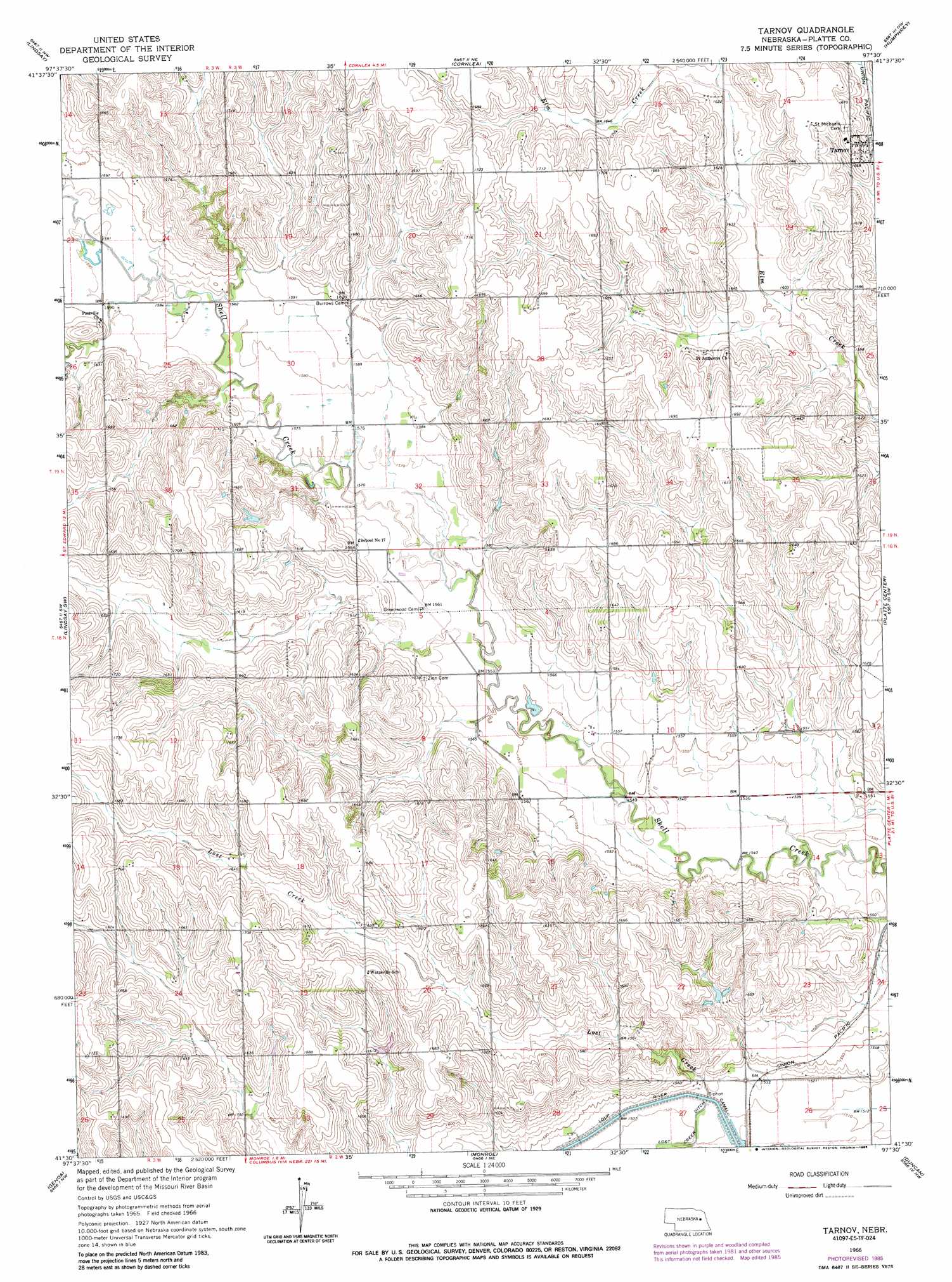
USGS Topo Quad 41097e5 - 1:24,000 scale
| Topo Map Name: | Tarnov |
| USGS Topo Quad ID: | 41097e5 |
| Print Size: | ca. 21 1/4" wide x 27" high |
| Southeast Coordinates: | 41.5° N latitude / 97.5° W longitude |
| Map Center Coordinates: | 41.5625° N latitude / 97.5625° W longitude |
| U.S. State: | NE |
| Filename: | O41097E5.jpg |
| Download Map JPG Image: | Tarnov topo map 1:24,000 scale |
| Map Type: | Topographic |
| Topo Series: | 7.5´ |
| Map Scale: | 1:24,000 |
| Source of Map Images: | United States Geological Survey (USGS) |
| Alternate Map Versions: |
Tarnov NE 1966, updated 1967 Download PDF Buy paper map Tarnov NE 1966, updated 1985 Download PDF Buy paper map Tarnov NE 2011 Download PDF Buy paper map Tarnov NE 2014 Download PDF Buy paper map |
1:24,000 Topo Quads surrounding Tarnov
Closter Se |
Battle Creek Sw |
Battle Creek Se |
Madison |
Madison Se |
Newman Grove |
Lindsay |
Cornlea |
Humphrey |
Creston |
Saint Edward |
Lindsay Sw |
Tarnov |
Platte Center |
Humphrey Se |
Fullerton Ne |
Genoa |
Monroe |
Duncan |
Columbus |
Havens |
Silver Creek |
Silver Creek Se |
Columbus Sw |
Columbus Se |
> Back to 41097e1 at 1:100,000 scale
> Back to 41096a1 at 1:250,000 scale
> Back to U.S. Topo Maps home
Tarnov topo map: Gazetteer
Tarnov: Populated Places
Tarnov elevation 503m 1650′Tarnov: Post Offices
Saint Anthony Post Office (historical) elevation 504m 1653′Tarnov Post Office (historical) elevation 503m 1650′
Tarnov: Streams
Lost Creek elevation 464m 1522′Tarnov digital topo map on disk
Buy this Tarnov topo map showing relief, roads, GPS coordinates and other geographical features, as a high-resolution digital map file on DVD: