Albion East Topo Map Nebraska
To zoom in, hover over the map of Albion East
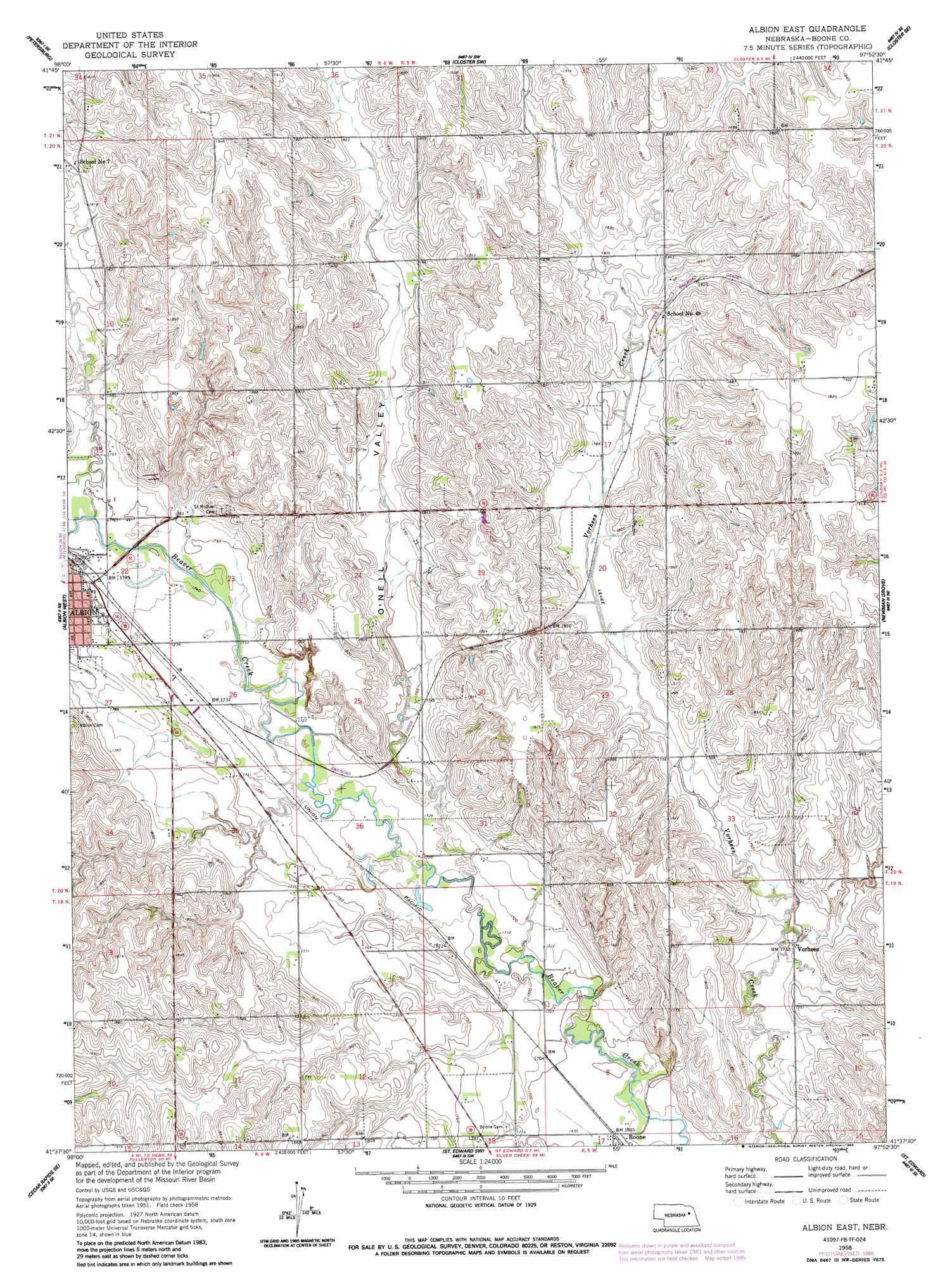
USGS Topo Quad 41097f8 - 1:24,000 scale
| Topo Map Name: | Albion East |
| USGS Topo Quad ID: | 41097f8 |
| Print Size: | ca. 21 1/4" wide x 27" high |
| Southeast Coordinates: | 41.625° N latitude / 97.875° W longitude |
| Map Center Coordinates: | 41.6875° N latitude / 97.9375° W longitude |
| U.S. State: | NE |
| Filename: | O41097F8.jpg |
| Download Map JPG Image: | Albion East topo map 1:24,000 scale |
| Map Type: | Topographic |
| Topo Series: | 7.5´ |
| Map Scale: | 1:24,000 |
| Source of Map Images: | United States Geological Survey (USGS) |
| Alternate Map Versions: |
Albion East NE 1958, updated 1960 Download PDF Buy paper map Albion East NE 1958, updated 1985 Download PDF Buy paper map Albion East NE 2011 Download PDF Buy paper map Albion East NE 2014 Download PDF Buy paper map |
1:24,000 Topo Quads surrounding Albion East
Elgin Nw |
Elgin |
Closter |
Closter Ne |
Emerick |
Elgin Sw |
Petersburg |
Closter Sw |
Closter Se |
Battle Creek Sw |
Akron |
Albion West |
Albion East |
Newman Grove |
Lindsay |
Cedar Rapids |
Cedar Rapids Se |
Saint Edward Sw |
Saint Edward |
Lindsay Sw |
Belgrade Nw |
Belgrade |
Merchiston |
Fullerton Ne |
Genoa |
> Back to 41097e1 at 1:100,000 scale
> Back to 41096a1 at 1:250,000 scale
> Back to U.S. Topo Maps home
Albion East topo map: Gazetteer
Albion East: Dams
Choat Dam elevation 541m 1774′Albion East: Parks
Ben Bowman Kiwanis Roadside Park elevation 531m 1742′Albion East: Populated Places
Boone elevation 516m 1692′Vorhees elevation 529m 1735′
Albion East: Post Offices
Boone Post Office elevation 516m 1692′Albion East: Reservoirs
Choat Reservoir elevation 541m 1774′Albion East: Valleys
O'Neil Valley elevation 526m 1725′Albion East digital topo map on disk
Buy this Albion East topo map showing relief, roads, GPS coordinates and other geographical features, as a high-resolution digital map file on DVD: