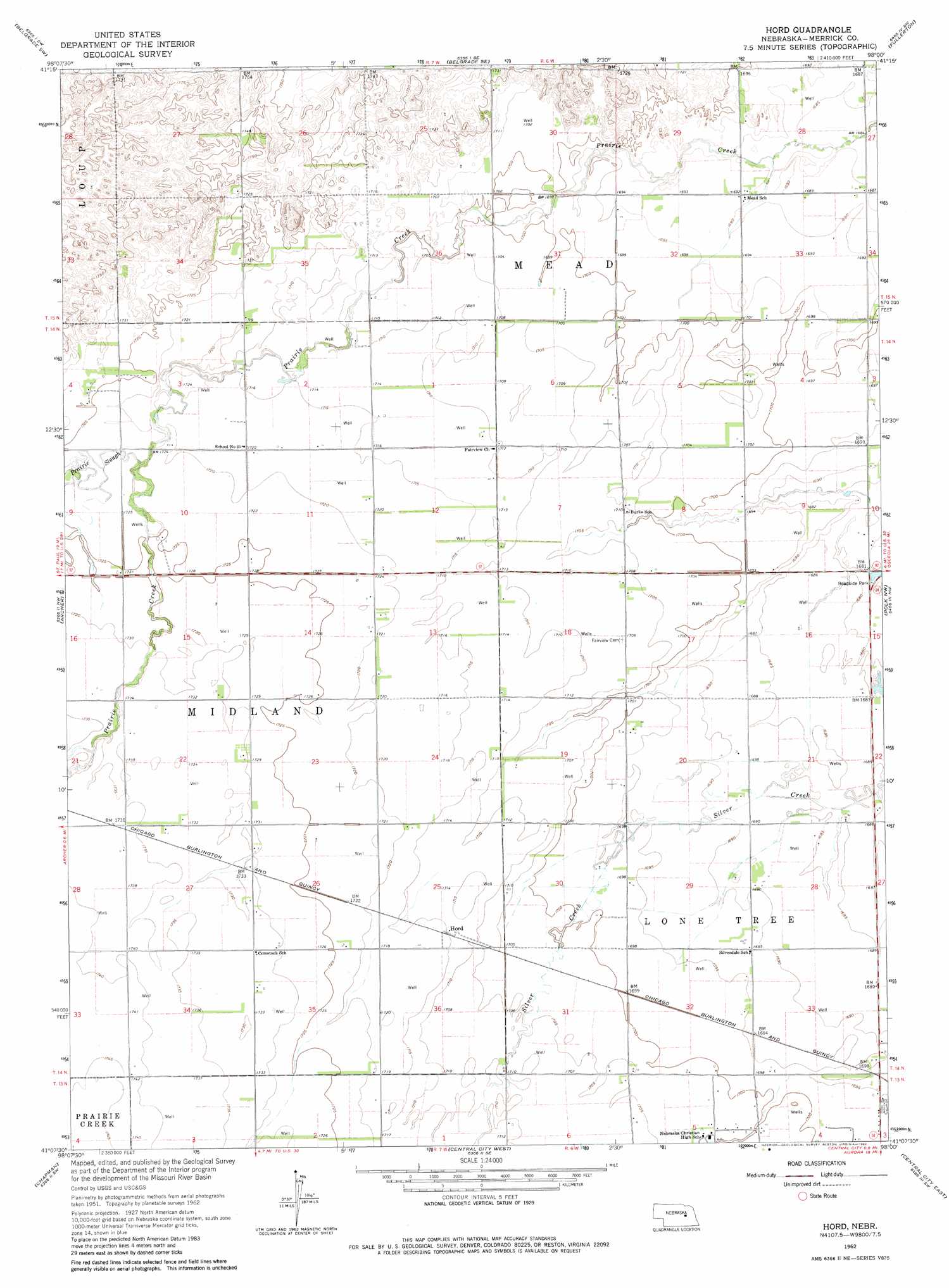
Hord Topo Map Nebraska
To zoom in, hover over the map of Hord
USGS Topo Quad 41098b1 - 1:24,000 scale
| Topo Map Name: | Hord |
| USGS Topo Quad ID: | 41098b1 |
| Print Size: | ca. 21 1/4" wide x 27" high |
| Southeast Coordinates: | 41.125° N latitude / 98° W longitude |
| Map Center Coordinates: | 41.1875° N latitude / 98.0625° W longitude |
| U.S. State: | NE |
| Filename: | O41098B1.jpg |
| Download Map JPG Image: | Hord topo map 1:24,000 scale |
| Map Type: | Topographic |
| Topo Series: | 7.5´ |
| Map Scale: | 1:24,000 |
| Source of Map Images: | United States Geological Survey (USGS) |
| Alternate Map Versions: |
Hord NE 1962, updated 1963 Download PDF Buy paper map Hord NE 1962, updated 1982 Download PDF Buy paper map Hord NE 2011 Download PDF Buy paper map Hord NE 2014 Download PDF Buy paper map |
1:24,000 Topo Quads surrounding Hord
Wolbach Ne |
Belgrade Nw |
Belgrade |
Merchiston |
Fullerton Ne |
Cushing |
Belgrade Sw |
Belgrade Se |
Fullerton |
Havens |
Palmer |
Archer |
Hord |
Polk Nw |
Clarks |
Saint Lebory |
Chapman |
Central City West |
Central City East |
Polk |
Grand Island |
Phillips |
Murphy |
Hampton |
Henderson Ne |
> Back to 41098a1 at 1:100,000 scale
> Back to 41098a1 at 1:250,000 scale
> Back to U.S. Topo Maps home
Hord digital topo map on disk
Buy this Hord topo map showing relief, roads, GPS coordinates and other geographical features, as a high-resolution digital map file on DVD: