Nysted Topo Map Nebraska
To zoom in, hover over the map of Nysted
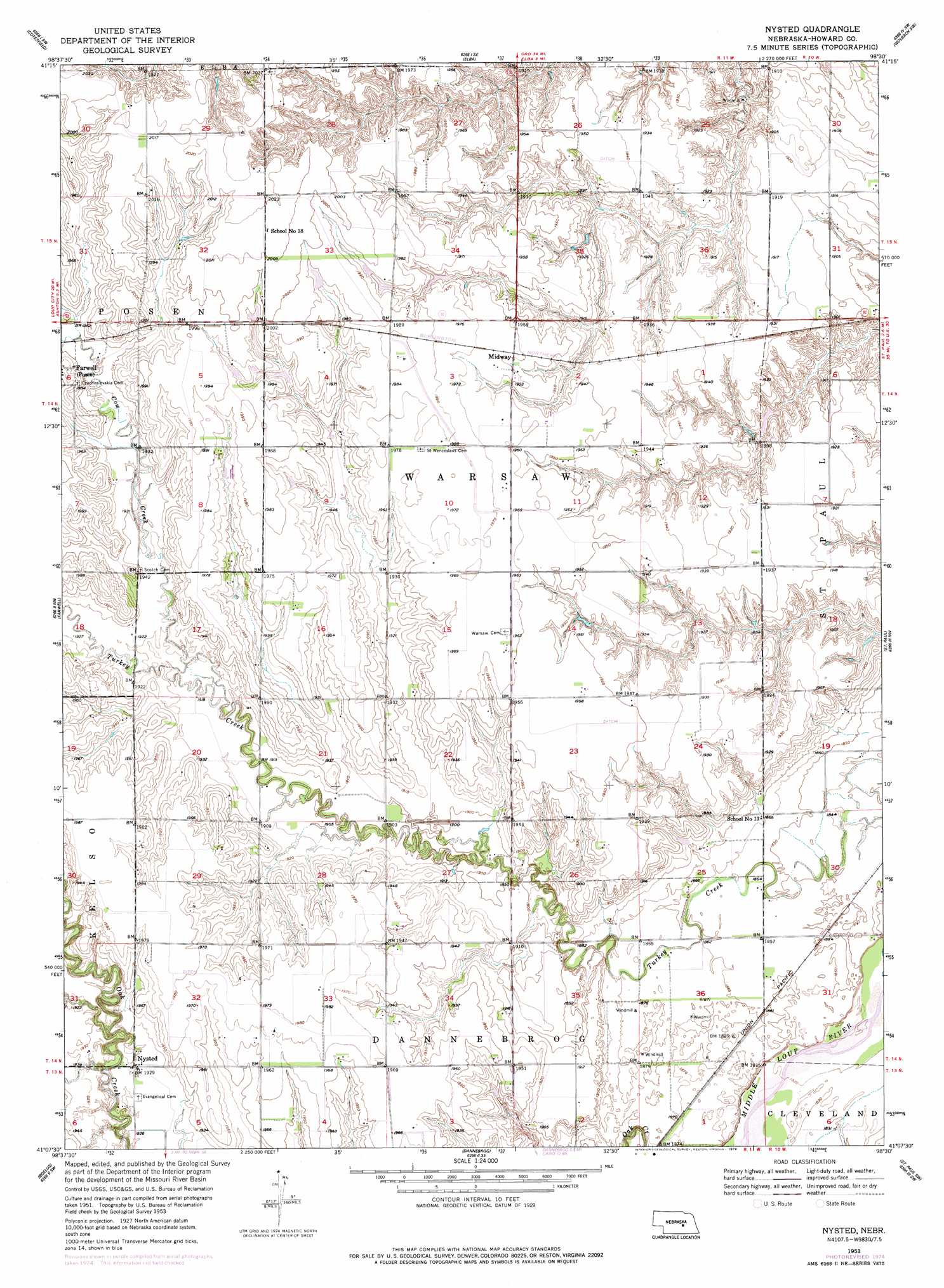
USGS Topo Quad 41098b5 - 1:24,000 scale
| Topo Map Name: | Nysted |
| USGS Topo Quad ID: | 41098b5 |
| Print Size: | ca. 21 1/4" wide x 27" high |
| Southeast Coordinates: | 41.125° N latitude / 98.5° W longitude |
| Map Center Coordinates: | 41.1875° N latitude / 98.5625° W longitude |
| U.S. State: | NE |
| Filename: | O41098B5.jpg |
| Download Map JPG Image: | Nysted topo map 1:24,000 scale |
| Map Type: | Topographic |
| Topo Series: | 7.5´ |
| Map Scale: | 1:24,000 |
| Source of Map Images: | United States Geological Survey (USGS) |
| Alternate Map Versions: |
Nysted NE 1953, updated 1955 Download PDF Buy paper map Nysted NE 1953, updated 1978 Download PDF Buy paper map Nysted NE 2011 Download PDF Buy paper map Nysted NE 2014 Download PDF Buy paper map |
1:24,000 Topo Quads surrounding Nysted
North Loup |
Scotia |
Scotia Ne |
Wolbach |
Wolbach Ne |
Loup City Se |
Cotesfield |
Elba |
Wolbach Sw |
Cushing |
Ashton |
Farwell |
Nysted |
Saint Paul |
Palmer |
Rockville |
Boelus |
Dannebrog |
Saint Paul Sw |
Saint Lebory |
Poole Ne |
Cameron |
Shelton Ne |
Abbott |
Grand Island |
> Back to 41098a1 at 1:100,000 scale
> Back to 41098a1 at 1:250,000 scale
> Back to U.S. Topo Maps home
Nysted topo map: Gazetteer
Nysted: Dams
Jacobs Waste Treatment Dam elevation 598m 1961′Jensen Dam elevation 585m 1919′
Ransom Dam elevation 567m 1860′
Nysted: Parks
Saint Wenceslaus Cemetery Historical Marker elevation 603m 1978′Nysted: Populated Places
Midway elevation 598m 1961′Nysted elevation 589m 1932′
Nysted: Post Offices
Nysted Post Office (historical) elevation 589m 1932′Nysted: Reservoirs
Jacobs Waste Treatment Reservoir elevation 598m 1961′Jensen Reservoir elevation 585m 1919′
Ransom Reservoir elevation 567m 1860′
Nysted: Streams
Cow Creek elevation 581m 1906′Nysted digital topo map on disk
Buy this Nysted topo map showing relief, roads, GPS coordinates and other geographical features, as a high-resolution digital map file on DVD: