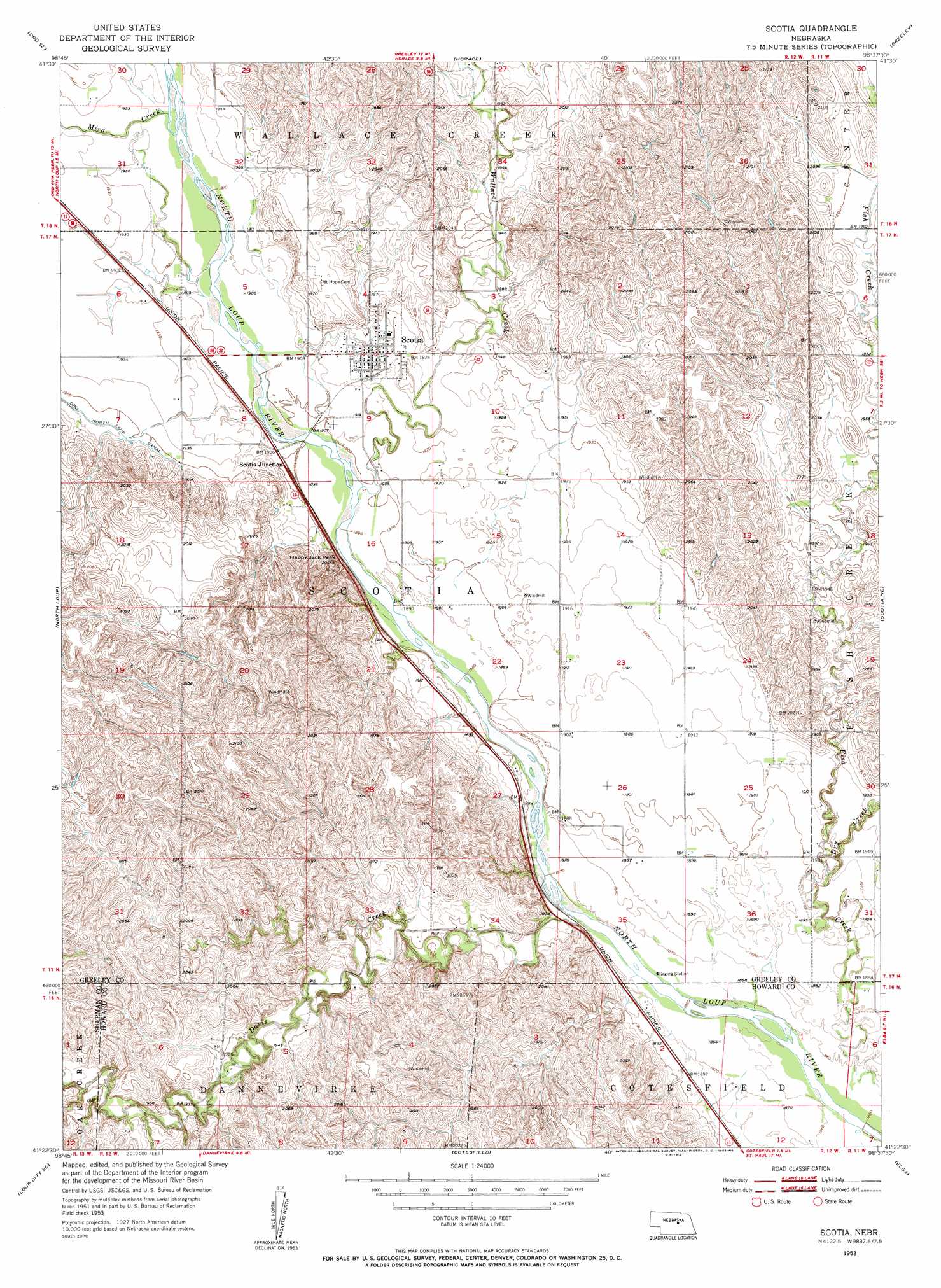
Scotia Topo Map Nebraska
To zoom in, hover over the map of Scotia
USGS Topo Quad 41098d6 - 1:24,000 scale
| Topo Map Name: | Scotia |
| USGS Topo Quad ID: | 41098d6 |
| Print Size: | ca. 21 1/4" wide x 27" high |
| Southeast Coordinates: | 41.375° N latitude / 98.625° W longitude |
| Map Center Coordinates: | 41.4375° N latitude / 98.6875° W longitude |
| U.S. State: | NE |
| Filename: | O41098D6.jpg |
| Download Map JPG Image: | Scotia topo map 1:24,000 scale |
| Map Type: | Topographic |
| Topo Series: | 7.5´ |
| Map Scale: | 1:24,000 |
| Source of Map Images: | United States Geological Survey (USGS) |
| Alternate Map Versions: |
Scotia NE 1953, updated 1955 Download PDF Buy paper map Scotia NE 1953, updated 1955 Download PDF Buy paper map Scotia NE 2011 Download PDF Buy paper map Scotia NE 2014 Download PDF Buy paper map |
1:24,000 Topo Quads surrounding Scotia
Ord Nw |
Ord Ne |
Greeley Nw |
Greeley Ne |
Spalding Nw |
Ord |
Ord Se |
Horace |
Greeley |
Spalding Sw |
Loup City Nw |
North Loup |
Scotia |
Scotia Ne |
Wolbach |
Loup City |
Loup City Se |
Cotesfield |
Elba |
Wolbach Sw |
Ravenna Nw |
Ashton |
Farwell |
Nysted |
Saint Paul |
> Back to 41098a1 at 1:100,000 scale
> Back to 41098a1 at 1:250,000 scale
> Back to U.S. Topo Maps home
Scotia topo map: Gazetteer
Scotia: Airports
Scotia Airport elevation 589m 1932′Scotia: Dams
Davis Creek Dam elevation 608m 1994′Scotia: Parks
Chalk Mine Historical Marker (historical) elevation 604m 1981′Scotia: Populated Places
Scotia elevation 588m 1929′Scotia Junction elevation 581m 1906′
Scotia: Post Offices
Scotia Post Office elevation 587m 1925′Scotia: Reservoirs
Davis Creek Reservoir elevation 608m 1994′Scotia: Streams
Boxelder Creek elevation 610m 2001′Davis Creek elevation 569m 1866′
Dry Creek elevation 574m 1883′
Mira Creek elevation 583m 1912′
Wallace Creek elevation 577m 1893′
Scotia: Summits
Happy Jack Peak elevation 624m 2047′Scotia digital topo map on disk
Buy this Scotia topo map showing relief, roads, GPS coordinates and other geographical features, as a high-resolution digital map file on DVD: