Cedar Rapids Topo Map Nebraska
To zoom in, hover over the map of Cedar Rapids
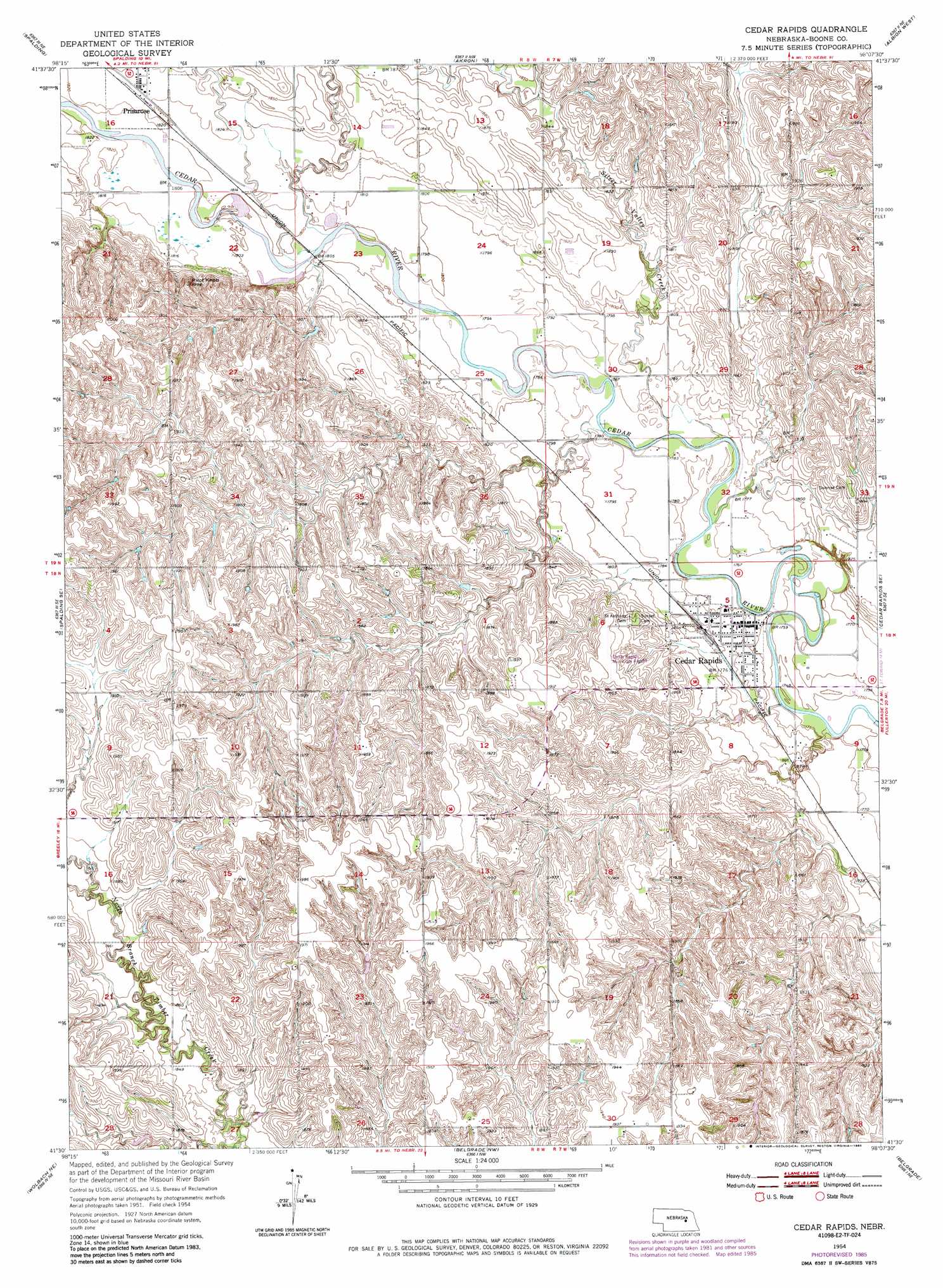
USGS Topo Quad 41098e2 - 1:24,000 scale
| Topo Map Name: | Cedar Rapids |
| USGS Topo Quad ID: | 41098e2 |
| Print Size: | ca. 21 1/4" wide x 27" high |
| Southeast Coordinates: | 41.5° N latitude / 98.125° W longitude |
| Map Center Coordinates: | 41.5625° N latitude / 98.1875° W longitude |
| U.S. State: | NE |
| Filename: | O41098E2.jpg |
| Download Map JPG Image: | Cedar Rapids topo map 1:24,000 scale |
| Map Type: | Topographic |
| Topo Series: | 7.5´ |
| Map Scale: | 1:24,000 |
| Source of Map Images: | United States Geological Survey (USGS) |
| Alternate Map Versions: |
Cedar Rapids NE 1954, updated 1956 Download PDF Buy paper map Cedar Rapids NE 1954, updated 1978 Download PDF Buy paper map Cedar Rapids NE 1954, updated 1985 Download PDF Buy paper map Cedar Rapids NE 2011 Download PDF Buy paper map Cedar Rapids NE 2014 Download PDF Buy paper map |
1:24,000 Topo Quads surrounding Cedar Rapids
Spalding 2 Sw |
Spalding 2 Se |
Elgin Sw |
Petersburg |
Closter Sw |
Spalding Nw |
Spalding |
Akron |
Albion West |
Albion East |
Spalding Sw |
Spalding Se |
Cedar Rapids |
Cedar Rapids Se |
Saint Edward Sw |
Wolbach |
Wolbach Ne |
Belgrade Nw |
Belgrade |
Merchiston |
Wolbach Sw |
Cushing |
Belgrade Sw |
Belgrade Se |
Fullerton |
> Back to 41098e1 at 1:100,000 scale
> Back to 41098a1 at 1:250,000 scale
> Back to U.S. Topo Maps home
Cedar Rapids topo map: Gazetteer
Cedar Rapids: Airports
Cedar Rapids Municipal Airport elevation 575m 1886′Cedar Rapids: Parks
Cedar Rapids City Park elevation 538m 1765′Cedar Rapids: Populated Places
Cedar Rapids elevation 538m 1765′Primrose elevation 556m 1824′
Cedar Rapids: Post Offices
Cedar Rapids Post Office elevation 538m 1765′Primrose Post Office elevation 556m 1824′
Cedar Rapids: Streams
Silver Valley Creek elevation 540m 1771′Cedar Rapids: Summits
Pilot Knob elevation 607m 1991′Cedar Rapids digital topo map on disk
Buy this Cedar Rapids topo map showing relief, roads, GPS coordinates and other geographical features, as a high-resolution digital map file on DVD: