Horace Topo Map Nebraska
To zoom in, hover over the map of Horace
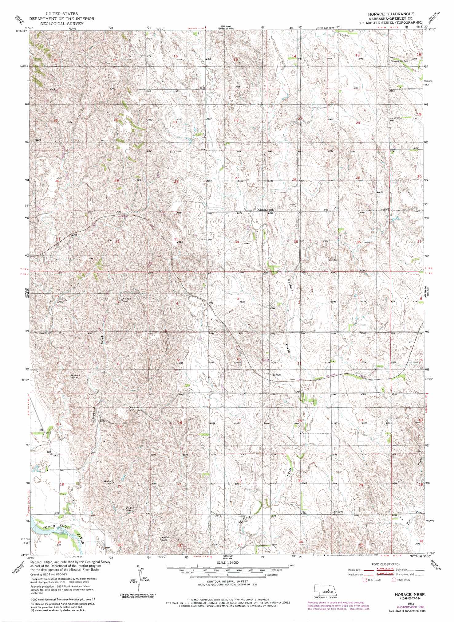
USGS Topo Quad 41098e6 - 1:24,000 scale
| Topo Map Name: | Horace |
| USGS Topo Quad ID: | 41098e6 |
| Print Size: | ca. 21 1/4" wide x 27" high |
| Southeast Coordinates: | 41.5° N latitude / 98.625° W longitude |
| Map Center Coordinates: | 41.5625° N latitude / 98.6875° W longitude |
| U.S. State: | NE |
| Filename: | O41098E6.jpg |
| Download Map JPG Image: | Horace topo map 1:24,000 scale |
| Map Type: | Topographic |
| Topo Series: | 7.5´ |
| Map Scale: | 1:24,000 |
| Source of Map Images: | United States Geological Survey (USGS) |
| Alternate Map Versions: |
Horace NE 1954, updated 1955 Download PDF Buy paper map Horace NE 1954, updated 1978 Download PDF Buy paper map Horace NE 1954, updated 1985 Download PDF Buy paper map Horace NE 2011 Download PDF Buy paper map Horace NE 2014 Download PDF Buy paper map |
1:24,000 Topo Quads surrounding Horace
Gables Sw |
Gables Se |
Ericson |
Bartlett Se |
Spalding 2 Sw |
Ord Nw |
Ord Ne |
Greeley Nw |
Greeley Ne |
Spalding Nw |
Ord |
Ord Se |
Horace |
Greeley |
Spalding Sw |
Loup City Nw |
North Loup |
Scotia |
Scotia Ne |
Wolbach |
Loup City |
Loup City Se |
Cotesfield |
Elba |
Wolbach Sw |
> Back to 41098e1 at 1:100,000 scale
> Back to 41098a1 at 1:250,000 scale
> Back to U.S. Topo Maps home
Horace topo map: Gazetteer
Horace: Populated Places
Horace elevation 628m 2060′Horace: Post Offices
Horace Post Office (historical) elevation 628m 2060′Horace: Streams
Shephard Creek elevation 585m 1919′Horace digital topo map on disk
Buy this Horace topo map showing relief, roads, GPS coordinates and other geographical features, as a high-resolution digital map file on DVD: