Gables Nw Topo Map Nebraska
To zoom in, hover over the map of Gables Nw
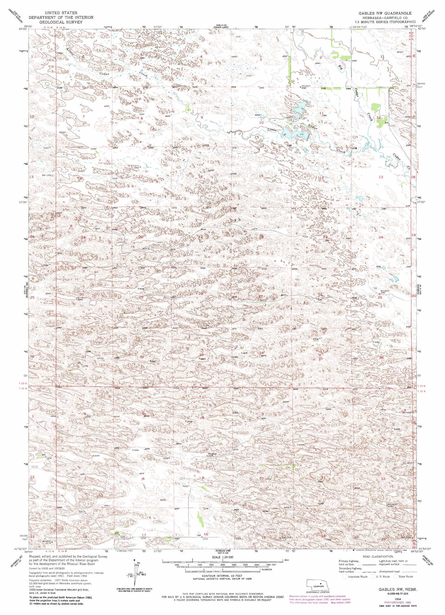
USGS Topo Quad 41098h8 - 1:24,000 scale
| Topo Map Name: | Gables Nw |
| USGS Topo Quad ID: | 41098h8 |
| Print Size: | ca. 21 1/4" wide x 27" high |
| Southeast Coordinates: | 41.875° N latitude / 98.875° W longitude |
| Map Center Coordinates: | 41.9375° N latitude / 98.9375° W longitude |
| U.S. State: | NE |
| Filename: | O41098H8.jpg |
| Download Map JPG Image: | Gables Nw topo map 1:24,000 scale |
| Map Type: | Topographic |
| Topo Series: | 7.5´ |
| Map Scale: | 1:24,000 |
| Source of Map Images: | United States Geological Survey (USGS) |
| Alternate Map Versions: |
Gables NW NE 1954, updated 1956 Download PDF Buy paper map Gables NW NE 1954, updated 1978 Download PDF Buy paper map Gables NW NE 1954, updated 1985 Download PDF Buy paper map Gables NW NE 2011 Download PDF Buy paper map Gables NW NE 2014 Download PDF Buy paper map |
1:24,000 Topo Quads surrounding Gables Nw
Bruner Lake |
Swan Lake |
Amelia |
Chambers West |
Chambers East |
Carson Lake |
Abbott Ranch |
Chain Lake |
Miles Ranch |
Goose Lake Sw |
Burwell Nw |
Burwell Ne |
Gables Nw |
Gables |
Bartlett Nw |
Burwell |
Burwell Se |
Gables Sw |
Gables Se |
Ericson |
Comstock Nw |
Elyria |
Ord Nw |
Ord Ne |
Greeley Nw |
> Back to 41098e1 at 1:100,000 scale
> Back to 41098a1 at 1:250,000 scale
> Back to U.S. Topo Maps home
Gables Nw topo map: Gazetteer
Gables Nw: Streams
Big Cedar Creek elevation 663m 2175′Little Cedar Creek elevation 663m 2175′
Gables Nw digital topo map on disk
Buy this Gables Nw topo map showing relief, roads, GPS coordinates and other geographical features, as a high-resolution digital map file on DVD: