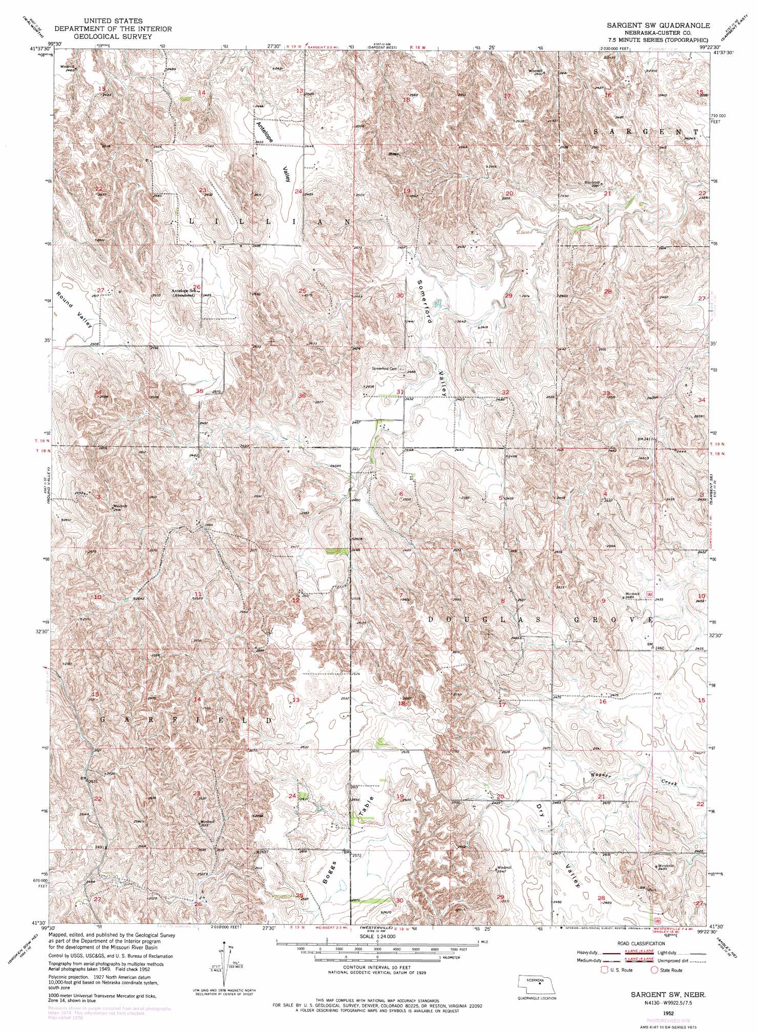
Sargent Sw Topo Map Nebraska
To zoom in, hover over the map of Sargent Sw
USGS Topo Quad 41099e4 - 1:24,000 scale
| Topo Map Name: | Sargent Sw |
| USGS Topo Quad ID: | 41099e4 |
| Print Size: | ca. 21 1/4" wide x 27" high |
| Southeast Coordinates: | 41.5° N latitude / 99.375° W longitude |
| Map Center Coordinates: | 41.5625° N latitude / 99.4375° W longitude |
| U.S. State: | NE |
| Filename: | O41099E4.jpg |
| Download Map JPG Image: | Sargent Sw topo map 1:24,000 scale |
| Map Type: | Topographic |
| Topo Series: | 7.5´ |
| Map Scale: | 1:24,000 |
| Source of Map Images: | United States Geological Survey (USGS) |
| Alternate Map Versions: |
Sargent SW NE 1952, updated 1954 Download PDF Buy paper map Sargent SW NE 1952, updated 1978 Download PDF Buy paper map Sargent SW NE 2011 Download PDF Buy paper map Sargent SW NE 2014 Download PDF Buy paper map |
1:24,000 Topo Quads surrounding Sargent Sw
Almeria Sw |
Almeria |
Taylor |
Taylor Se |
Burwell |
Milburn |
Walworth |
Sargent West |
Sargent East |
Comstock Nw |
Lillian |
Round Valley |
Sargent Sw |
Sargent Se |
Comstock |
Broken Bow |
Broken Bow Ne |
Westerville |
Ansley Ne |
Arcadia West |
Broken Bow Sw |
Broken Bow Se |
Ansley |
Ansley Se |
Arcadia Sw |
> Back to 41099e1 at 1:100,000 scale
> Back to 41098a1 at 1:250,000 scale
> Back to U.S. Topo Maps home
Sargent Sw topo map: Gazetteer
Sargent Sw: Populated Places
Elton (historical) elevation 769m 2522′Sargent Sw: Post Offices
Coburgh Post Office (historical) elevation 750m 2460′Elton Post Office (historical) elevation 769m 2522′
Somerford Post Office (historical) elevation 742m 2434′
Sargent Sw: Summits
Boggs Table elevation 787m 2582′Sargent Sw: Valleys
Antelope Valley elevation 753m 2470′Somerford Valley elevation 736m 2414′
Sargent Sw digital topo map on disk
Buy this Sargent Sw topo map showing relief, roads, GPS coordinates and other geographical features, as a high-resolution digital map file on DVD: