Ringgold Topo Map Nebraska
To zoom in, hover over the map of Ringgold
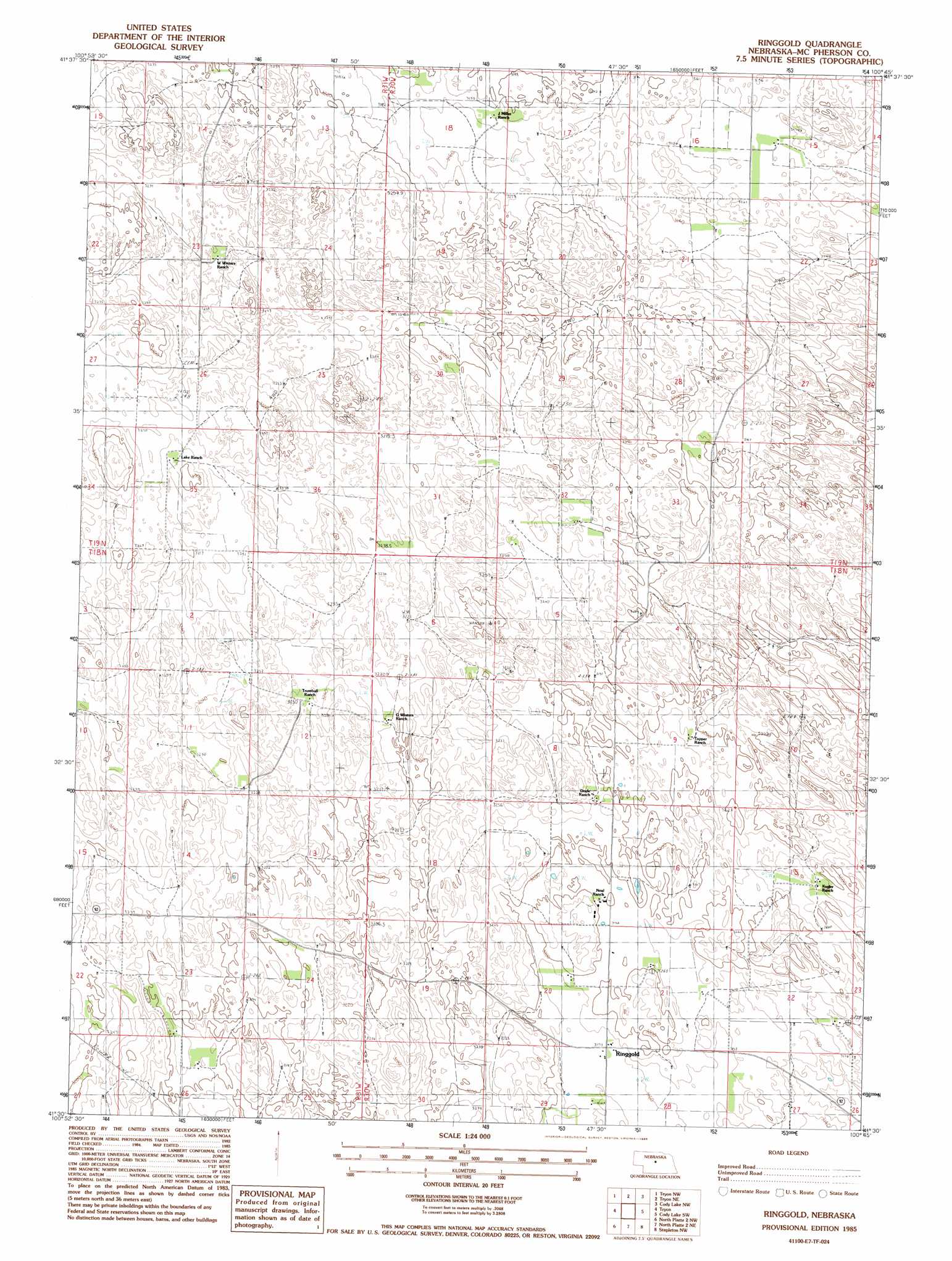
USGS Topo Quad 41100e7 - 1:24,000 scale
| Topo Map Name: | Ringgold |
| USGS Topo Quad ID: | 41100e7 |
| Print Size: | ca. 21 1/4" wide x 27" high |
| Southeast Coordinates: | 41.5° N latitude / 100.75° W longitude |
| Map Center Coordinates: | 41.5625° N latitude / 100.8125° W longitude |
| U.S. State: | NE |
| Filename: | O41100e7.jpg |
| Download Map JPG Image: | Ringgold topo map 1:24,000 scale |
| Map Type: | Topographic |
| Topo Series: | 7.5´ |
| Map Scale: | 1:24,000 |
| Source of Map Images: | United States Geological Survey (USGS) |
| Alternate Map Versions: |
Ringgold NE 1985, updated 1986 Download PDF Buy paper map Ringgold NE 2011 Download PDF Buy paper map Ringgold NE 2014 Download PDF Buy paper map |
1:24,000 Topo Quads surrounding Ringgold
Dismal River Ranch |
Shimmins Lake |
Shimmins Lake Se |
Thedford Sw |
Thedford Se |
Wright Valley Ne |
Tryon Nw |
Tryon Ne |
Cody Lake Nw |
Happy Hollow |
Schneringer Valley |
Tryon |
Ringgold |
Cody Lake Sw |
Cody Lake |
Pierson Ranch |
North Platte 2 Nw |
North Platte 2 Ne |
Stapleton Nw |
Stapleton |
Green Ranch |
North Platte 2 Sw |
North Platte 2 Se |
Stapleton Sw |
Stapleton Se |
> Back to 41100e1 at 1:100,000 scale
> Back to 41100a1 at 1:250,000 scale
> Back to U.S. Topo Maps home
Ringgold topo map: Gazetteer
Ringgold: Airports
Trumbull Ranch Airport elevation 994m 3261′Ringgold: Populated Places
Ringgold elevation 968m 3175′Ringgold: Post Offices
Ringgold Post Office (historical) elevation 968m 3175′Ringgold digital topo map on disk
Buy this Ringgold topo map showing relief, roads, GPS coordinates and other geographical features, as a high-resolution digital map file on DVD: