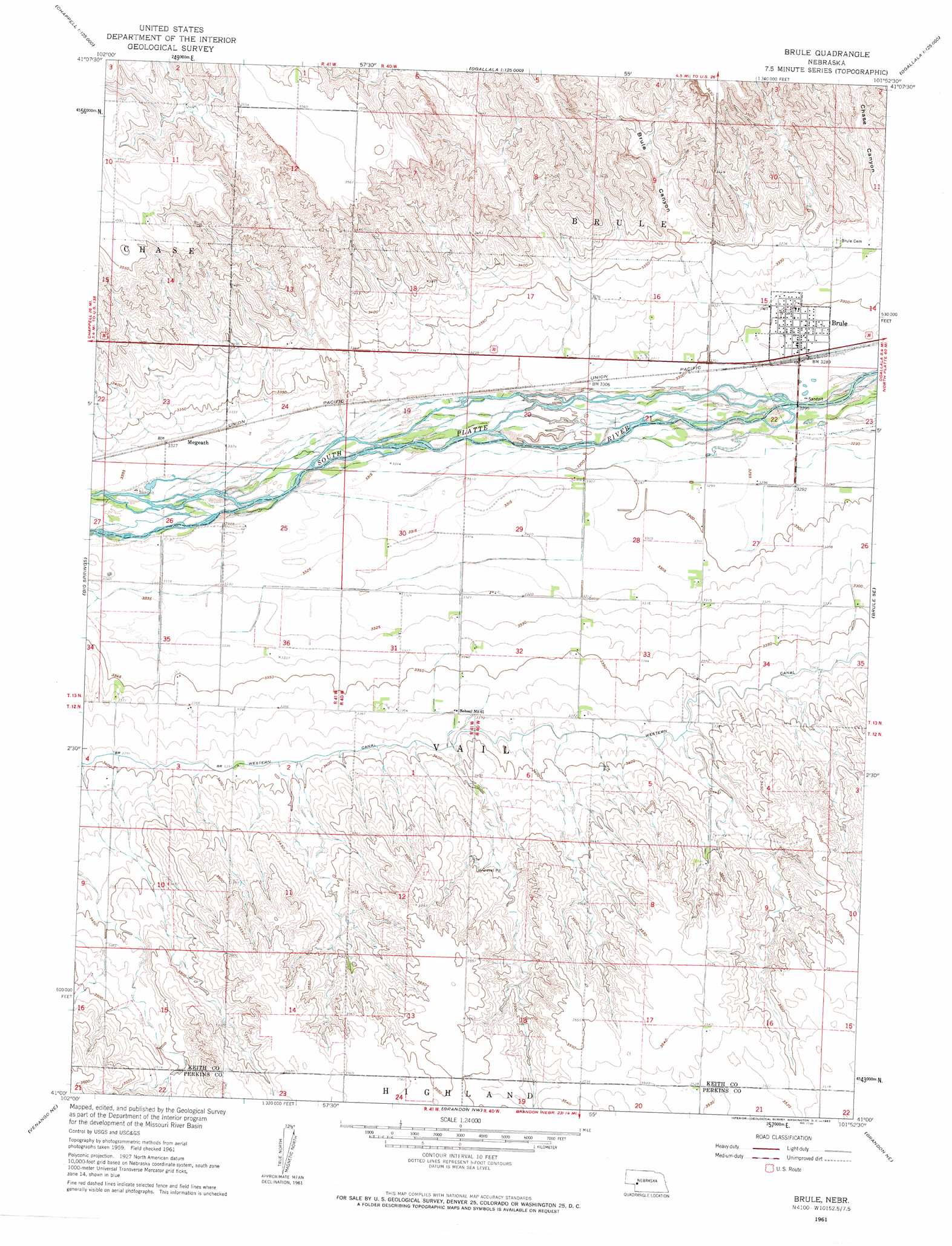
Brule Topo Map Nebraska
To zoom in, hover over the map of Brule
USGS Topo Quad 41101a8 - 1:24,000 scale
| Topo Map Name: | Brule |
| USGS Topo Quad ID: | 41101a8 |
| Print Size: | ca. 21 1/4" wide x 27" high |
| Southeast Coordinates: | 41° N latitude / 101.875° W longitude |
| Map Center Coordinates: | 41.0625° N latitude / 101.9375° W longitude |
| U.S. State: | NE |
| Filename: | O41101a8.jpg |
| Download Map JPG Image: | Brule topo map 1:24,000 scale |
| Map Type: | Topographic |
| Topo Series: | 7.5´ |
| Map Scale: | 1:24,000 |
| Source of Map Images: | United States Geological Survey (USGS) |
| Alternate Map Versions: |
Brule NE 1961, updated 1963 Download PDF Buy paper map Brule NE 2011 Download PDF Buy paper map Brule NE 2014 Download PDF Buy paper map |
1:24,000 Topo Quads surrounding Brule
Lewellen |
Ruthton |
Belmar |
Lemoyne |
Martin |
Big Springs Nw |
Big Springs Ne |
Brule Nw |
Brule Ne |
Ogallala |
Barton |
Big Springs |
Brule |
Brule Se |
Ogallala Sw |
Venango Nw |
Venango Ne |
Brandon Nw |
Brandon Ne |
Wild Horse Spring |
Venango Sw |
Venango |
Brandon |
Brandon Se |
Grant |
> Back to 41101a1 at 1:100,000 scale
> Back to 41100a1 at 1:250,000 scale
> Back to U.S. Topo Maps home
Brule topo map: Gazetteer
Brule: Crossings
Interchange 117 elevation 1003m 3290′Brule: Dams
Detention Dam 1-A-1 elevation 1030m 3379′Brule: Parks
California Hill Historical Marker elevation 1045m 3428′Brule: Populated Places
Beals Trailer Court elevation 1003m 3290′Brule elevation 1003m 3290′
Megeath elevation 1015m 3330′
Brule: Post Offices
Brule Post Office elevation 1003m 3290′Brule: Reservoirs
Brule Creek Reservoir 1-A elevation 1030m 3379′Brule: Valleys
Brule Canyon elevation 1021m 3349′Brule digital topo map on disk
Buy this Brule topo map showing relief, roads, GPS coordinates and other geographical features, as a high-resolution digital map file on DVD: