Paxton North Topo Map Nebraska
To zoom in, hover over the map of Paxton North
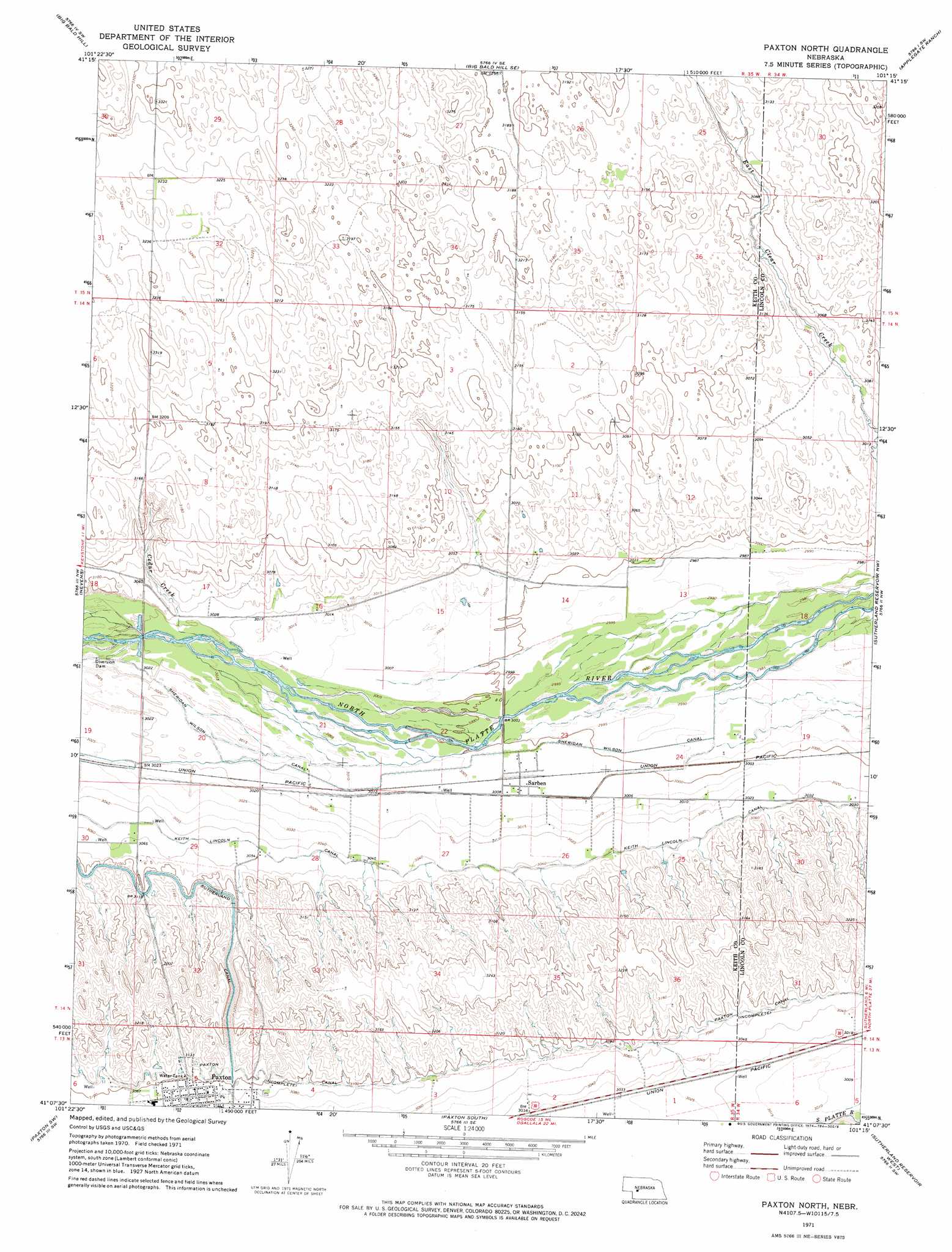
USGS Topo Quad 41101b3 - 1:24,000 scale
| Topo Map Name: | Paxton North |
| USGS Topo Quad ID: | 41101b3 |
| Print Size: | ca. 21 1/4" wide x 27" high |
| Southeast Coordinates: | 41.125° N latitude / 101.25° W longitude |
| Map Center Coordinates: | 41.1875° N latitude / 101.3125° W longitude |
| U.S. State: | NE |
| Filename: | O41101b3.jpg |
| Download Map JPG Image: | Paxton North topo map 1:24,000 scale |
| Map Type: | Topographic |
| Topo Series: | 7.5´ |
| Map Scale: | 1:24,000 |
| Source of Map Images: | United States Geological Survey (USGS) |
| Alternate Map Versions: |
Paxton North NE 1971, updated 1974 Download PDF Buy paper map Paxton North NE 2011 Download PDF Buy paper map Paxton North NE 2014 Download PDF Buy paper map |
1:24,000 Topo Quads surrounding Paxton North
Spotted Horse Valley |
Bucktail Lake |
Big Bald Hill Ne |
Tin Camp Ranch |
Pierson Ranch |
Glinn Ranch |
Big Bald Hill |
Big Bald Hill Se |
Applegate Ranch |
Green Ranch |
Keystone |
Nevens |
Paxton North |
Sutherland Reservoir Nw |
Hershey West |
Ogallala Se |
Paxton Sw |
Paxton South |
Sutherland Reservoir West |
Sutherland Reservoir East |
Grant Ne |
Elsie Nw |
Elsie Ne |
Wallace Nw |
Wallace Ne |
> Back to 41101a1 at 1:100,000 scale
> Back to 41100a1 at 1:250,000 scale
> Back to U.S. Topo Maps home
Paxton North topo map: Gazetteer
Paxton North: Airports
McConnell Field elevation 920m 3018′Paxton North: Canals
Keith Lincoln Canal elevation 926m 3038′Sheridan Wilson Canal elevation 916m 3005′
Paxton North: Populated Places
Sarben elevation 917m 3008′Paxton North: Post Offices
Sarben Post Office (historical) elevation 917m 3008′Paxton North: Streams
Cedar Creek elevation 921m 3021′Paxton North digital topo map on disk
Buy this Paxton North topo map showing relief, roads, GPS coordinates and other geographical features, as a high-resolution digital map file on DVD: