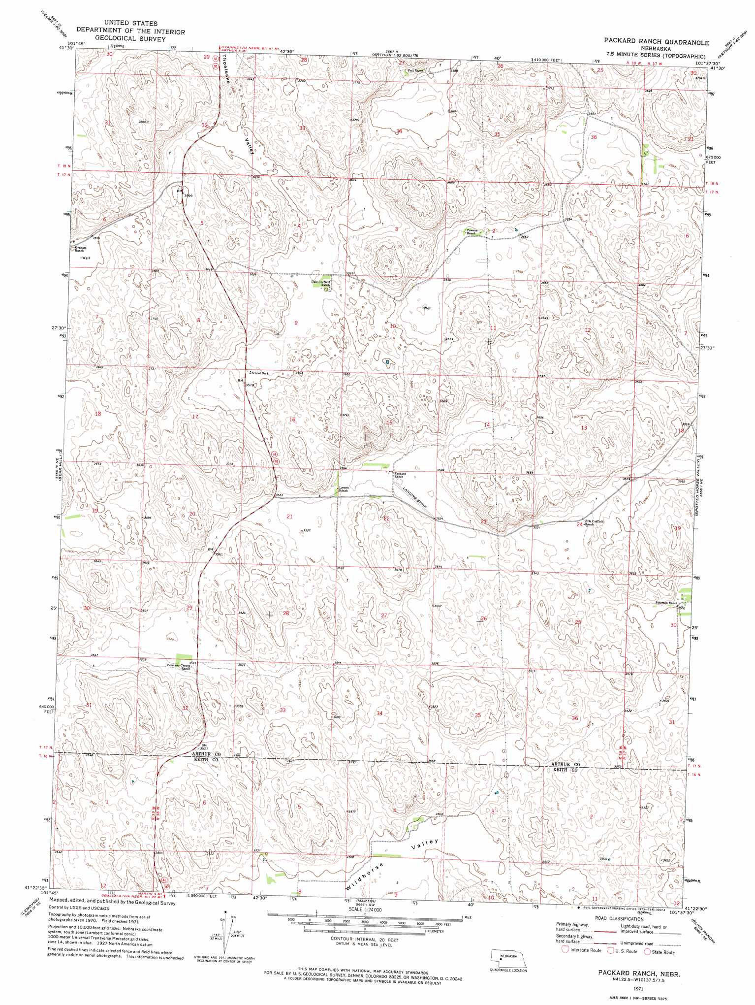
Packard Ranch Topo Map Nebraska
To zoom in, hover over the map of Packard Ranch
USGS Topo Quad 41101d6 - 1:24,000 scale
| Topo Map Name: | Packard Ranch |
| USGS Topo Quad ID: | 41101d6 |
| Print Size: | ca. 21 1/4" wide x 27" high |
| Southeast Coordinates: | 41.375° N latitude / 101.625° W longitude |
| Map Center Coordinates: | 41.4375° N latitude / 101.6875° W longitude |
| U.S. State: | NE |
| Filename: | O41101d6.jpg |
| Download Map JPG Image: | Packard Ranch topo map 1:24,000 scale |
| Map Type: | Topographic |
| Topo Series: | 7.5´ |
| Map Scale: | 1:24,000 |
| Source of Map Images: | United States Geological Survey (USGS) |
| Alternate Map Versions: |
Packard Ranch NE 1971, updated 1973 Download PDF Buy paper map Packard Ranch NE 2011 Download PDF Buy paper map Packard Ranch NE 2014 Download PDF Buy paper map |
1:24,000 Topo Quads surrounding Packard Ranch
Bourquim Hill |
Jensen Lake |
K C Lake |
Cheyenne Lake |
Lena |
Velma Sw |
Hulbert Lake |
Arthur |
Lightning Valley |
Bucktail |
Williams Ranch |
Bear Hill |
Packard Ranch |
Spotted Horse Valley |
Bucktail Lake |
Belmar |
Lemoyne |
Martin |
Glinn Ranch |
Big Bald Hill |
Brule Nw |
Brule Ne |
Ogallala |
Keystone |
Nevens |
> Back to 41101a1 at 1:100,000 scale
> Back to 41100a1 at 1:250,000 scale
> Back to U.S. Topo Maps home
Packard Ranch topo map: Gazetteer
Packard Ranch: Airports
Packard Ranch Airport elevation 1094m 3589′Packard Ranch: Valleys
Thoelecke Valley elevation 1100m 3608′Wildhorse Valley elevation 1067m 3500′
Packard Ranch digital topo map on disk
Buy this Packard Ranch topo map showing relief, roads, GPS coordinates and other geographical features, as a high-resolution digital map file on DVD: