Broadwater Sw Topo Map Nebraska
To zoom in, hover over the map of Broadwater Sw
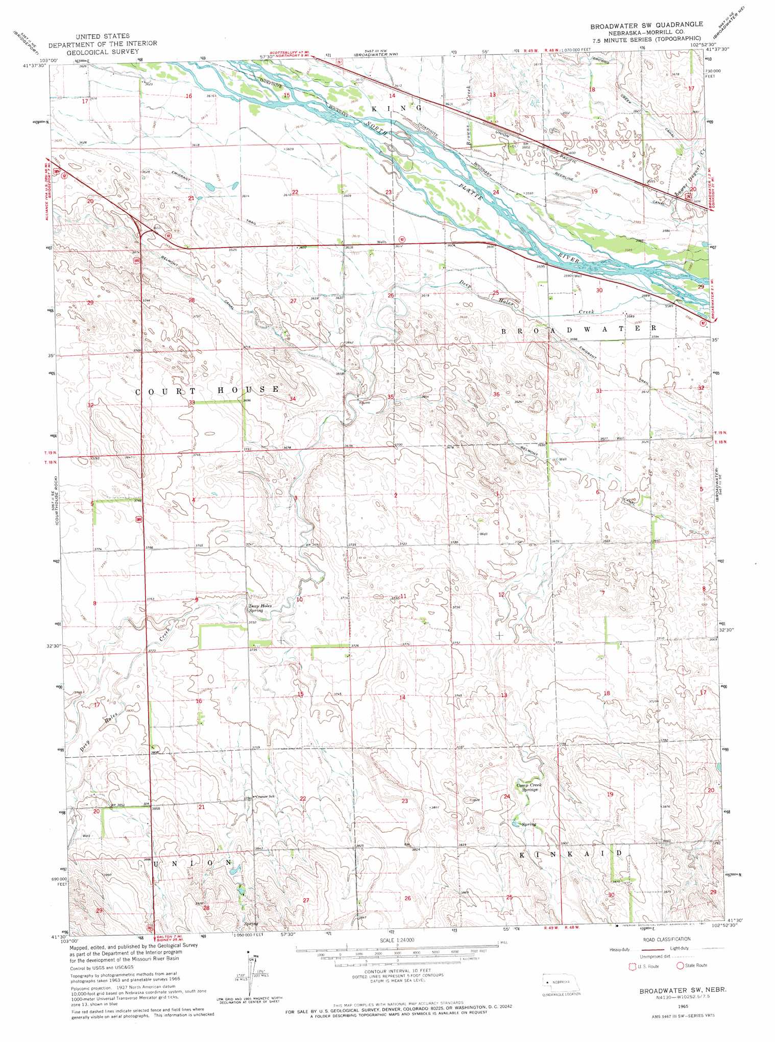
USGS Topo Quad 41102e8 - 1:24,000 scale
| Topo Map Name: | Broadwater Sw |
| USGS Topo Quad ID: | 41102e8 |
| Print Size: | ca. 21 1/4" wide x 27" high |
| Southeast Coordinates: | 41.5° N latitude / 102.875° W longitude |
| Map Center Coordinates: | 41.5625° N latitude / 102.9375° W longitude |
| U.S. State: | NE |
| Filename: | O41102E8.jpg |
| Download Map JPG Image: | Broadwater Sw topo map 1:24,000 scale |
| Map Type: | Topographic |
| Topo Series: | 7.5´ |
| Map Scale: | 1:24,000 |
| Source of Map Images: | United States Geological Survey (USGS) |
| Alternate Map Versions: |
Broadwater SW NE 1965, updated 1967 Download PDF Buy paper map Broadwater SW NE 2011 Download PDF Buy paper map Broadwater SW NE 2014 Download PDF Buy paper map |
1:24,000 Topo Quads surrounding Broadwater Sw
Angora |
Angora Se |
Camp Lake |
Norris Lake |
Storm Lake |
Bridgeport Nw |
Bridgeport |
Broadwater Nw |
Broadwater Ne |
Tar Valley |
Roundhouse Rock |
Courthouse Rock |
Broadwater Sw |
Broadwater |
Tar Valley Sw |
Horsehead Ranch |
Mud Springs |
Dalton |
Fairchild Ranch |
Lisco Nw |
Mud Springs Sw |
Mud Springs Se |
Gurley |
Dalton Se |
Lisco Sw |
> Back to 41102e1 at 1:100,000 scale
> Back to 41102a1 at 1:250,000 scale
> Back to U.S. Topo Maps home
Broadwater Sw topo map: Gazetteer
Broadwater Sw: Parks
Amanda Lamme Historical Marker elevation 1117m 3664′Broadwater Sw: Springs
Camp Creek Springs elevation 1148m 3766′Deep Holes Spring elevation 1135m 3723′
Broadwater Sw: Streams
Browns Creek elevation 1098m 3602′Deep Holes Creek elevation 1092m 3582′
Lower Dugout Creek elevation 1098m 3602′
Broadwater Sw digital topo map on disk
Buy this Broadwater Sw topo map showing relief, roads, GPS coordinates and other geographical features, as a high-resolution digital map file on DVD:
Eastern Wyoming & Western South Dakota
Buy digital topo maps: Eastern Wyoming & Western South Dakota