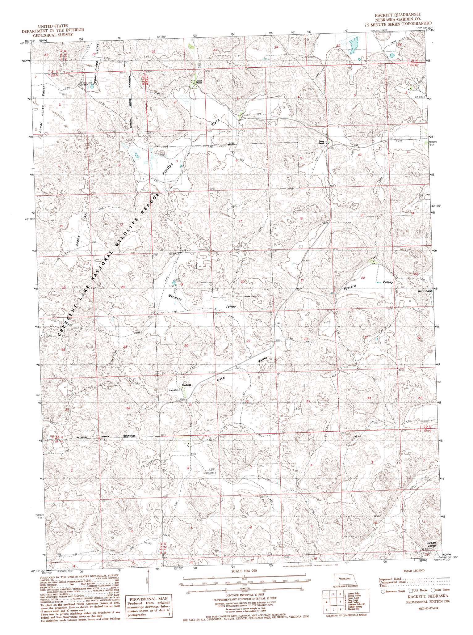
Rackett Topo Map Nebraska
To zoom in, hover over the map of Rackett
USGS Topo Quad 41102f2 - 1:24,000 scale
| Topo Map Name: | Rackett |
| USGS Topo Quad ID: | 41102f2 |
| Print Size: | ca. 21 1/4" wide x 27" high |
| Southeast Coordinates: | 41.625° N latitude / 102.125° W longitude |
| Map Center Coordinates: | 41.6875° N latitude / 102.1875° W longitude |
| U.S. State: | NE |
| Filename: | O41102F2.jpg |
| Download Map JPG Image: | Rackett topo map 1:24,000 scale |
| Map Type: | Topographic |
| Topo Series: | 7.5´ |
| Map Scale: | 1:24,000 |
| Source of Map Images: | United States Geological Survey (USGS) |
| Alternate Map Versions: |
Rackett NE 1986, updated 1986 Download PDF Buy paper map Rackett NE 2011 Download PDF Buy paper map Rackett NE 2014 Download PDF Buy paper map |
1:24,000 Topo Quads surrounding Rackett
Schoonover Lake |
Black Lake |
Mccarty Lake |
Alkali Lake |
Wild Horse Hill |
Mumper |
Hessey Lake |
Young Valley |
Curry Lake |
Long Valley |
Crescent Lake |
Deer Lake |
Rackett |
Well Valley |
Bourquim Hill |
Sugar Loaf Hill |
Crescent Lake Se |
Gusher Spring |
Rackett Se |
Velma Sw |
Coumbe Bluff |
Oshkosh |
Twin Buttes |
Old Baldy |
Williams Ranch |
> Back to 41102e1 at 1:100,000 scale
> Back to 41102a1 at 1:250,000 scale
> Back to U.S. Topo Maps home
Rackett topo map: Gazetteer
Rackett: Basins
Bennett Valley elevation 1153m 3782′Gate Valley elevation 1151m 3776′
Upper Jones Valley elevation 1159m 3802′
Wymore Valley elevation 1151m 3776′
Rackett: Flats
Adams Flats elevation 1152m 3779′Phillips Flats elevation 1157m 3795′
Rackett: Lakes
Ward Lake elevation 1146m 3759′Rackett: Populated Places
Rackett elevation 1152m 3779′Rackett: Post Offices
Rackett Post Office (historical) elevation 1152m 3779′Rackett digital topo map on disk
Buy this Rackett topo map showing relief, roads, GPS coordinates and other geographical features, as a high-resolution digital map file on DVD:
Eastern Wyoming & Western South Dakota
Buy digital topo maps: Eastern Wyoming & Western South Dakota