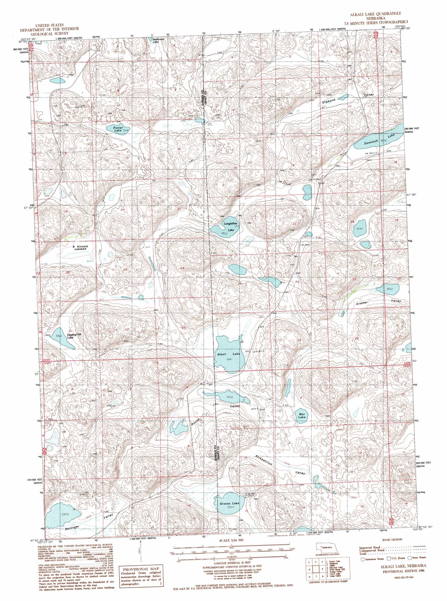
Alkali Lake Topo Map Nebraska
To zoom in, hover over the map of Alkali Lake
USGS Topo Quad 41102h1 - 1:24,000 scale
| Topo Map Name: | Alkali Lake |
| USGS Topo Quad ID: | 41102h1 |
| Print Size: | ca. 21 1/4" wide x 27" high |
| Southeast Coordinates: | 41.875° N latitude / 102° W longitude |
| Map Center Coordinates: | 41.9375° N latitude / 102.0625° W longitude |
| U.S. State: | NE |
| Filename: | O41102H1.jpg |
| Download Map JPG Image: | Alkali Lake topo map 1:24,000 scale |
| Map Type: | Topographic |
| Topo Series: | 7.5´ |
| Map Scale: | 1:24,000 |
| Source of Map Images: | United States Geological Survey (USGS) |
| Alternate Map Versions: |
Alkali Lake NE 1986, updated 1986 Download PDF Buy paper map Alkali Lake NE 2011 Download PDF Buy paper map Alkali Lake NE 2014 Download PDF Buy paper map |
1:24,000 Topo Quads surrounding Alkali Lake
White Lake |
Arnold Lake |
Lowe Valley |
Camp Valley |
Mother Lake |
Ellsworth |
Gaunt Lake |
Bangham |
Ashby |
Hyannis North |
Black Lake |
Mccarty Lake |
Alkali Lake |
Wild Horse Hill |
Hyannis South |
Hessey Lake |
Young Valley |
Curry Lake |
Long Valley |
George Lake Se |
Deer Lake |
Rackett |
Well Valley |
Bourquim Hill |
Jensen Lake |
> Back to 41102e1 at 1:100,000 scale
> Back to 41102a1 at 1:250,000 scale
> Back to U.S. Topo Maps home
Alkali Lake topo map: Gazetteer
Alkali Lake: Basins
Ballinger Valley elevation 1177m 3861′Diamond Valley elevation 1177m 3861′
Kirkpatrick Valley elevation 1169m 3835′
Kramer Valley elevation 1171m 3841′
Round Valley elevation 1193m 3914′
Alkali Lake: Lakes
Alkali Lake elevation 1172m 3845′Dipping Vat Lake elevation 1178m 3864′
Dominick Lake elevation 1172m 3845′
Groves Lake elevation 1165m 3822′
Longfellow Lake elevation 1172m 3845′
Mar Lake elevation 1165m 3822′
Potter Lake elevation 1178m 3864′
R Kincaid Lake elevation 1181m 3874′
Alkali Lake digital topo map on disk
Buy this Alkali Lake topo map showing relief, roads, GPS coordinates and other geographical features, as a high-resolution digital map file on DVD:
Eastern Wyoming & Western South Dakota
Buy digital topo maps: Eastern Wyoming & Western South Dakota