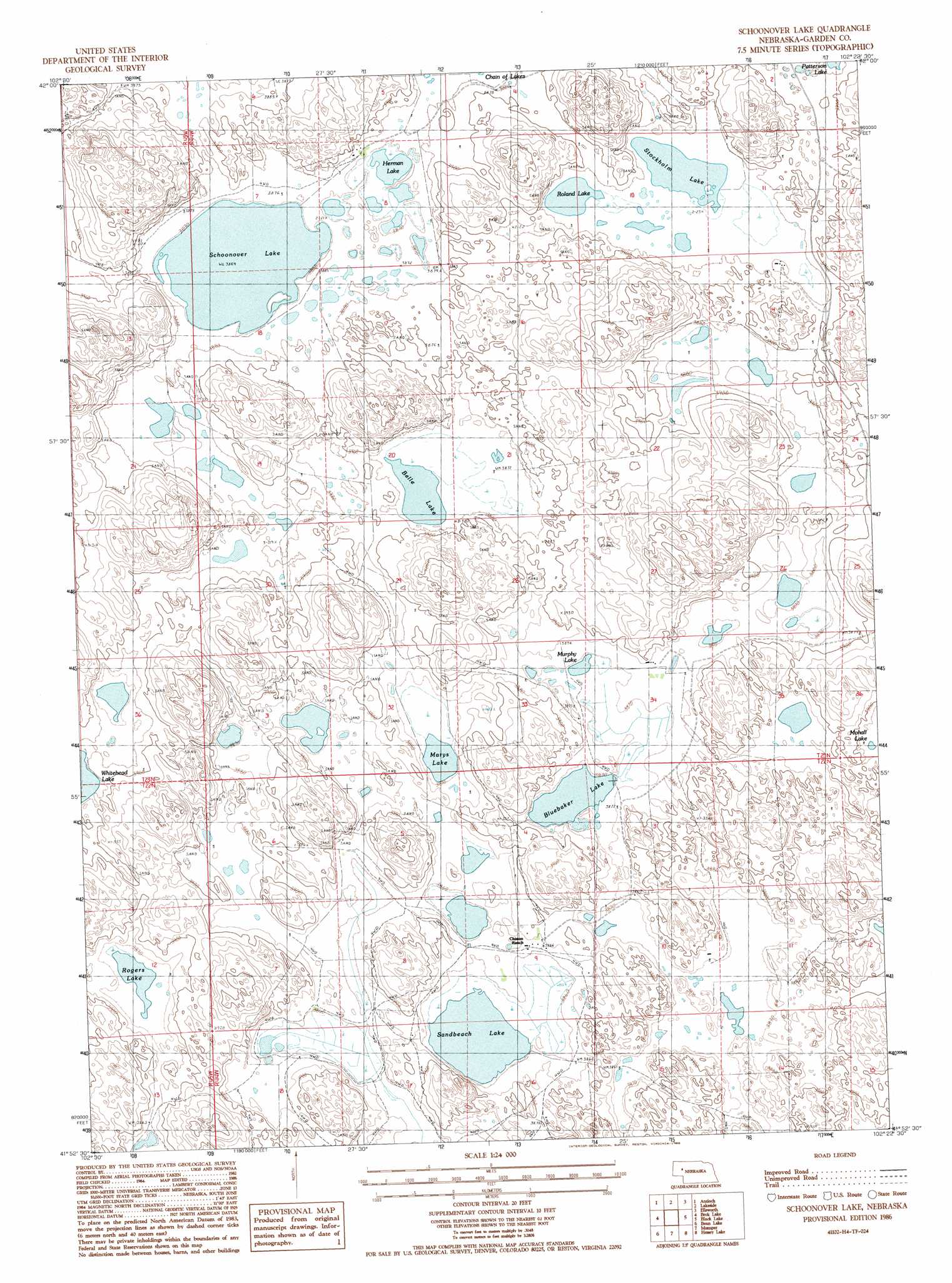
Schoonover Lake Topo Map Nebraska
To zoom in, hover over the map of Schoonover Lake
USGS Topo Quad 41102h4 - 1:24,000 scale
| Topo Map Name: | Schoonover Lake |
| USGS Topo Quad ID: | 41102h4 |
| Print Size: | ca. 21 1/4" wide x 27" high |
| Southeast Coordinates: | 41.875° N latitude / 102.375° W longitude |
| Map Center Coordinates: | 41.9375° N latitude / 102.4375° W longitude |
| U.S. State: | NE |
| Filename: | O41102H4.jpg |
| Download Map JPG Image: | Schoonover Lake topo map 1:24,000 scale |
| Map Type: | Topographic |
| Topo Series: | 7.5´ |
| Map Scale: | 1:24,000 |
| Source of Map Images: | United States Geological Survey (USGS) |
| Alternate Map Versions: |
Schoonover Lake NE 1986, updated 1986 Download PDF Buy paper map Schoonover Lake NE 2011 Download PDF Buy paper map Schoonover Lake NE 2014 Download PDF Buy paper map |
1:24,000 Topo Quads surrounding Schoonover Lake
Krause Lake West |
Krause Lake East |
Peter Long Lake |
White Lake |
Arnold Lake |
Jesse Lake |
Antioch |
Lakeside |
Ellsworth |
Gaunt Lake |
Mccarthy Lake |
Beck Lake |
Schoonover Lake |
Black Lake |
Mccarty Lake |
Storm Lake |
Bean Lake |
Mumper |
Hessey Lake |
Young Valley |
Tar Valley |
Richardson Lake |
Crescent Lake |
Deer Lake |
Rackett |
> Back to 41102e1 at 1:100,000 scale
> Back to 41102a1 at 1:250,000 scale
> Back to U.S. Topo Maps home
Schoonover Lake topo map: Gazetteer
Schoonover Lake: Lakes
Belle Lake elevation 1180m 3871′Bluebaker Lake elevation 1180m 3871′
Bristol Lake elevation 1182m 3877′
Foster Lake elevation 1176m 3858′
Herman Lake elevation 1180m 3871′
Marys Lake elevation 1181m 3874′
Murphy Lake elevation 1180m 3871′
Rogers Lake elevation 1180m 3871′
Roland Lake elevation 1180m 3871′
Sandbeach Lake elevation 1175m 3854′
Schoonover Lake elevation 1180m 3871′
Stockholm Lake elevation 1180m 3871′
Schoonover Lake digital topo map on disk
Buy this Schoonover Lake topo map showing relief, roads, GPS coordinates and other geographical features, as a high-resolution digital map file on DVD:
Eastern Wyoming & Western South Dakota
Buy digital topo maps: Eastern Wyoming & Western South Dakota