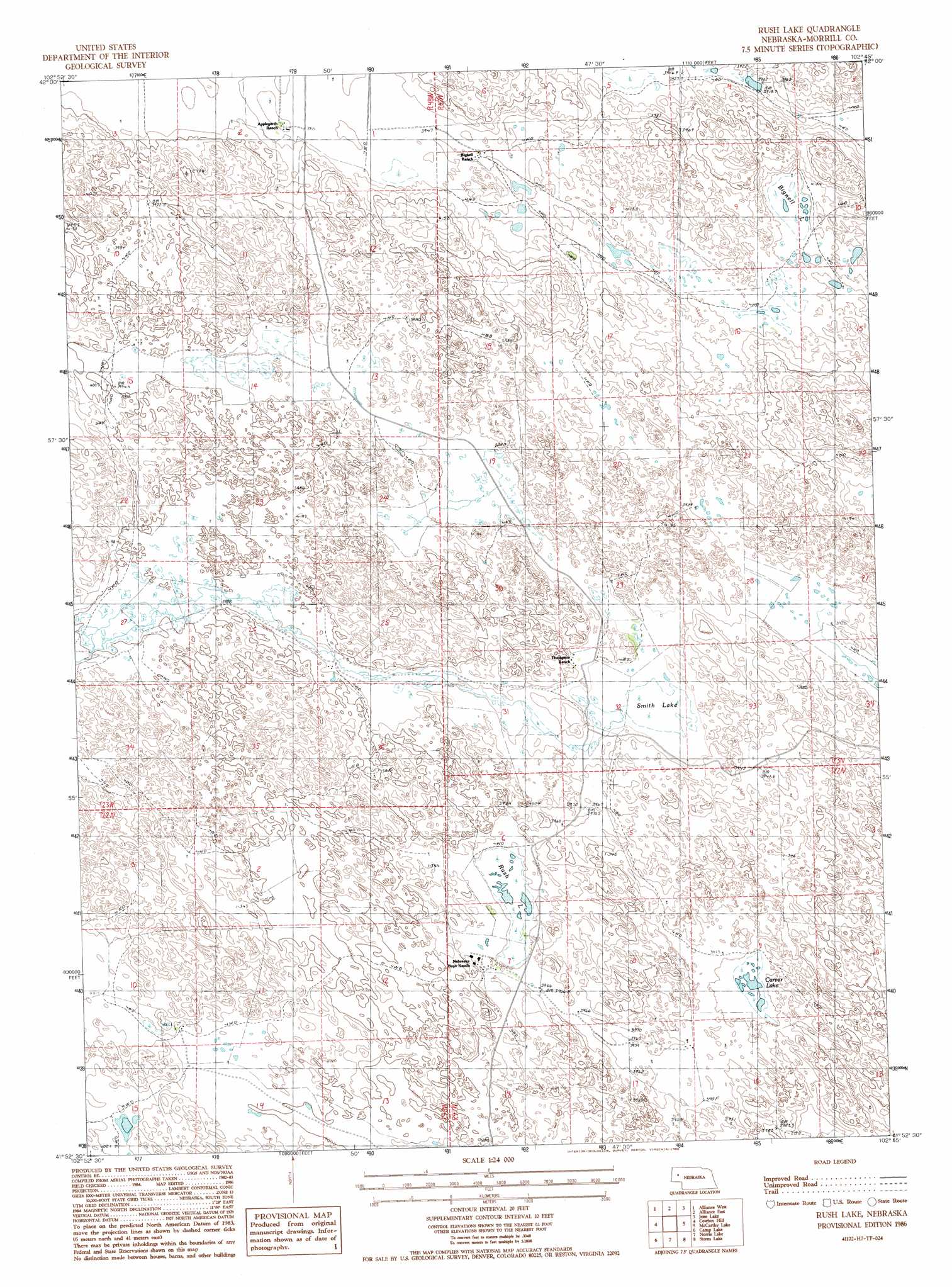
Rush Lake Topo Map Nebraska
To zoom in, hover over the map of Rush Lake
USGS Topo Quad 41102h7 - 1:24,000 scale
| Topo Map Name: | Rush Lake |
| USGS Topo Quad ID: | 41102h7 |
| Print Size: | ca. 21 1/4" wide x 27" high |
| Southeast Coordinates: | 41.875° N latitude / 102.75° W longitude |
| Map Center Coordinates: | 41.9375° N latitude / 102.8125° W longitude |
| U.S. State: | NE |
| Filename: | O41102H7.jpg |
| Download Map JPG Image: | Rush Lake topo map 1:24,000 scale |
| Map Type: | Topographic |
| Topo Series: | 7.5´ |
| Map Scale: | 1:24,000 |
| Source of Map Images: | United States Geological Survey (USGS) |
| Alternate Map Versions: |
Rush Lake NE 1986, updated 1986 Download PDF Buy paper map Rush Lake NE 2011 Download PDF Buy paper map Rush Lake NE 2014 Download PDF Buy paper map |
1:24,000 Topo Quads surrounding Rush Lake
Hemingford 4 Ne |
Berea Creek West |
Berea Creek East |
Krause Lake West |
Krause Lake East |
Hemingford 4 Se |
Alliance West |
Alliance East |
Jesse Lake |
Antioch |
Angora Ne |
Cowboy Hill |
Rush Lake |
Mccarthy Lake |
Beck Lake |
Angora Se |
Camp Lake |
Norris Lake |
Storm Lake |
Bean Lake |
Bridgeport |
Broadwater Nw |
Broadwater Ne |
Tar Valley |
Richardson Lake |
> Back to 41102e1 at 1:100,000 scale
> Back to 41102a1 at 1:250,000 scale
> Back to U.S. Topo Maps home
Rush Lake topo map: Gazetteer
Rush Lake: Lakes
Bignell Lake elevation 1201m 3940′Carver Lake elevation 1202m 3943′
Rush Lake elevation 1206m 3956′
Smith Lake elevation 1205m 3953′
Rush Lake: Populated Places
Nebraska Boys Ranch elevation 1214m 3982′Rush Lake digital topo map on disk
Buy this Rush Lake topo map showing relief, roads, GPS coordinates and other geographical features, as a high-resolution digital map file on DVD:
Eastern Wyoming & Western South Dakota
Buy digital topo maps: Eastern Wyoming & Western South Dakota