Mud Springs Topo Map Nebraska
To zoom in, hover over the map of Mud Springs
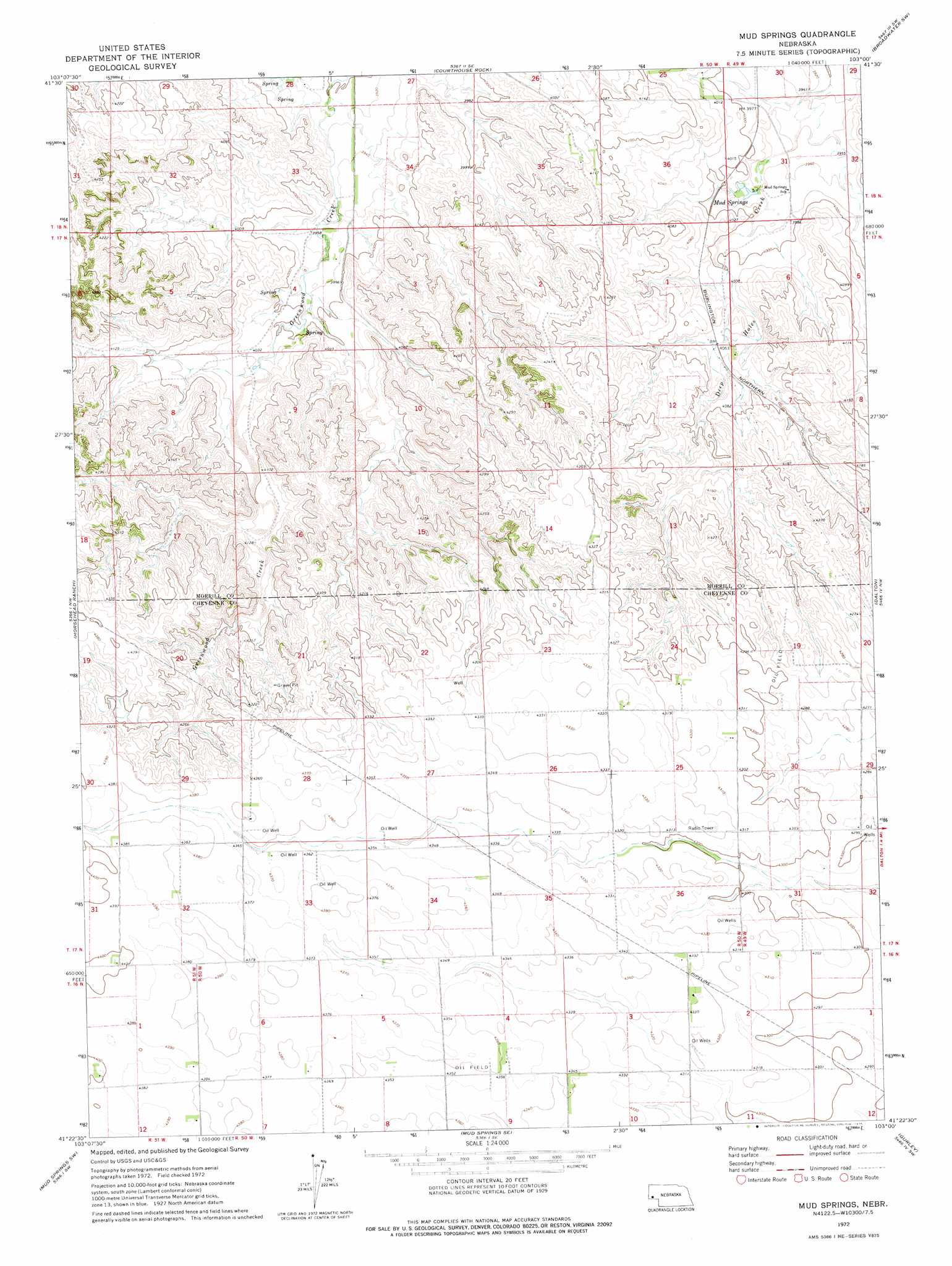
USGS Topo Quad 41103d1 - 1:24,000 scale
| Topo Map Name: | Mud Springs |
| USGS Topo Quad ID: | 41103d1 |
| Print Size: | ca. 21 1/4" wide x 27" high |
| Southeast Coordinates: | 41.375° N latitude / 103° W longitude |
| Map Center Coordinates: | 41.4375° N latitude / 103.0625° W longitude |
| U.S. State: | NE |
| Filename: | O41103D1.jpg |
| Download Map JPG Image: | Mud Springs topo map 1:24,000 scale |
| Map Type: | Topographic |
| Topo Series: | 7.5´ |
| Map Scale: | 1:24,000 |
| Source of Map Images: | United States Geological Survey (USGS) |
| Alternate Map Versions: |
Mud Springs NE 1972, updated 1975 Download PDF Buy paper map Mud Springs NE 2011 Download PDF Buy paper map Mud Springs NE 2014 Download PDF Buy paper map |
1:24,000 Topo Quads surrounding Mud Springs
South Bayard |
Bridgeport Nw |
Bridgeport |
Broadwater Nw |
Broadwater Ne |
Redington |
Roundhouse Rock |
Courthouse Rock |
Broadwater Sw |
Broadwater |
Potter 2 Ne |
Horsehead Ranch |
Mud Springs |
Dalton |
Fairchild Ranch |
Potter 2 Se |
Mud Springs Sw |
Mud Springs Se |
Gurley |
Dalton Se |
Potter |
Point Of Rocks |
Brownson |
Sidney |
Sunol |
> Back to 41103a1 at 1:100,000 scale
> Back to 41102a1 at 1:250,000 scale
> Back to U.S. Topo Maps home
Mud Springs digital topo map on disk
Buy this Mud Springs topo map showing relief, roads, GPS coordinates and other geographical features, as a high-resolution digital map file on DVD:
Eastern Wyoming & Western South Dakota
Buy digital topo maps: Eastern Wyoming & Western South Dakota