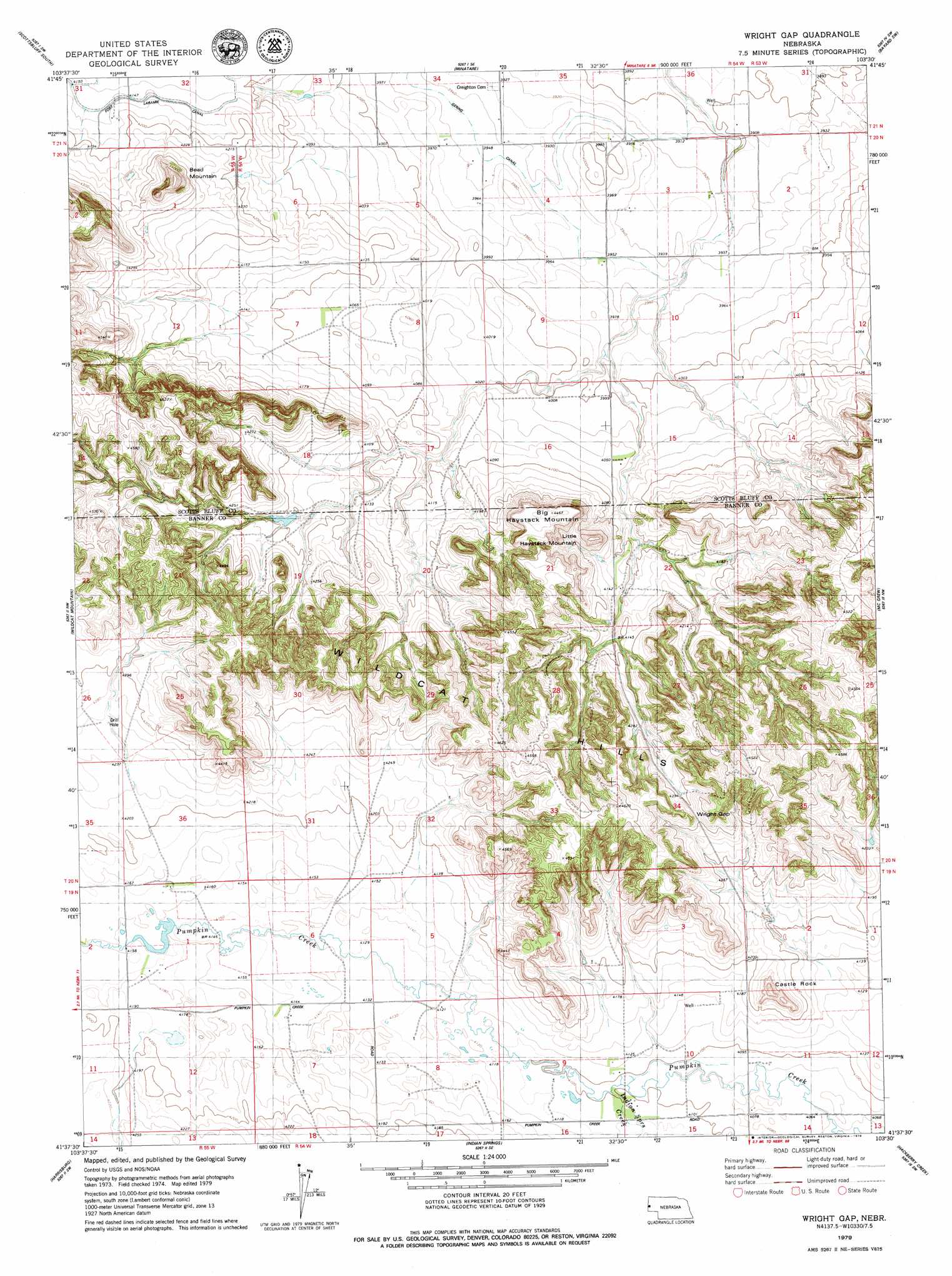
Wright Gap Topo Map Nebraska
To zoom in, hover over the map of Wright Gap
USGS Topo Quad 41103f5 - 1:24,000 scale
| Topo Map Name: | Wright Gap |
| USGS Topo Quad ID: | 41103f5 |
| Print Size: | ca. 21 1/4" wide x 27" high |
| Southeast Coordinates: | 41.625° N latitude / 103.5° W longitude |
| Map Center Coordinates: | 41.6875° N latitude / 103.5625° W longitude |
| U.S. State: | NE |
| Filename: | O41103F5.jpg |
| Download Map JPG Image: | Wright Gap topo map 1:24,000 scale |
| Map Type: | Topographic |
| Topo Series: | 7.5´ |
| Map Scale: | 1:24,000 |
| Source of Map Images: | United States Geological Survey (USGS) |
| Alternate Map Versions: |
Scotts Bluff 4 NE NE 1973, updated 1974 Download PDF Buy paper map Wright Gap NE 2011 Download PDF Buy paper map Wright Gap NE 2014 Download PDF Buy paper map |
1:24,000 Topo Quads surrounding Wright Gap
Mitchell |
Scottsbluff North |
Lake Alice |
Lake Minatare |
Bayard Ne |
Roubadeau Pass |
Scottsbluff South |
Minatare |
Bayard Sw |
Bayard |
Murray Lake Ne |
Wildcat Mountain |
Wright Gap |
Mcgrew |
South Bayard |
Gabe Rock |
Harrisburg |
Indian Springs |
Hackberry Creek |
Redington |
Kimball 2 Ne |
Bennett Reservoir Nw |
Lone Pine Butte |
Singleton Ranch |
Potter 2 Ne |
> Back to 41103e1 at 1:100,000 scale
> Back to 41102a1 at 1:250,000 scale
> Back to U.S. Topo Maps home
Wright Gap topo map: Gazetteer
Wright Gap: Airports
Corr Airport elevation 1214m 3982′Wright Gap: Dams
Brashear Group Dam elevation 1262m 4140′Cannell Dam East elevation 1291m 4235′
Cannell Dam West elevation 1280m 4199′
Darrell Roberts Dam elevation 1278m 4192′
Wright Gap: Gaps
Wright Gap elevation 1333m 4373′Wright Gap: Reservoirs
Brashear Group Reservoir elevation 1262m 4140′Cannell Reservoir East elevation 1291m 4235′
Cannell Reservoir West elevation 1280m 4199′
Darrell Roberts Reservoir elevation 1278m 4192′
Wright Gap: Streams
Indian Springs Creek elevation 1250m 4101′Wright Gap: Summits
Bead Mountain elevation 1405m 4609′Big Haystack Mountain elevation 1362m 4468′
Castle Rock elevation 1360m 4461′
Little Haystack Mountain elevation 1341m 4399′
Wright Gap digital topo map on disk
Buy this Wright Gap topo map showing relief, roads, GPS coordinates and other geographical features, as a high-resolution digital map file on DVD:
Eastern Wyoming & Western South Dakota
Buy digital topo maps: Eastern Wyoming & Western South Dakota