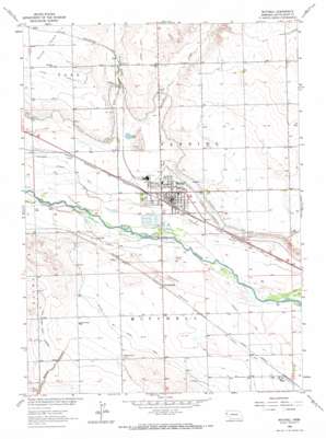
Mitchell Topo Map Nebraska
To zoom in, hover over the map of Mitchell
USGS Topo Quad 41103h7 - 1:24,000 scale
| Topo Map Name: | Mitchell |
| USGS Topo Quad ID: | 41103h7 |
| Print Size: | ca. 21 1/4" wide x 27" high |
| Southeast Coordinates: | 41.875° N latitude / 103.75° W longitude |
| Map Center Coordinates: | 41.9375° N latitude / 103.8125° W longitude |
| U.S. State: | NE |
| Filename: | O41103H7.jpg |
| Download Map JPG Image: | Mitchell topo map 1:24,000 scale |
| Map Type: | Topographic |
| Topo Series: | 7.5´ |
| Map Scale: | 1:24,000 |
| Source of Map Images: | United States Geological Survey (USGS) |
| Alternate Map Versions: |
Mitchell NE 1963, updated 1965 Download PDF Buy paper map Mitchell NE 1963, updated 1973 Download PDF Buy paper map Mitchell NE 2011 Download PDF Buy paper map Mitchell NE 2014 Download PDF Buy paper map |
1:24,000 Topo Quads surrounding Mitchell
> Back to 41103e1 at 1:100,000 scale
> Back to 41102a1 at 1:250,000 scale
> Back to U.S. Topo Maps home
Mitchell topo map: Gazetteer
Mitchell: Canals
Lateral 21 Main elevation 1265m 4150′Mitchell Drain elevation 1207m 3959′
Mitchell: Lakes
Lewis Lake elevation 1211m 3973′Mitchell: Populated Places
Doyle elevation 1226m 4022′Haig elevation 1196m 3923′
Jane elevation 1202m 3943′
Mitchell elevation 1205m 3953′
Pelton elevation 1206m 3956′
Redus elevation 1243m 4078′
South Mitchell elevation 1210m 3969′
Sunflower Mobile Home Park elevation 1205m 3953′
Mitchell: Post Offices
Haig Post Office (historical) elevation 1196m 3923′Mitchell Post Office elevation 1205m 3953′
Mitchell: Streams
Dry Spottedtail Creek elevation 1202m 3943′S East Bald Peak Drain elevation 1257m 4124′
Spottedtail Creek elevation 1207m 3959′
Mitchell: Valleys
Browns Canyon elevation 1231m 4038′Mitchell digital topo map on disk
Buy this Mitchell topo map showing relief, roads, GPS coordinates and other geographical features, as a high-resolution digital map file on DVD:
Eastern Wyoming & Western South Dakota
Buy digital topo maps: Eastern Wyoming & Western South Dakota


