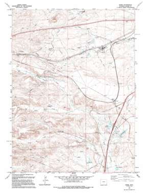
Borie Topo Map Wyoming
To zoom in, hover over the map of Borie
USGS Topo Quad 41104a8 - 1:24,000 scale
| Topo Map Name: | Borie |
| USGS Topo Quad ID: | 41104a8 |
| Print Size: | ca. 21 1/4" wide x 27" high |
| Southeast Coordinates: | 41° N latitude / 104.875° W longitude |
| Map Center Coordinates: | 41.0625° N latitude / 104.9375° W longitude |
| U.S. State: | WY |
| Filename: | o41104a8.jpg |
| Download Map JPG Image: | Borie topo map 1:24,000 scale |
| Map Type: | Topographic |
| Topo Series: | 7.5´ |
| Map Scale: | 1:24,000 |
| Source of Map Images: | United States Geological Survey (USGS) |
| Alternate Map Versions: |
Borie WY 1961, updated 1963 Download PDF Buy paper map Borie WY 1961, updated 1972 Download PDF Buy paper map Borie WY 1994, updated 1994 Download PDF Buy paper map Borie WY 2012 Download PDF Buy paper map Borie WY 2015 Download PDF Buy paper map |
1:24,000 Topo Quads surrounding Borie
> Back to 41104a1 at 1:100,000 scale
> Back to 41104a1 at 1:250,000 scale
> Back to U.S. Topo Maps home
Borie topo map: Gazetteer
Borie: Canals
Polaris Ditch elevation 1903m 6243′Borie: Dams
7XL Dam elevation 1895m 6217′Clear Creek Dam elevation 1892m 6207′
Gleason Number 2 Dam elevation 1893m 6210′
Polaris Dam elevation 1858m 6095′
Spotswood Number 2 Dam elevation 1857m 6092′
Borie: Oilfields
Borie Oil Field elevation 1994m 6541′Borie: Populated Places
Speer elevation 1943m 6374′Borie: Reservoirs
7XL Reservoir elevation 1895m 6217′Clear Creek Reservoir elevation 1892m 6207′
Gleason Number 2 Reservoir elevation 1893m 6210′
Polaris Reservoir elevation 1894m 6213′
Polaris Reservoir elevation 1858m 6095′
Spotswood Reservoir Number 2 elevation 1857m 6092′
Terry Reservoir elevation 1856m 6089′
Valley Reservoir elevation 1897m 6223′
Borie: Streams
Brush Creek elevation 1857m 6092′Corlett Creek elevation 1901m 6236′
Dry Creek elevation 1920m 6299′
Duck Creek elevation 1858m 6095′
Goose Creek elevation 1913m 6276′
Hazard Creek elevation 1907m 6256′
Spring Creek elevation 1930m 6332′
Willow Creek elevation 1982m 6502′
Borie: Wells
Elkar Well elevation 2014m 6607′Finnerty Well elevation 2000m 6561′
Webber Well elevation 1957m 6420′
Borie digital topo map on disk
Buy this Borie topo map showing relief, roads, GPS coordinates and other geographical features, as a high-resolution digital map file on DVD:
Eastern Wyoming & Western South Dakota
Buy digital topo maps: Eastern Wyoming & Western South Dakota


