Tracy Topo Map Wyoming
To zoom in, hover over the map of Tracy
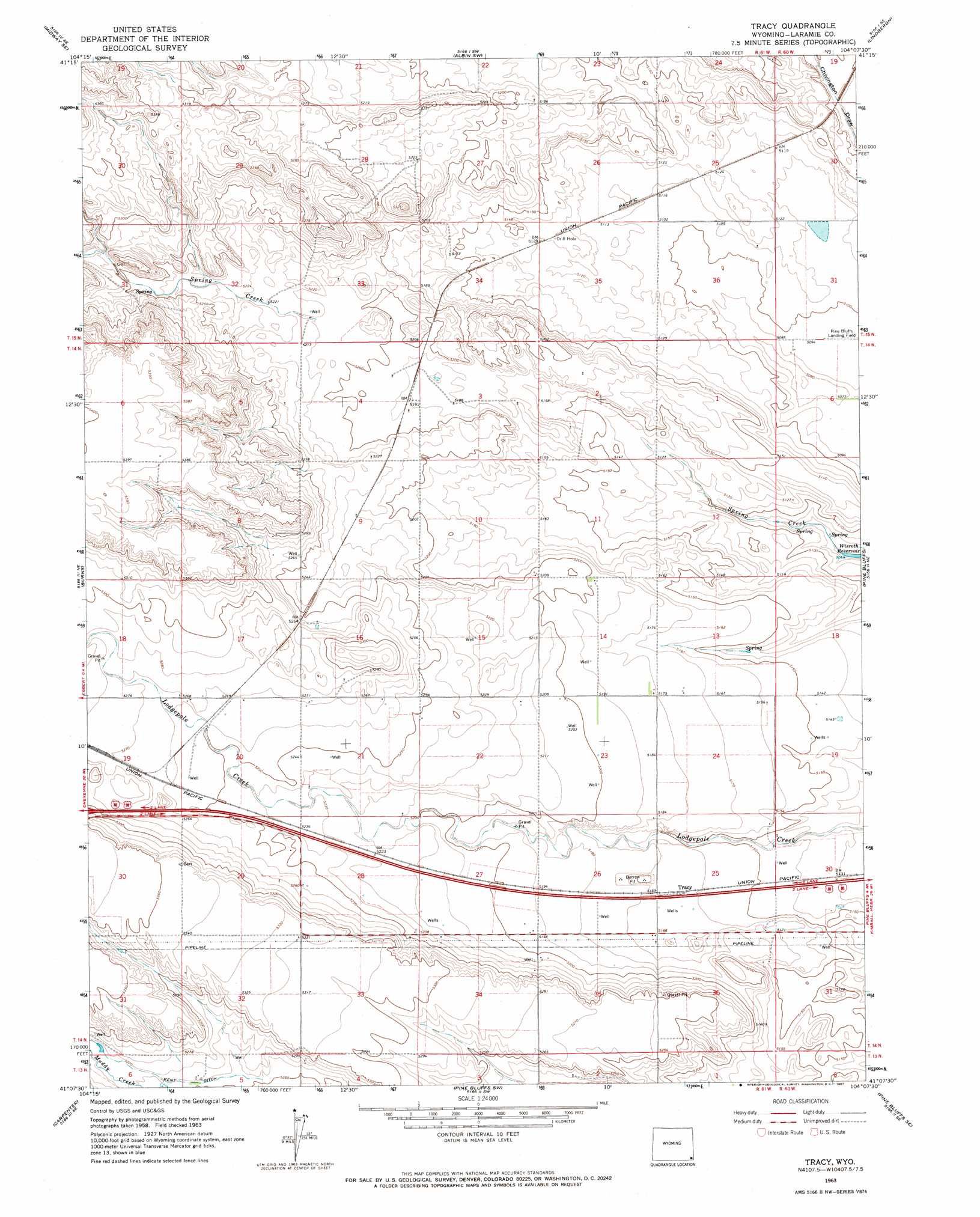
USGS Topo Quad 41104b2 - 1:24,000 scale
| Topo Map Name: | Tracy |
| USGS Topo Quad ID: | 41104b2 |
| Print Size: | ca. 21 1/4" wide x 27" high |
| Southeast Coordinates: | 41.125° N latitude / 104.125° W longitude |
| Map Center Coordinates: | 41.1875° N latitude / 104.1875° W longitude |
| U.S. State: | WY |
| Filename: | o41104b2.jpg |
| Download Map JPG Image: | Tracy topo map 1:24,000 scale |
| Map Type: | Topographic |
| Topo Series: | 7.5´ |
| Map Scale: | 1:24,000 |
| Source of Map Images: | United States Geological Survey (USGS) |
| Alternate Map Versions: |
Tracy WY 1963, updated 1967 Download PDF Buy paper map Tracy WY 2012 Download PDF Buy paper map Tracy WY 2015 Download PDF Buy paper map |
1:24,000 Topo Quads surrounding Tracy
Midway |
Round Top |
Gurney Peak |
Albin |
Kimball 2 Nw |
Midway Sw |
Midway Se |
Albin Sw |
Lindbergh |
Kimball 2 Sw |
Hillsdale |
Burns |
Tracy |
Pine Bluffs |
Bushnell |
Arcola |
Carpenter |
Pine Bluffs Sw |
Pine Bluffs Se |
Bushnell Sw |
Hereford Nw |
Hereford |
Grover North |
Grover Ne |
Dolan Spring |
> Back to 41104a1 at 1:100,000 scale
> Back to 41104a1 at 1:250,000 scale
> Back to U.S. Topo Maps home
Tracy topo map: Gazetteer
Tracy: Airports
Pine Bluffs Municipal Airport elevation 1565m 5134′Tracy: Canals
Kent Ditch elevation 1603m 5259′Tracy: Populated Places
Tracy elevation 1576m 5170′Tracy digital topo map on disk
Buy this Tracy topo map showing relief, roads, GPS coordinates and other geographical features, as a high-resolution digital map file on DVD:
Eastern Wyoming & Western South Dakota
Buy digital topo maps: Eastern Wyoming & Western South Dakota