Durham Topo Map Wyoming
To zoom in, hover over the map of Durham
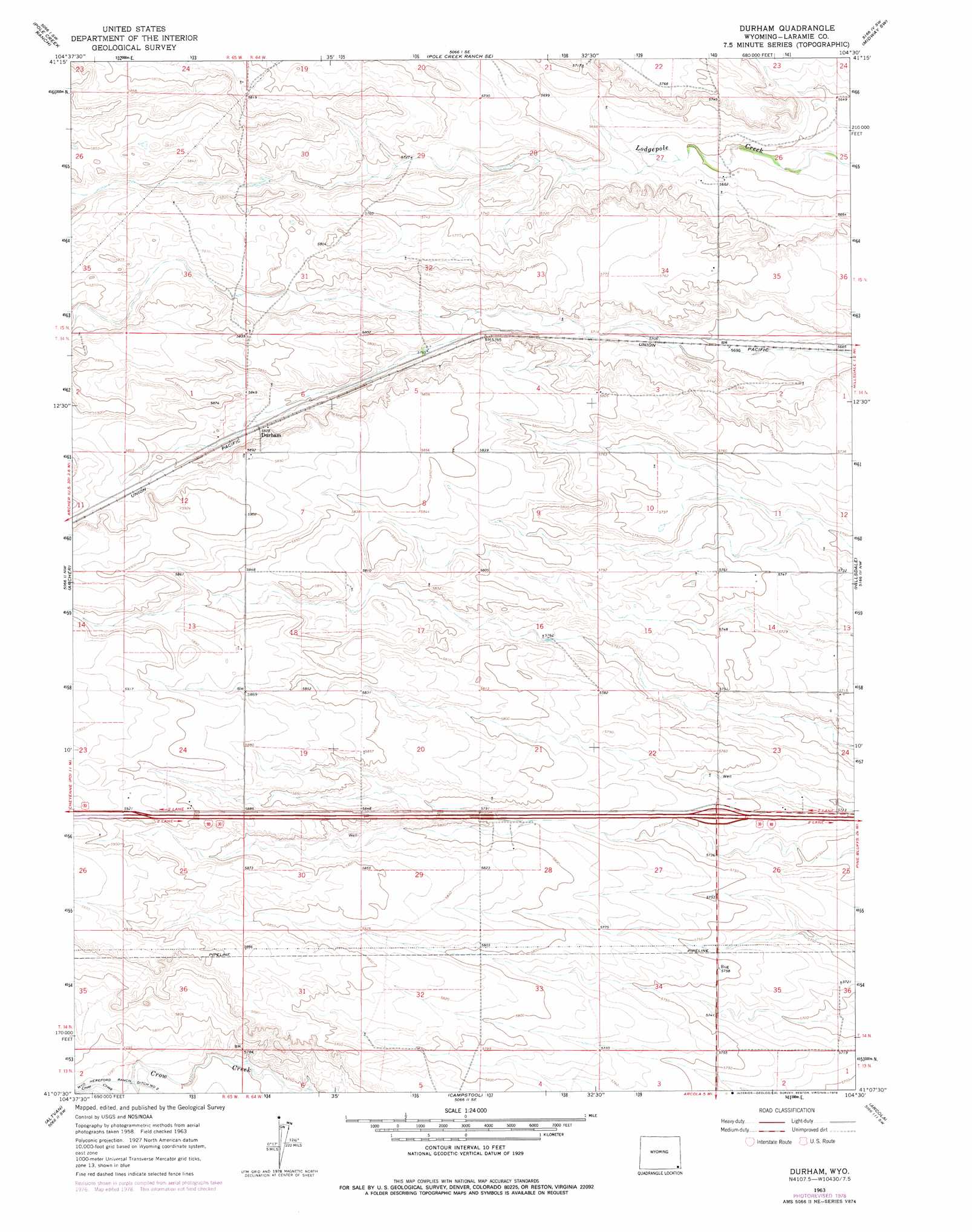
USGS Topo Quad 41104b5 - 1:24,000 scale
| Topo Map Name: | Durham |
| USGS Topo Quad ID: | 41104b5 |
| Print Size: | ca. 21 1/4" wide x 27" high |
| Southeast Coordinates: | 41.125° N latitude / 104.5° W longitude |
| Map Center Coordinates: | 41.1875° N latitude / 104.5625° W longitude |
| U.S. State: | WY |
| Filename: | o41104b5.jpg |
| Download Map JPG Image: | Durham topo map 1:24,000 scale |
| Map Type: | Topographic |
| Topo Series: | 7.5´ |
| Map Scale: | 1:24,000 |
| Source of Map Images: | United States Geological Survey (USGS) |
| Alternate Map Versions: |
Durham WY 1963, updated 1967 Download PDF Buy paper map Durham WY 1963, updated 1978 Download PDF Buy paper map Durham WY 2012 Download PDF Buy paper map Durham WY 2015 Download PDF Buy paper map |
1:24,000 Topo Quads surrounding Durham
Lewis Ranch |
J H D Ranch |
Little Indian Draw |
Midway |
Round Top |
P O Ranch |
Pole Creek Ranch |
Pole Creek Ranch Se |
Midway Sw |
Midway Se |
Cheyenne North |
Archer |
Durham |
Hillsdale |
Burns |
Cheyenne South |
Altvan |
Campstool |
Arcola |
Carpenter |
Carr East |
Eastman Creek North |
Squaw Rock |
Hereford Nw |
Hereford |
> Back to 41104a1 at 1:100,000 scale
> Back to 41104a1 at 1:250,000 scale
> Back to U.S. Topo Maps home
Durham topo map: Gazetteer
Durham: Airports
Skyview Airpark elevation 1777m 5830′Durham: Canals
Wyoming Hereford Ranch Ditch Number 2 elevation 1761m 5777′Durham: Mines
Dean Fogg Pit elevation 1768m 5800′Durham: Populated Places
Durham elevation 1778m 5833′Durham digital topo map on disk
Buy this Durham topo map showing relief, roads, GPS coordinates and other geographical features, as a high-resolution digital map file on DVD:
Eastern Wyoming & Western South Dakota
Buy digital topo maps: Eastern Wyoming & Western South Dakota