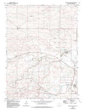
Round Top Lake Topo Map Wyoming
To zoom in, hover over the map of Round Top Lake
USGS Topo Quad 41104b8 - 1:24,000 scale
| Topo Map Name: | Round Top Lake |
| USGS Topo Quad ID: | 41104b8 |
| Print Size: | ca. 21 1/4" wide x 27" high |
| Southeast Coordinates: | 41.125° N latitude / 104.875° W longitude |
| Map Center Coordinates: | 41.1875° N latitude / 104.9375° W longitude |
| U.S. State: | WY |
| Filename: | o41104b8.jpg |
| Download Map JPG Image: | Round Top Lake topo map 1:24,000 scale |
| Map Type: | Topographic |
| Topo Series: | 7.5´ |
| Map Scale: | 1:24,000 |
| Source of Map Images: | United States Geological Survey (USGS) |
| Alternate Map Versions: |
Round Top Lake WY 1961, updated 1963 Download PDF Buy paper map Round Top Lake WY 1961, updated 1972 Download PDF Buy paper map Round Top Lake WY 1961, updated 1978 Download PDF Buy paper map Round Top Lake WY 1961, updated 1994 Download PDF Buy paper map Round Top Lake WY 2012 Download PDF Buy paper map Round Top Lake WY 2015 Download PDF Buy paper map |
1:24,000 Topo Quads surrounding Round Top Lake
> Back to 41104a1 at 1:100,000 scale
> Back to 41104a1 at 1:250,000 scale
> Back to U.S. Topo Maps home
Round Top Lake topo map: Gazetteer
Round Top Lake: Dams
Experiment Station Dam elevation 1920m 6299′Fred Hersig Dam elevation 1937m 6354′
John W Griffen Dam elevation 1924m 6312′
Round Top Lake: Reservoirs
Equalizing Reservoir elevation 1920m 6299′Fred Hersig Reservoir elevation 1937m 6354′
John W Griffen Reservoir elevation 1924m 6312′
King Reservoir elevation 1938m 6358′
Round Top Lake elevation 1925m 6315′
Round Top Lake: Streams
Spring Creek elevation 1902m 6240′Round Top Lake: Summits
Round Top elevation 1937m 6354′Round Top Lake: Wells
Bailey Number 1 Well elevation 1952m 6404′Bailey Number 5 Well elevation 1965m 6446′
Bell Number 10 Well elevation 1930m 6332′
Bell Number 11 Well elevation 1915m 6282′
Bell Number 12 Well elevation 1935m 6348′
Bell Number 14 Well elevation 1906m 6253′
Bell Number 15 Well elevation 1924m 6312′
Bell Number 16 Well elevation 1931m 6335′
Bell Number 17 Well elevation 1931m 6335′
Bell Number 24 Well elevation 1932m 6338′
Bell Number 25 Well elevation 1943m 6374′
Bell Number 5 Well elevation 1908m 6259′
Bell Number 6 Well elevation 1912m 6272′
Bell Number 8 Well elevation 1927m 6322′
Eddy Well elevation 1949m 6394′
Elkar Number 1 Well elevation 1944m 6377′
Elkar Number 3 Well elevation 1947m 6387′
Happy Jack Number 1 Well elevation 1941m 6368′
Happy Jack Number 2 Well elevation 1954m 6410′
Happy Jack Number 3 Well elevation 1961m 6433′
Holman Well elevation 1927m 6322′
King Number 2 Well elevation 1999m 6558′
King Number 4 Well elevation 1986m 6515′
Koppes Number 1 Well elevation 1971m 6466′
Koppes Number 2 Well elevation 1976m 6482′
Koppes Number 3 Well elevation 1990m 6528′
Koppes Number 4 Well elevation 1997m 6551′
Round Top Lake digital topo map on disk
Buy this Round Top Lake topo map showing relief, roads, GPS coordinates and other geographical features, as a high-resolution digital map file on DVD:
Eastern Wyoming & Western South Dakota
Buy digital topo maps: Eastern Wyoming & Western South Dakota


