C S Ranch Topo Map Wyoming
To zoom in, hover over the map of C S Ranch
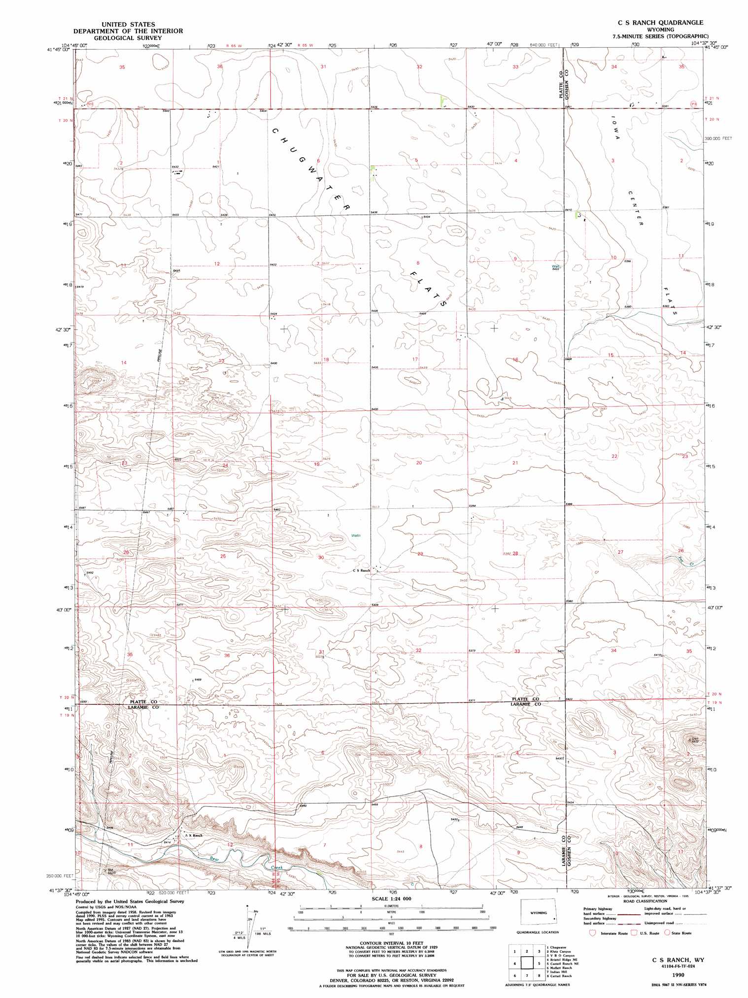
USGS Topo Quad 41104f6 - 1:24,000 scale
| Topo Map Name: | C S Ranch |
| USGS Topo Quad ID: | 41104f6 |
| Print Size: | ca. 21 1/4" wide x 27" high |
| Southeast Coordinates: | 41.625° N latitude / 104.625° W longitude |
| Map Center Coordinates: | 41.6875° N latitude / 104.6875° W longitude |
| U.S. State: | WY |
| Filename: | o41104f6.jpg |
| Download Map JPG Image: | C S Ranch topo map 1:24,000 scale |
| Map Type: | Topographic |
| Topo Series: | 7.5´ |
| Map Scale: | 1:24,000 |
| Source of Map Images: | United States Geological Survey (USGS) |
| Alternate Map Versions: |
C S Ranch WY 1963, updated 1967 Download PDF Buy paper map C S Ranch WY 1963, updated 1993 Download PDF Buy paper map C S Ranch WY 1990, updated 1995 Download PDF Buy paper map C S Ranch WY 2012 Download PDF Buy paper map C S Ranch WY 2015 Download PDF Buy paper map |
1:24,000 Topo Quads surrounding C S Ranch
Ferguson Corner |
Bordeaux |
Dickinson Hill |
Glomill Reservoir |
Veteran |
Double L Ranch |
Chugwater |
Klutz Canyon |
Y B O Ranch |
Needle Rock |
Whitcomb Hill |
Bristol Ridge Ne |
C S Ranch |
Cattail Ranch Ne |
Diamond Flat |
Bristol Ridge |
Moffett Ranch |
Indian Hill |
Cattail Ranch |
Rocky Hollow |
Nimmo Ranch |
Lewis Ranch |
J H D Ranch |
Little Indian Draw |
Midway |
> Back to 41104e1 at 1:100,000 scale
> Back to 41104a1 at 1:250,000 scale
> Back to U.S. Topo Maps home
No gazetteer data is available for the C S Ranch topo map sheet.
C S Ranch digital topo map on disk
Buy this C S Ranch topo map showing relief, roads, GPS coordinates and other geographical features, as a high-resolution digital map file on DVD:
Eastern Wyoming & Western South Dakota
Buy digital topo maps: Eastern Wyoming & Western South Dakota