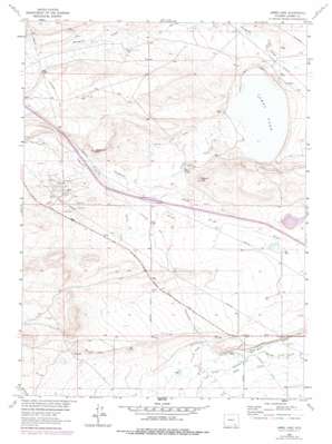
James Lake Topo Map Wyoming
To zoom in, hover over the map of James Lake
USGS Topo Quad 41105d8 - 1:24,000 scale
| Topo Map Name: | James Lake |
| USGS Topo Quad ID: | 41105d8 |
| Print Size: | ca. 21 1/4" wide x 27" high |
| Southeast Coordinates: | 41.375° N latitude / 105.875° W longitude |
| Map Center Coordinates: | 41.4375° N latitude / 105.9375° W longitude |
| U.S. State: | WY |
| Filename: | o41105d8.jpg |
| Download Map JPG Image: | James Lake topo map 1:24,000 scale |
| Map Type: | Topographic |
| Topo Series: | 7.5´ |
| Map Scale: | 1:24,000 |
| Source of Map Images: | United States Geological Survey (USGS) |
| Alternate Map Versions: |
James Lake WY 1963, updated 1966 Download PDF Buy paper map James Lake WY 1963, updated 1978 Download PDF Buy paper map James Lake WY 2012 Download PDF Buy paper map James Lake WY 2015 Download PDF Buy paper map |
1:24,000 Topo Quads surrounding James Lake
> Back to 41105a1 at 1:100,000 scale
> Back to 41104a1 at 1:250,000 scale
> Back to U.S. Topo Maps home
James Lake topo map: Gazetteer
James Lake: Canals
Battin Ditch elevation 2226m 7303′Bellamy Ditch elevation 2223m 7293′
Bellamy Ditch Number 1 elevation 2238m 7342′
Bellamy Ditch Number 2 elevation 2224m 7296′
Bellamy Ditch Number 2 elevation 2253m 7391′
James Lake: Lakes
James Lake elevation 2203m 7227′James Lake: Oilfields
Quealy Dome Oil Field elevation 2278m 7473′James Lake: Streams
Mill Creek elevation 2203m 7227′Sevenmile Creek elevation 2205m 7234′
James Lake: Summits
Sevenmile Hill elevation 2292m 7519′Signal Hill elevation 2260m 7414′
James Lake digital topo map on disk
Buy this James Lake topo map showing relief, roads, GPS coordinates and other geographical features, as a high-resolution digital map file on DVD:
Eastern Wyoming & Western South Dakota
Buy digital topo maps: Eastern Wyoming & Western South Dakota


