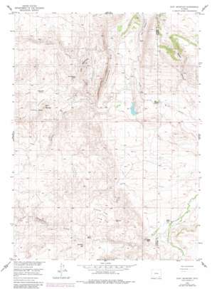
Goat Mountain Topo Map Wyoming
To zoom in, hover over the map of Goat Mountain
USGS Topo Quad 41105e3 - 1:24,000 scale
| Topo Map Name: | Goat Mountain |
| USGS Topo Quad ID: | 41105e3 |
| Print Size: | ca. 21 1/4" wide x 27" high |
| Southeast Coordinates: | 41.5° N latitude / 105.25° W longitude |
| Map Center Coordinates: | 41.5625° N latitude / 105.3125° W longitude |
| U.S. State: | WY |
| Filename: | o41105e3.jpg |
| Download Map JPG Image: | Goat Mountain topo map 1:24,000 scale |
| Map Type: | Topographic |
| Topo Series: | 7.5´ |
| Map Scale: | 1:24,000 |
| Source of Map Images: | United States Geological Survey (USGS) |
| Alternate Map Versions: |
Goat Mountain WY 1955, updated 1957 Download PDF Buy paper map Goat Mountain WY 1955, updated 1957 Download PDF Buy paper map Goat Mountain WY 1955, updated 1982 Download PDF Buy paper map Goat Mountain WY 2012 Download PDF Buy paper map Goat Mountain WY 2015 Download PDF Buy paper map |
1:24,000 Topo Quads surrounding Goat Mountain
> Back to 41105e1 at 1:100,000 scale
> Back to 41104a1 at 1:250,000 scale
> Back to U.S. Topo Maps home
Goat Mountain topo map: Gazetteer
Goat Mountain: Dams
Bell Dam elevation 1986m 6515′Goat Mountain: Flats
Coyote Flat elevation 2256m 7401′Long Flat elevation 2207m 7240′
Goat Mountain: Mines
North Iron Mountain Mine elevation 2208m 7244′Spring Creek Mine elevation 2163m 7096′
Goat Mountain: Reservoirs
Bell Reservoir elevation 1986m 6515′Goat Mountain: Streams
Ricker Creek elevation 1984m 6509′Shanton Creek elevation 2024m 6640′
Spring Creek elevation 1954m 6410′
Strong Creek elevation 2037m 6683′
Goat Mountain: Summits
Dummy Hill elevation 2206m 7237′Eagle Top elevation 2118m 6948′
Goat Mountain elevation 2219m 7280′
Iron Mountain elevation 2258m 7408′
Limestone Rim elevation 2244m 7362′
Goat Mountain: Valleys
Hay Canyon elevation 2038m 6686′Middle Canyon elevation 1964m 6443′
Goat Mountain digital topo map on disk
Buy this Goat Mountain topo map showing relief, roads, GPS coordinates and other geographical features, as a high-resolution digital map file on DVD:
Eastern Wyoming & Western South Dakota
Buy digital topo maps: Eastern Wyoming & Western South Dakota


