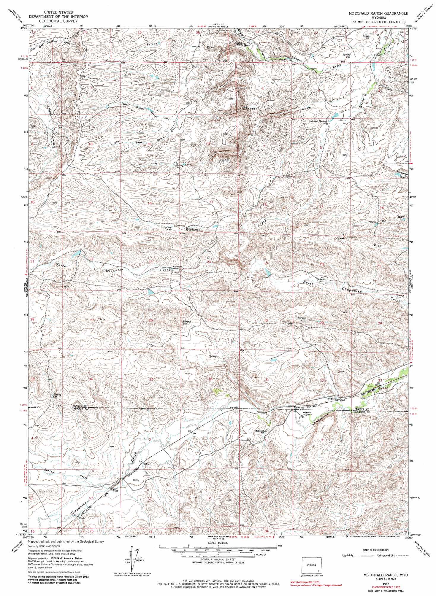
Mcdonald Ranch Topo Map Wyoming
To zoom in, hover over the map of Mcdonald Ranch
USGS Topo Quad 41105f1 - 1:24,000 scale
| Topo Map Name: | Mcdonald Ranch |
| USGS Topo Quad ID: | 41105f1 |
| Print Size: | ca. 21 1/4" wide x 27" high |
| Southeast Coordinates: | 41.625° N latitude / 105° W longitude |
| Map Center Coordinates: | 41.6875° N latitude / 105.0625° W longitude |
| U.S. State: | WY |
| Filename: | o41105f1.jpg |
| Download Map JPG Image: | Mcdonald Ranch topo map 1:24,000 scale |
| Map Type: | Topographic |
| Topo Series: | 7.5´ |
| Map Scale: | 1:24,000 |
| Source of Map Images: | United States Geological Survey (USGS) |
| Alternate Map Versions: |
Mc Donald Ranch WY 1962, updated 1964 Download PDF Buy paper map McDonald Ranch WY 1962, updated 1984 Download PDF Buy paper map Mc Donald Ranch WY 1962, updated 1984 Download PDF Buy paper map McDonald Ranch WY 2012 Download PDF Buy paper map McDonald Ranch WY 2015 Download PDF Buy paper map |
1:24,000 Topo Quads surrounding Mcdonald Ranch
Moonshine Peak |
Squaw Rock |
Natwick |
Ferguson Corner |
Bordeaux |
Poe Mountain |
Natwick Sw |
Richeau Hills |
Double L Ranch |
Chugwater |
Indian Guide |
Delano Ranch |
Mcdonald Ranch |
Whitcomb Hill |
Bristol Ridge Ne |
Goat Mountain |
Farthing |
Hirsig Ranch |
Bristol Ridge |
Moffett Ranch |
Ragged Top Mountain |
Horse Creek |
Dereemer Ranch |
Nimmo Ranch |
Lewis Ranch |
> Back to 41105e1 at 1:100,000 scale
> Back to 41104a1 at 1:250,000 scale
> Back to U.S. Topo Maps home
Mcdonald Ranch topo map: Gazetteer
Mcdonald Ranch: Dams
Hugh McDonald Dam elevation 1805m 5921′Morrison Number 2 Dam elevation 1895m 6217′
Mcdonald Ranch: Reservoirs
Hugh McDonald Reservoir elevation 1805m 5921′Morrison Number 2 Reservoir elevation 1895m 6217′
Mcdonald Ranch: Springs
Richeau Spring elevation 1774m 5820′Mcdonald Ranch: Streams
Canyon Creek elevation 1736m 5695′Spring Creek elevation 1800m 5905′
Watergap Creek elevation 1799m 5902′
Mcdonald Ranch: Valleys
North Steer Draw elevation 1914m 6279′Parson Draw elevation 1812m 5944′
South Steer Draw elevation 1916m 6286′
Steer Draw elevation 1754m 5754′
Mcdonald Ranch digital topo map on disk
Buy this Mcdonald Ranch topo map showing relief, roads, GPS coordinates and other geographical features, as a high-resolution digital map file on DVD:
Eastern Wyoming & Western South Dakota
Buy digital topo maps: Eastern Wyoming & Western South Dakota