Richeau Hills Topo Map Wyoming
To zoom in, hover over the map of Richeau Hills
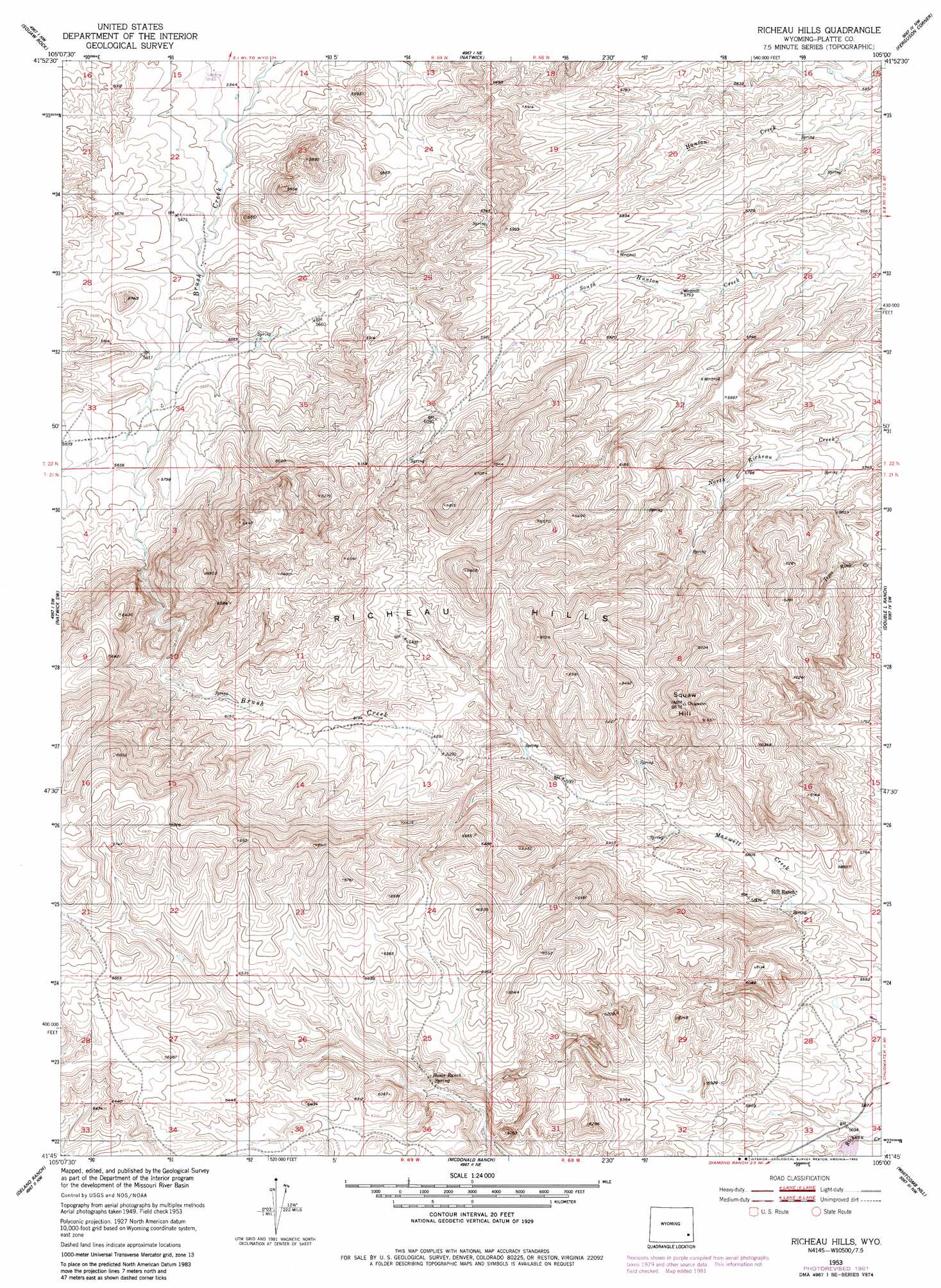
USGS Topo Quad 41105g1 - 1:24,000 scale
| Topo Map Name: | Richeau Hills |
| USGS Topo Quad ID: | 41105g1 |
| Print Size: | ca. 21 1/4" wide x 27" high |
| Southeast Coordinates: | 41.75° N latitude / 105° W longitude |
| Map Center Coordinates: | 41.8125° N latitude / 105.0625° W longitude |
| U.S. State: | WY |
| Filename: | o41105g1.jpg |
| Download Map JPG Image: | Richeau Hills topo map 1:24,000 scale |
| Map Type: | Topographic |
| Topo Series: | 7.5´ |
| Map Scale: | 1:24,000 |
| Source of Map Images: | United States Geological Survey (USGS) |
| Alternate Map Versions: |
Richeau Hills WY 1953, updated 1954 Download PDF Buy paper map Richeau Hills WY 1953, updated 1982 Download PDF Buy paper map Richeau Hills WY 2012 Download PDF Buy paper map Richeau Hills WY 2015 Download PDF Buy paper map |
1:24,000 Topo Quads surrounding Richeau Hills
Reese Mountain |
Hightower Sw |
Hightower |
Wheatland |
Antelope Gap |
Moonshine Peak |
Squaw Rock |
Natwick |
Ferguson Corner |
Bordeaux |
Poe Mountain |
Natwick Sw |
Richeau Hills |
Double L Ranch |
Chugwater |
Indian Guide |
Delano Ranch |
Mcdonald Ranch |
Whitcomb Hill |
Bristol Ridge Ne |
Goat Mountain |
Farthing |
Hirsig Ranch |
Bristol Ridge |
Moffett Ranch |
> Back to 41105e1 at 1:100,000 scale
> Back to 41104a1 at 1:250,000 scale
> Back to U.S. Topo Maps home
Richeau Hills topo map: Gazetteer
Richeau Hills: Dams
Richard Reservoir Number 1 Dam elevation 1721m 5646′Richeau Hills: Ranges
Richeau Hills elevation 1979m 6492′Richeau Hills: Reservoirs
Richard Reservoir Number 1 elevation 1721m 5646′Richeau Hills: Springs
Home Ranch Spring elevation 1864m 6115′Richeau Hills: Summits
Squaw Hill elevation 2025m 6643′Richeau Hills digital topo map on disk
Buy this Richeau Hills topo map showing relief, roads, GPS coordinates and other geographical features, as a high-resolution digital map file on DVD:
Eastern Wyoming & Western South Dakota
Buy digital topo maps: Eastern Wyoming & Western South Dakota