Natwick Sw Topo Map Wyoming
To zoom in, hover over the map of Natwick Sw
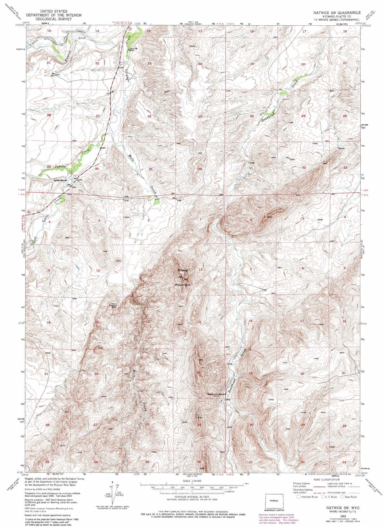
USGS Topo Quad 41105g2 - 1:24,000 scale
| Topo Map Name: | Natwick Sw |
| USGS Topo Quad ID: | 41105g2 |
| Print Size: | ca. 21 1/4" wide x 27" high |
| Southeast Coordinates: | 41.75° N latitude / 105.125° W longitude |
| Map Center Coordinates: | 41.8125° N latitude / 105.1875° W longitude |
| U.S. State: | WY |
| Filename: | o41105g2.jpg |
| Download Map JPG Image: | Natwick Sw topo map 1:24,000 scale |
| Map Type: | Topographic |
| Topo Series: | 7.5´ |
| Map Scale: | 1:24,000 |
| Source of Map Images: | United States Geological Survey (USGS) |
| Alternate Map Versions: |
Natwick SW WY 1953, updated 1954 Download PDF Buy paper map Natwick SW WY 1953, updated 1977 Download PDF Buy paper map Natwick SW WY 1953, updated 1982 Download PDF Buy paper map Natwick SW WY 2012 Download PDF Buy paper map Natwick SW WY 2015 Download PDF Buy paper map |
1:24,000 Topo Quads surrounding Natwick Sw
Davidson Flats |
Reese Mountain |
Hightower Sw |
Hightower |
Wheatland |
Bull Camp Peak |
Moonshine Peak |
Squaw Rock |
Natwick |
Ferguson Corner |
Guide Rock |
Poe Mountain |
Natwick Sw |
Richeau Hills |
Double L Ranch |
Sheep Rock |
Indian Guide |
Delano Ranch |
Mcdonald Ranch |
Whitcomb Hill |
Baldy Mountain |
Goat Mountain |
Farthing |
Hirsig Ranch |
Bristol Ridge |
> Back to 41105e1 at 1:100,000 scale
> Back to 41104a1 at 1:250,000 scale
> Back to U.S. Topo Maps home
Natwick Sw topo map: Gazetteer
Natwick Sw: Dams
Gilbert Number 1 Dam elevation 1865m 6118′Natwick Sw: Reservoirs
Gilbert Reservoir elevation 1865m 6118′Natwick Sw: Streams
Bluegrass Creek elevation 1600m 5249′Mule Creek elevation 1627m 5337′
South Fork Sybille Creek elevation 1640m 5380′
Natwick Sw: Summits
Sheep Mountain elevation 2077m 6814′Natwick Sw digital topo map on disk
Buy this Natwick Sw topo map showing relief, roads, GPS coordinates and other geographical features, as a high-resolution digital map file on DVD:
Eastern Wyoming & Western South Dakota
Buy digital topo maps: Eastern Wyoming & Western South Dakota