Mcgill Lakes Topo Map Wyoming
To zoom in, hover over the map of Mcgill Lakes
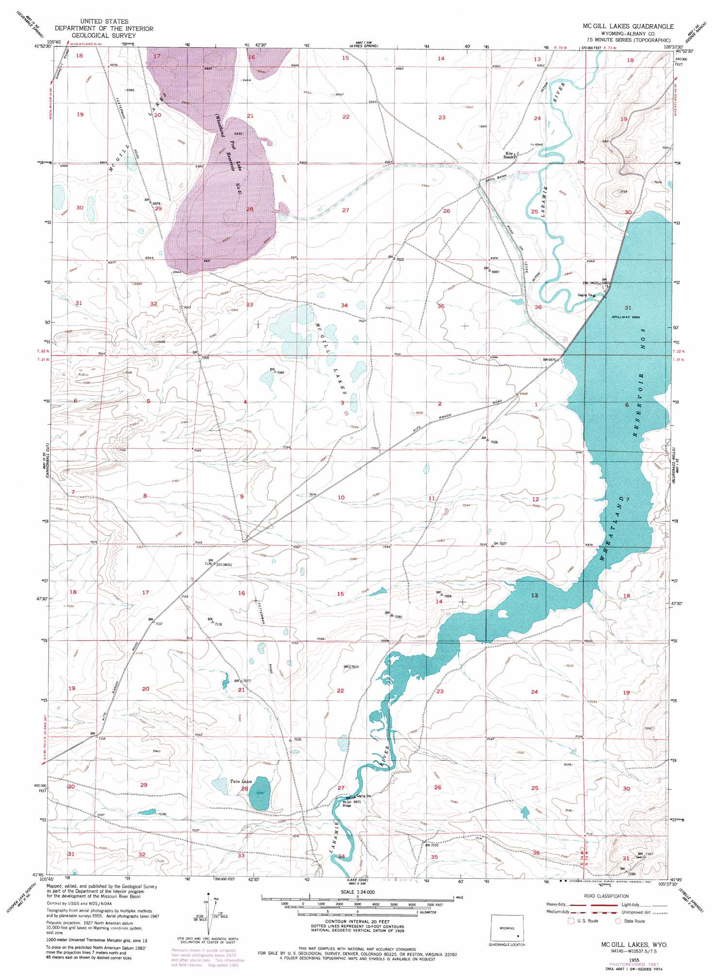
USGS Topo Quad 41105g6 - 1:24,000 scale
| Topo Map Name: | Mcgill Lakes |
| USGS Topo Quad ID: | 41105g6 |
| Print Size: | ca. 21 1/4" wide x 27" high |
| Southeast Coordinates: | 41.75° N latitude / 105.625° W longitude |
| Map Center Coordinates: | 41.8125° N latitude / 105.6875° W longitude |
| U.S. State: | WY |
| Filename: | o41105g6.jpg |
| Download Map JPG Image: | Mcgill Lakes topo map 1:24,000 scale |
| Map Type: | Topographic |
| Topo Series: | 7.5´ |
| Map Scale: | 1:24,000 |
| Source of Map Images: | United States Geological Survey (USGS) |
| Alternate Map Versions: |
Mc Gill Lakes WY 1955, updated 1956 Download PDF Buy paper map Mc Gill Lakes WY 1955, updated 1982 Download PDF Buy paper map McGill Lakes WY 2012 Download PDF Buy paper map McGill Lakes WY 2015 Download PDF Buy paper map |
1:24,000 Topo Quads surrounding Mcgill Lakes
Greasewood Knoll |
Boot Heel Se |
Pinto Creek |
Garrett |
Davidson Flats |
Pine Tree Ridge |
Sevenmile Spring |
Ayres Spring |
Dodge Ranch |
Bull Camp Peak |
Wilcox |
Cannonball Cut |
Mcgill Lakes |
Bluegrass Wells |
Guide Rock |
Rock River |
Cooper Lake North |
Lake Ione |
Sybille Springs |
Sheep Rock |
Big Judson |
Cooper Lake South |
Bosler |
Bosler Se |
Baldy Mountain |
> Back to 41105e1 at 1:100,000 scale
> Back to 41104a1 at 1:250,000 scale
> Back to U.S. Topo Maps home
Mcgill Lakes topo map: Gazetteer
Mcgill Lakes: Bridges
McGill Bridge elevation 2124m 6968′Mcgill Lakes: Dams
Wheatland Number 2 Dam elevation 2122m 6961′Mcgill Lakes: Lakes
McGill Lakes elevation 2128m 6981′Twin Lakes elevation 2132m 6994′
Mcgill Lakes: Reservoirs
Post Lake elevation 2118m 6948′Wheatland Reservoir Number 2 elevation 2122m 6961′
Mcgill Lakes digital topo map on disk
Buy this Mcgill Lakes topo map showing relief, roads, GPS coordinates and other geographical features, as a high-resolution digital map file on DVD:
Eastern Wyoming & Western South Dakota
Buy digital topo maps: Eastern Wyoming & Western South Dakota