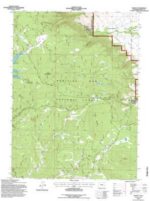
Albany Topo Map Wyoming
To zoom in, hover over the map of Albany
USGS Topo Quad 41106b2 - 1:24,000 scale
| Topo Map Name: | Albany |
| USGS Topo Quad ID: | 41106b2 |
| Print Size: | ca. 21 1/4" wide x 27" high |
| Southeast Coordinates: | 41.125° N latitude / 106.125° W longitude |
| Map Center Coordinates: | 41.1875° N latitude / 106.1875° W longitude |
| U.S. State: | WY |
| Filename: | o41106b2.jpg |
| Download Map JPG Image: | Albany topo map 1:24,000 scale |
| Map Type: | Topographic |
| Topo Series: | 7.5´ |
| Map Scale: | 1:24,000 |
| Source of Map Images: | United States Geological Survey (USGS) |
| Alternate Map Versions: |
Albany WY 1961, updated 1984 Download PDF Buy paper map Albany WY 1992, updated 1996 Download PDF Buy paper map Albany WY 2012 Download PDF Buy paper map Albany WY 2015 Download PDF Buy paper map |
| FStopo: | US Forest Service topo Albany is available: Download FStopo PDF Download FStopo TIF |
1:24,000 Topo Quads surrounding Albany
> Back to 41106a1 at 1:100,000 scale
> Back to 41106a1 at 1:250,000 scale
> Back to U.S. Topo Maps home
Albany topo map: Gazetteer
Albany: Mines
Hub Load Claim elevation 2739m 8986′Keystone Mine elevation 2860m 9383′
Lake Creek Mine elevation 2773m 9097′
Lake Resort Area Mine elevation 2668m 8753′
Albany: Populated Places
Albany elevation 2538m 8326′Deerwood elevation 2416m 7926′
Albany: Post Offices
Albany Post Office (historical) elevation 2538m 8326′Albany: Streams
Bird Creek elevation 2832m 9291′Curitan Creek elevation 2489m 8166′
Hay Creek elevation 2647m 8684′
Indian Creek elevation 2688m 8818′
June Creek elevation 2705m 8874′
Spring Creek elevation 2635m 8645′
Albany: Summits
Lake Mountain elevation 2968m 9737′Muddy Mountain elevation 2965m 9727′
Spruce Mountain elevation 3041m 9977′
Albany: Valleys
Hells Canyon elevation 2476m 8123′Albany digital topo map on disk
Buy this Albany topo map showing relief, roads, GPS coordinates and other geographical features, as a high-resolution digital map file on DVD:
Eastern Wyoming & Western South Dakota
Buy digital topo maps: Eastern Wyoming & Western South Dakota


