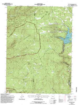
Keystone Topo Map Wyoming
To zoom in, hover over the map of Keystone
USGS Topo Quad 41106b3 - 1:24,000 scale
| Topo Map Name: | Keystone |
| USGS Topo Quad ID: | 41106b3 |
| Print Size: | ca. 21 1/4" wide x 27" high |
| Southeast Coordinates: | 41.125° N latitude / 106.25° W longitude |
| Map Center Coordinates: | 41.1875° N latitude / 106.3125° W longitude |
| U.S. State: | WY |
| Filename: | o41106b3.jpg |
| Download Map JPG Image: | Keystone topo map 1:24,000 scale |
| Map Type: | Topographic |
| Topo Series: | 7.5´ |
| Map Scale: | 1:24,000 |
| Source of Map Images: | United States Geological Survey (USGS) |
| Alternate Map Versions: |
Keystone WY 1961, updated 1963 Download PDF Buy paper map Keystone WY 1961, updated 1967 Download PDF Buy paper map Keystone WY 1961, updated 1984 Download PDF Buy paper map Keystone WY 1992, updated 1996 Download PDF Buy paper map Keystone WY 1992, updated 1996 Download PDF Buy paper map Keystone WY 2012 Download PDF Buy paper map Keystone WY 2015 Download PDF Buy paper map |
| FStopo: | US Forest Service topo Keystone is available: Download FStopo PDF Download FStopo TIF |
1:24,000 Topo Quads surrounding Keystone
> Back to 41106a1 at 1:100,000 scale
> Back to 41106a1 at 1:250,000 scale
> Back to U.S. Topo Maps home
Keystone topo map: Gazetteer
Keystone: Dams
Rob Roy Dam elevation 2852m 9356′Thompson Dam elevation 2878m 9442′
Keystone: Flats
Flume Creek Park elevation 2841m 9320′Keystone: Mines
Ak-sar-ben Group Mine elevation 2690m 8825′Albany Development Company Mine elevation 2948m 9671′
Albany Placer Mine elevation 2847m 9340′
Douglas Mine elevation 2860m 9383′
Duchess Mine elevation 2980m 9776′
Florence Mine elevation 2697m 8848′
Golden Key Mine elevation 2911m 9550′
Hamilton Group Mine elevation 2767m 9078′
Home Placers Mine elevation 2883m 9458′
Inversion Cabin Prospects elevation 2718m 8917′
Keystone Mine elevation 2717m 8914′
Maudem Group Mine elevation 2963m 9721′
Moores Gulch Mine elevation 2883m 9458′
Morning Star Claim elevation 2851m 9353′
New Rambler Mine elevation 2961m 9714′
Rambler Mine elevation 2961m 9714′
Sunset Mine elevation 2744m 9002′
Keystone: Populated Places
Jays Roost elevation 2965m 9727′Keystone elevation 2685m 8809′
Keystone: Reservoirs
Rob Roy Reservoir elevation 2852m 9356′Thompson Reservoir elevation 2878m 9442′
Keystone: Streams
Bear Creek elevation 2883m 9458′Dave Creek elevation 2883m 9458′
East Fork Devils Gate Creek elevation 2688m 8818′
Elk Creek elevation 2883m 9458′
Flume Creek elevation 2646m 8681′
Horse Creek elevation 2812m 9225′
Jim Creek elevation 2660m 8727′
Keystone Creek elevation 2704m 8871′
Lewis Creek elevation 2633m 8638′
Little Beaver Creek elevation 2673m 8769′
Rush Creek elevation 2883m 9458′
West Mullen Creek elevation 2807m 9209′
White Swan Creek elevation 2628m 8622′
Willow Creek elevation 2653m 8704′
Keystone: Valleys
Moores Gulch elevation 2883m 9458′Keystone digital topo map on disk
Buy this Keystone topo map showing relief, roads, GPS coordinates and other geographical features, as a high-resolution digital map file on DVD:
Eastern Wyoming & Western South Dakota
Buy digital topo maps: Eastern Wyoming & Western South Dakota


