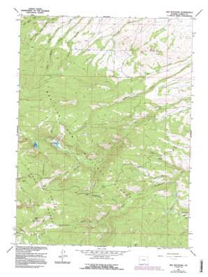
Red Mountain Topo Map Wyoming
To zoom in, hover over the map of Red Mountain
USGS Topo Quad 41106b8 - 1:24,000 scale
| Topo Map Name: | Red Mountain |
| USGS Topo Quad ID: | 41106b8 |
| Print Size: | ca. 21 1/4" wide x 27" high |
| Southeast Coordinates: | 41.125° N latitude / 106.875° W longitude |
| Map Center Coordinates: | 41.1875° N latitude / 106.9375° W longitude |
| U.S. State: | WY |
| Filename: | o41106b8.jpg |
| Download Map JPG Image: | Red Mountain topo map 1:24,000 scale |
| Map Type: | Topographic |
| Topo Series: | 7.5´ |
| Map Scale: | 1:24,000 |
| Source of Map Images: | United States Geological Survey (USGS) |
| Alternate Map Versions: |
Red Mountain WY 1961, updated 1963 Download PDF Buy paper map Red Mountain WY 1961, updated 1973 Download PDF Buy paper map Red Mountain WY 1961, updated 1983 Download PDF Buy paper map Red Mountain WY 1961, updated 1984 Download PDF Buy paper map Red Mountain WY 1961, updated 1995 Download PDF Buy paper map Red Mountain WY 1961, updated 1995 Download PDF Buy paper map Red Mountain WY 2012 Download PDF Buy paper map Red Mountain WY 2015 Download PDF Buy paper map |
| FStopo: | US Forest Service topo Red Mountain is available: Download FStopo PDF Download FStopo TIF |
1:24,000 Topo Quads surrounding Red Mountain
> Back to 41106a1 at 1:100,000 scale
> Back to 41106a1 at 1:250,000 scale
> Back to U.S. Topo Maps home
Red Mountain topo map: Gazetteer
Red Mountain: Dams
Cow Creek Lake Dam elevation 2697m 8848′Silver Lake Dam elevation 2795m 9169′
Red Mountain: Flats
Deadhorse Park elevation 2683m 8802′Red Mountain: Lakes
Silver Lake elevation 2800m 9186′Red Mountain: Mines
Battle Area Mine elevation 3024m 9921′Beulah Prospect elevation 3002m 9849′
Big Chief Group Mine elevation 2867m 9406′
Bonita Prospect Number One elevation 2634m 8641′
Bonita Prospect Number Two elevation 2634m 8641′
Continental Group Mine elevation 2698m 8851′
Copper Rock Group Mine elevation 2863m 9393′
D and L Group Mine elevation 2829m 9281′
Gertrude Mine elevation 2947m 9668′
Hidden Treasure Tunnel Mine elevation 2911m 9550′
Iron King Prospect elevation 2566m 8418′
Mohawk Prospect One elevation 2920m 9580′
Mohawk Prospect Two elevation 2689m 8822′
Newton Group Mine elevation 2700m 8858′
Portland and Hercules Mine elevation 3076m 10091′
Rambler Mine elevation 2864m 9396′
Umslopagus Group Mine elevation 3056m 10026′
Red Mountain: Parks
Dead Horse Park elevation 2628m 8622′Long Park elevation 3007m 9865′
Red Mountain: Populated Places
Battle (historical) elevation 3025m 9924′Elwood (historical) elevation 2607m 8553′
Red Mountain: Post Offices
Elwood Post Office (historical) elevation 2607m 8553′Red Mountain: Reservoirs
Cow Creek Lake elevation 2697m 8848′Cow Creek Reservoir elevation 2696m 8845′
Silver Lake elevation 2795m 9169′
Red Mountain: Streams
Beaver Creek elevation 2479m 8133′Bottle Creek elevation 2441m 8008′
Nellie Creek elevation 2609m 8559′
Willow Creek elevation 2481m 8139′
Red Mountain: Summits
Doane Peak elevation 3122m 10242′Green Mountain elevation 3129m 10265′
Red Mountain elevation 3200m 10498′
Red Mountain: Valleys
Hidden Treasure Gulch elevation 2617m 8585′Slaughterhouse Gulch elevation 2597m 8520′
Red Mountain digital topo map on disk
Buy this Red Mountain topo map showing relief, roads, GPS coordinates and other geographical features, as a high-resolution digital map file on DVD:
Eastern Wyoming & Western South Dakota
Buy digital topo maps: Eastern Wyoming & Western South Dakota


