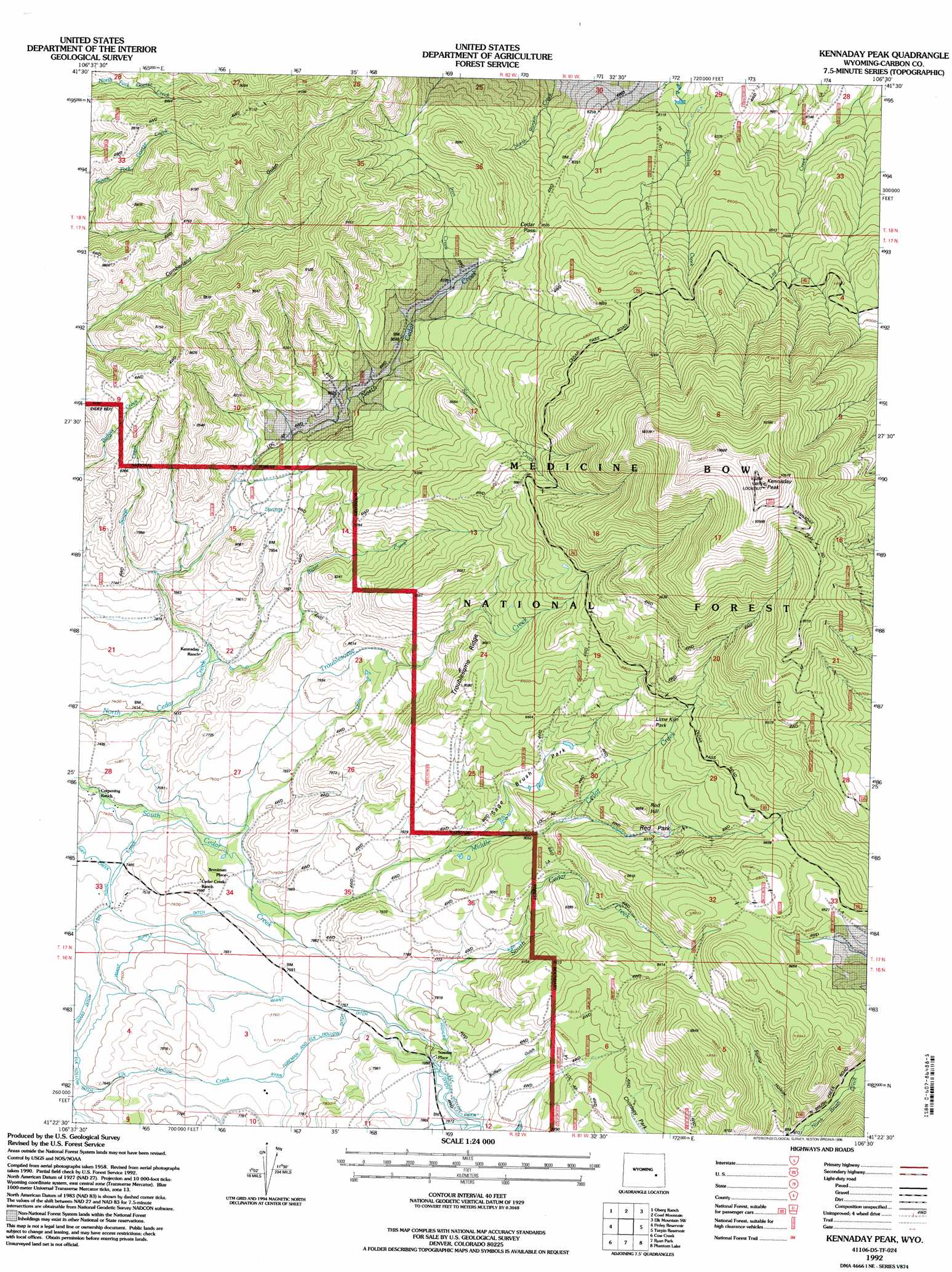
Kennaday Peak Topo Map Wyoming
To zoom in, hover over the map of Kennaday Peak
USGS Topo Quad 41106d5 - 1:24,000 scale
| Topo Map Name: | Kennaday Peak |
| USGS Topo Quad ID: | 41106d5 |
| Print Size: | ca. 21 1/4" wide x 27" high |
| Southeast Coordinates: | 41.375° N latitude / 106.5° W longitude |
| Map Center Coordinates: | 41.4375° N latitude / 106.5625° W longitude |
| U.S. State: | WY |
| Filename: | o41106d5.jpg |
| Download Map JPG Image: | Kennaday Peak topo map 1:24,000 scale |
| Map Type: | Topographic |
| Topo Series: | 7.5´ |
| Map Scale: | 1:24,000 |
| Source of Map Images: | United States Geological Survey (USGS) |
| Alternate Map Versions: |
Kennaday Peak WY 1961, updated 1963 Download PDF Buy paper map Kennaday Peak WY 1961, updated 1973 Download PDF Buy paper map Kennaday Peak WY 1961, updated 1984 Download PDF Buy paper map Kennaday Peak WY 1992, updated 1996 Download PDF Buy paper map Kennaday Peak WY 2012 Download PDF Buy paper map Kennaday Peak WY 2015 Download PDF Buy paper map |
| FStopo: | US Forest Service topo Kennaday Peak is available: Download FStopo PDF Download FStopo TIF |
1:24,000 Topo Quads surrounding Kennaday Peak
Meads |
Coal Bank Basin |
Rattlesnake Pass |
Elk Mountain |
T L Ranch |
Overland |
Oberg Ranch |
Coad Mountain |
Elk Mountain Sw |
White Rock Canyon |
Saratoga |
Finley Reservoir |
Kennaday Peak |
Turpin Reservoir |
Sand Lake |
Cow Creek Ranch |
Cow Creek |
Ryan Park |
Phantom Lake |
Medicine Bow Peak |
Encampment |
Gunst Reservoir |
Barcus Peak |
Overlook Hill |
Keystone |
> Back to 41106a1 at 1:100,000 scale
> Back to 41106a1 at 1:250,000 scale
> Back to U.S. Topo Maps home
Kennaday Peak topo map: Gazetteer
Kennaday Peak: Canals
Highland Ditch elevation 2394m 7854′Ryan Foreman and Elk Hollow Ditch elevation 2367m 7765′
Wiant Supply Ditch elevation 2317m 7601′
Kennaday Peak: Flats
Lime Kiln Park elevation 2630m 8628′Red Park elevation 2536m 8320′
Sage Brush Park elevation 2493m 8179′
Kennaday Peak: Gaps
Cedar Pass elevation 2607m 8553′Kennaday Peak: Ridges
Troublesome Ridge elevation 2619m 8592′Kennaday Peak: Streams
Bitter Creek elevation 2275m 7463′Hay Creek elevation 2247m 7372′
Iron Creek elevation 2514m 8248′
Middle Cedar Creek elevation 2298m 7539′
Savage Creek elevation 2311m 7582′
Sawmill Creek elevation 2458m 8064′
Troublesome Creek elevation 2279m 7477′
Kennaday Peak: Summits
Kennaday Peak elevation 3290m 10793′Red Hill elevation 2631m 8631′
Kennaday Peak: Trails
Troublesome Trail elevation 2539m 8330′Kennaday Peak digital topo map on disk
Buy this Kennaday Peak topo map showing relief, roads, GPS coordinates and other geographical features, as a high-resolution digital map file on DVD:
Eastern Wyoming & Western South Dakota
Buy digital topo maps: Eastern Wyoming & Western South Dakota