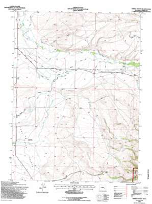
Oberg Ranch Topo Map Wyoming
To zoom in, hover over the map of Oberg Ranch
USGS Topo Quad 41106e6 - 1:24,000 scale
| Topo Map Name: | Oberg Ranch |
| USGS Topo Quad ID: | 41106e6 |
| Print Size: | ca. 21 1/4" wide x 27" high |
| Southeast Coordinates: | 41.5° N latitude / 106.625° W longitude |
| Map Center Coordinates: | 41.5625° N latitude / 106.6875° W longitude |
| U.S. State: | WY |
| Filename: | o41106e6.jpg |
| Download Map JPG Image: | Oberg Ranch topo map 1:24,000 scale |
| Map Type: | Topographic |
| Topo Series: | 7.5´ |
| Map Scale: | 1:24,000 |
| Source of Map Images: | United States Geological Survey (USGS) |
| Alternate Map Versions: |
Oberg Ranch WY 1955, updated 1957 Download PDF Buy paper map Oberg Ranch WY 1955, updated 1977 Download PDF Buy paper map Oberg Ranch WY 1955, updated 1984 Download PDF Buy paper map Oberg Ranch WY 1992, updated 1996 Download PDF Buy paper map Oberg Ranch WY 2012 Download PDF Buy paper map Oberg Ranch WY 2015 Download PDF Buy paper map |
| FStopo: | US Forest Service topo Oberg Ranch is available: Download FStopo PDF Download FStopo TIF |
1:24,000 Topo Quads surrounding Oberg Ranch
> Back to 41106e1 at 1:100,000 scale
> Back to 41106a1 at 1:250,000 scale
> Back to U.S. Topo Maps home
Oberg Ranch topo map: Gazetteer
Oberg Ranch: Canals
Allen Ditch elevation 2130m 6988′Ault Faussett Ditch elevation 2159m 7083′
Ault Highline Ditch elevation 2189m 7181′
Dodds and Allen Ditch elevation 2154m 7066′
Kincaid Ditch elevation 2147m 7043′
Nickel Scribner Ditch elevation 2122m 6961′
Shelton Allen Ditch elevation 2164m 7099′
Swan Ditch elevation 2104m 6902′
Oberg Ranch: Flats
Lake Creek Flats elevation 2089m 6853′Overland Flats elevation 2139m 7017′
Oberg Ranch: Streams
Dry Creek elevation 2086m 6843′Headquarters Creek elevation 2141m 7024′
Lemoine Creek elevation 2129m 6984′
North Fork Dry Creek elevation 2144m 7034′
Oberg Creek elevation 2178m 7145′
South Fork Dry Creek elevation 2144m 7034′
South Fork Lake Creek elevation 2111m 6925′
Oberg Ranch: Valleys
Sand Draw elevation 2138m 7014′Oberg Ranch digital topo map on disk
Buy this Oberg Ranch topo map showing relief, roads, GPS coordinates and other geographical features, as a high-resolution digital map file on DVD:
Eastern Wyoming & Western South Dakota
Buy digital topo maps: Eastern Wyoming & Western South Dakota


