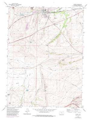
Hanna Topo Map Wyoming
To zoom in, hover over the map of Hanna
USGS Topo Quad 41106g5 - 1:24,000 scale
| Topo Map Name: | Hanna |
| USGS Topo Quad ID: | 41106g5 |
| Print Size: | ca. 21 1/4" wide x 27" high |
| Southeast Coordinates: | 41.75° N latitude / 106.5° W longitude |
| Map Center Coordinates: | 41.8125° N latitude / 106.5625° W longitude |
| U.S. State: | WY |
| Filename: | o41106g5.jpg |
| Download Map JPG Image: | Hanna topo map 1:24,000 scale |
| Map Type: | Topographic |
| Topo Series: | 7.5´ |
| Map Scale: | 1:24,000 |
| Source of Map Images: | United States Geological Survey (USGS) |
| Alternate Map Versions: |
Hanna WY 1971, updated 1975 Download PDF Buy paper map Hanna WY 1971, updated 1983 Download PDF Buy paper map Hanna WY 2012 Download PDF Buy paper map Hanna WY 2015 Download PDF Buy paper map |
1:24,000 Topo Quads surrounding Hanna
> Back to 41106e1 at 1:100,000 scale
> Back to 41106a1 at 1:250,000 scale
> Back to U.S. Topo Maps home
Hanna topo map: Gazetteer
Hanna: Dams
Kinney Dam elevation 2116m 6942′Stephenson Dam elevation 2061m 6761′
Hanna: Gaps
Quealy Gap elevation 2275m 7463′Wilson Gap elevation 2148m 7047′
Hanna: Mines
Hanna Number Five Mine elevation 2104m 6902′Hanna Number Four Mine elevation 2108m 6916′
Hanna Number Four-A Mine elevation 2065m 6774′
Hanna Number One Mine elevation 2075m 6807′
Hanna Number Six Mine elevation 2099m 6886′
Hanna Number Three Mine elevation 2074m 6804′
Hanna Number Three-and-a-half Mine elevation 2072m 6797′
Hanna Number Two Mine elevation 2071m 6794′
Laramie Energy Research Center Mine elevation 2107m 6912′
Rosebud Pit Number One Mine elevation 2097m 6879′
Hanna: Parks
Mine Disaster Memorial elevation 2092m 6863′Hanna: Populated Places
Hanna elevation 2078m 6817′Hanna: Ranges
Sand Hills elevation 2200m 7217′Hanna: Reservoirs
Hanna Reservoir elevation 2167m 7109′Kinney Reservoir elevation 2111m 6925′
Martinez Reservoir elevation 2134m 7001′
Stephenson Reservoir elevation 2061m 6761′
Stevies Lake elevation 2056m 6745′
Hanna: Ridges
Halleck Ridge elevation 2319m 7608′Wilson Ridge elevation 2183m 7162′
Hanna: Springs
Limburger Spring elevation 2156m 7073′Martinez Springs elevation 2148m 7047′
Quealy Spring elevation 2238m 7342′
Standpipe Spring elevation 2151m 7057′
Hanna: Streams
Dana Springs Creek elevation 2092m 6863′Jim Creek elevation 2080m 6824′
Kinney Creek elevation 2100m 6889′
Martinez Springs Creek elevation 2097m 6879′
Percy Creek elevation 2100m 6889′
Stink Creek elevation 2064m 6771′
Weed Creek elevation 2151m 7057′
Hanna: Valleys
Standpipe Draw elevation 2067m 6781′Hanna digital topo map on disk
Buy this Hanna topo map showing relief, roads, GPS coordinates and other geographical features, as a high-resolution digital map file on DVD:
Eastern Wyoming & Western South Dakota
Buy digital topo maps: Eastern Wyoming & Western South Dakota


