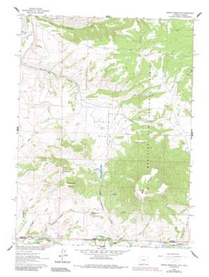
Grieve Reservoir Topo Map Wyoming
To zoom in, hover over the map of Grieve Reservoir
USGS Topo Quad 41107a3 - 1:24,000 scale
| Topo Map Name: | Grieve Reservoir |
| USGS Topo Quad ID: | 41107a3 |
| Print Size: | ca. 21 1/4" wide x 27" high |
| Southeast Coordinates: | 41° N latitude / 107.25° W longitude |
| Map Center Coordinates: | 41.0625° N latitude / 107.3125° W longitude |
| U.S. States: | WY, CO |
| Filename: | o41107a3.jpg |
| Download Map JPG Image: | Grieve Reservoir topo map 1:24,000 scale |
| Map Type: | Topographic |
| Topo Series: | 7.5´ |
| Map Scale: | 1:24,000 |
| Source of Map Images: | United States Geological Survey (USGS) |
| Alternate Map Versions: |
Grieve Reservoir WY 1961, updated 1963 Download PDF Buy paper map Grieve Reservoir WY 1961, updated 1984 Download PDF Buy paper map Grieve Reservoir WY 2012 Download PDF Buy paper map Grieve Reservoir WY 2015 Download PDF Buy paper map |
| FStopo: | US Forest Service topo Grieve Reservoir is available: Download FStopo PDF Download FStopo TIF |
1:24,000 Topo Quads surrounding Grieve Reservoir
> Back to 41107a1 at 1:100,000 scale
> Back to 41106a1 at 1:250,000 scale
> Back to U.S. Topo Maps home
Grieve Reservoir topo map: Gazetteer
Grieve Reservoir: Basins
Reader Basin elevation 2159m 7083′Grieve Reservoir: Dams
Highline Dam elevation 2165m 7103′Grieve Reservoir: Mines
Linde Opening Mine elevation 2089m 6853′Lucksinger Opening Mine elevation 2154m 7066′
Grieve Reservoir: Reservoirs
Grieve Reservoir elevation 2165m 7103′Highline Reservoir elevation 2165m 7103′
Grieve Reservoir: Streams
Fly Creek elevation 2020m 6627′Fly Creek elevation 2014m 6607′
Loco Creek elevation 2058m 6751′
Grieve Reservoir: Summits
Battle Mountain elevation 2773m 9097′Horse Mountain elevation 2437m 7995′
Little Horse Mountain elevation 2410m 7906′
Sugarloaf Mountain elevation 2203m 7227′
Grieve Reservoir: Valleys
East Sweetwater Gulch elevation 2016m 6614′McCagar Draw elevation 2001m 6564′
Rye Grass Gulch elevation 2002m 6568′
Spring Gulch elevation 2040m 6692′
West Sweetwater Gulch elevation 1997m 6551′
Grieve Reservoir digital topo map on disk
Buy this Grieve Reservoir topo map showing relief, roads, GPS coordinates and other geographical features, as a high-resolution digital map file on DVD:
Eastern Wyoming & Western South Dakota
Buy digital topo maps: Eastern Wyoming & Western South Dakota


