Garden Gulch Topo Map Wyoming
To zoom in, hover over the map of Garden Gulch
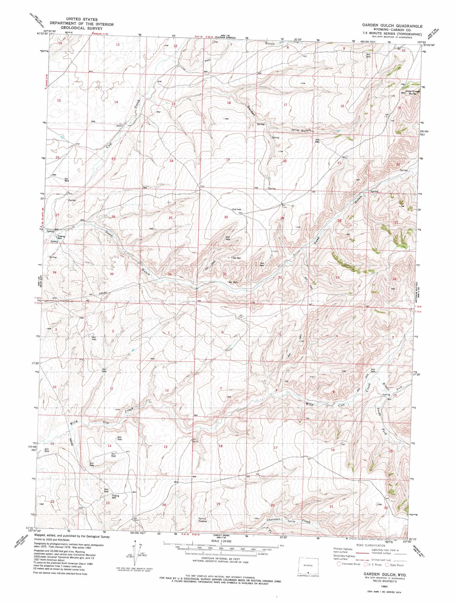
USGS Topo Quad 41107c5 - 1:24,000 scale
| Topo Map Name: | Garden Gulch |
| USGS Topo Quad ID: | 41107c5 |
| Print Size: | ca. 21 1/4" wide x 27" high |
| Southeast Coordinates: | 41.25° N latitude / 107.5° W longitude |
| Map Center Coordinates: | 41.3125° N latitude / 107.5625° W longitude |
| U.S. State: | WY |
| Filename: | o41107c5.jpg |
| Download Map JPG Image: | Garden Gulch topo map 1:24,000 scale |
| Map Type: | Topographic |
| Topo Series: | 7.5´ |
| Map Scale: | 1:24,000 |
| Source of Map Images: | United States Geological Survey (USGS) |
| Alternate Map Versions: |
Garden Gulch WY 1982, updated 1983 Download PDF Buy paper map Garden Gulch WY 2012 Download PDF Buy paper map Garden Gulch WY 2015 Download PDF Buy paper map |
1:24,000 Topo Quads surrounding Garden Gulch
High Point |
Seaverson Reservoir |
Fillmore Ranch |
Bridge Pass |
La Marsh Creek West |
Duck Lake |
Doty Mountain |
Sulphur Springs |
Pole Gulch |
Pine Grove Ranch |
Mexican Flats |
Blue Gap |
Garden Gulch |
Ketchum Buttes |
Mccarty Ranch |
Flat Top Mountain |
Peach Orchard Flat |
Smiley Draw |
Browns Hill |
Tullis |
Poison Basin |
Baggs |
Dixon |
Savery |
Grieve Reservoir |
> Back to 41107a1 at 1:100,000 scale
> Back to 41106a1 at 1:250,000 scale
> Back to U.S. Topo Maps home
Garden Gulch topo map: Gazetteer
Garden Gulch: Streams
Middle Fork Wild Cow Creek elevation 2087m 6847′South Fork Cherokee Creek elevation 2073m 6801′
South Fork Wild Cow Creek elevation 2086m 6843′
Garden Gulch: Summits
Cow Creek Butte elevation 2398m 7867′Garden Gulch: Valleys
Deep Gulch elevation 2017m 6617′Garden Gulch elevation 2051m 6729′
Hay Gulch elevation 2062m 6765′
Garden Gulch digital topo map on disk
Buy this Garden Gulch topo map showing relief, roads, GPS coordinates and other geographical features, as a high-resolution digital map file on DVD:
Eastern Wyoming & Western South Dakota
Buy digital topo maps: Eastern Wyoming & Western South Dakota