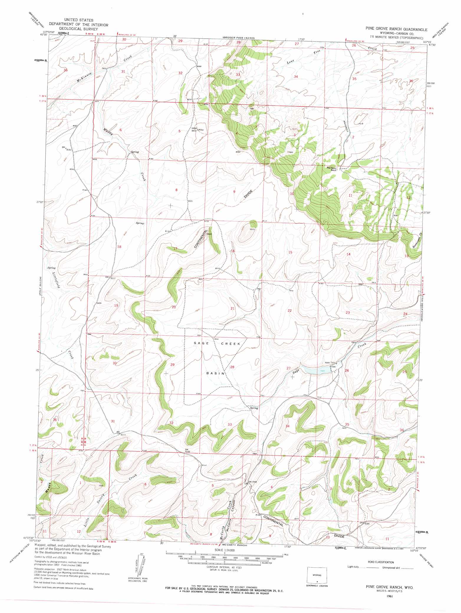
Pine Grove Ranch Topo Map Wyoming
To zoom in, hover over the map of Pine Grove Ranch
USGS Topo Quad 41107d3 - 1:24,000 scale
| Topo Map Name: | Pine Grove Ranch |
| USGS Topo Quad ID: | 41107d3 |
| Print Size: | ca. 21 1/4" wide x 27" high |
| Southeast Coordinates: | 41.375° N latitude / 107.25° W longitude |
| Map Center Coordinates: | 41.4375° N latitude / 107.3125° W longitude |
| U.S. State: | WY |
| Filename: | o41107d3.jpg |
| Download Map JPG Image: | Pine Grove Ranch topo map 1:24,000 scale |
| Map Type: | Topographic |
| Topo Series: | 7.5´ |
| Map Scale: | 1:24,000 |
| Source of Map Images: | United States Geological Survey (USGS) |
| Alternate Map Versions: |
Pine Grove Ranch WY 1961, updated 1963 Download PDF Buy paper map Pine Grove Ranch WY 2012 Download PDF Buy paper map Pine Grove Ranch WY 2015 Download PDF Buy paper map |
1:24,000 Topo Quads surrounding Pine Grove Ranch
Riner |
Separation Peak |
Coal Mine Ridge |
Smith Draw West |
Smith Draw East |
Fillmore Ranch |
Bridge Pass |
La Marsh Creek West |
La Marsh Creek East |
Kindt Reservoir |
Sulphur Springs |
Pole Gulch |
Pine Grove Ranch |
Middlewood Hill |
Jack Creek Reservoir |
Garden Gulch |
Ketchum Buttes |
Mccarty Ranch |
Divide Peak |
Sharp Hill |
Smiley Draw |
Browns Hill |
Tullis |
Singer Peak |
Bridger Peak |
> Back to 41107a1 at 1:100,000 scale
> Back to 41106a1 at 1:250,000 scale
> Back to U.S. Topo Maps home
Pine Grove Ranch topo map: Gazetteer
Pine Grove Ranch: Basins
Sage Creek Basin elevation 2378m 7801′Pine Grove Ranch: Dams
Rawlins Dam elevation 2343m 7687′Pine Grove Ranch: Reservoirs
Rawlins Reservoir elevation 2343m 7687′Pine Grove Ranch: Streams
Muddy Spring Creek elevation 2403m 7883′Pine Grove Ranch digital topo map on disk
Buy this Pine Grove Ranch topo map showing relief, roads, GPS coordinates and other geographical features, as a high-resolution digital map file on DVD:
Eastern Wyoming & Western South Dakota
Buy digital topo maps: Eastern Wyoming & Western South Dakota