Mexican Flats Nw Topo Map Wyoming
To zoom in, hover over the map of Mexican Flats Nw
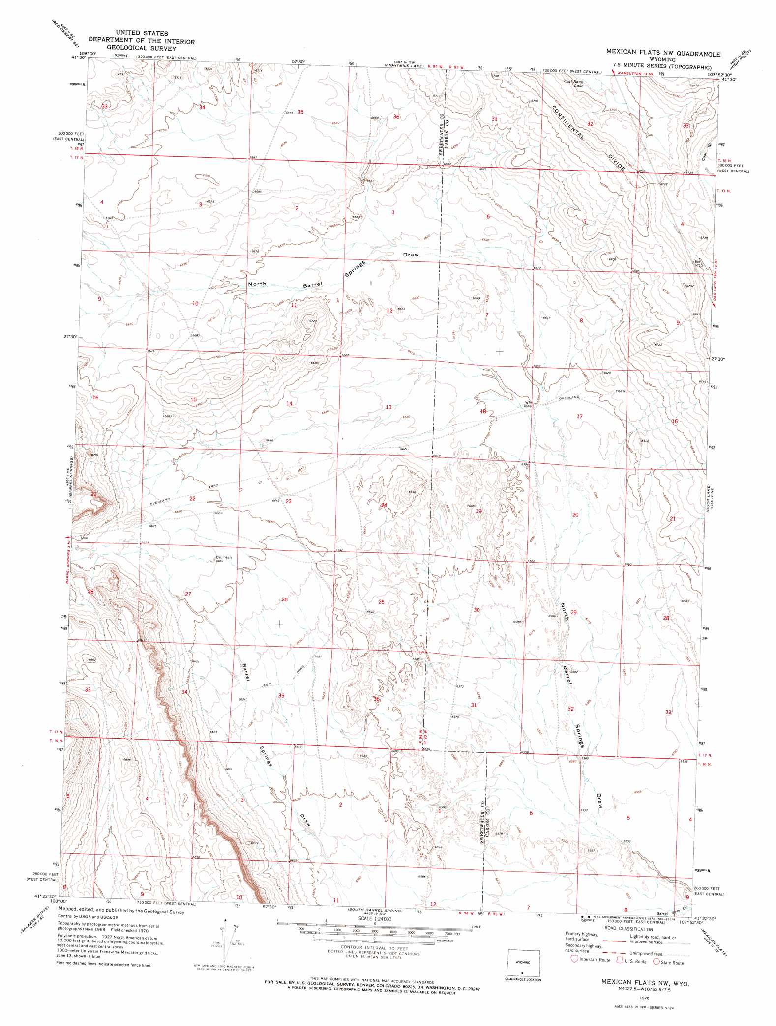
USGS Topo Quad 41107d8 - 1:24,000 scale
| Topo Map Name: | Mexican Flats Nw |
| USGS Topo Quad ID: | 41107d8 |
| Print Size: | ca. 21 1/4" wide x 27" high |
| Southeast Coordinates: | 41.375° N latitude / 107.875° W longitude |
| Map Center Coordinates: | 41.4375° N latitude / 107.9375° W longitude |
| U.S. State: | WY |
| Filename: | o41107d8.jpg |
| Download Map JPG Image: | Mexican Flats Nw topo map 1:24,000 scale |
| Map Type: | Topographic |
| Topo Series: | 7.5´ |
| Map Scale: | 1:24,000 |
| Source of Map Images: | United States Geological Survey (USGS) |
| Alternate Map Versions: |
Mexican Flats NW WY 1970, updated 1973 Download PDF Buy paper map Mexican Flats NW WY 2012 Download PDF Buy paper map Mexican Flats NW WY 2015 Download PDF Buy paper map |
1:24,000 Topo Quads surrounding Mexican Flats Nw
Red Desert Nw |
Red Desert |
Wamsutter |
Creston |
Creston Junction |
Red Desert Sw |
Red Desert Se |
Eightmile Lake |
High Point |
Seaverson Reservoir |
Haystack Flats |
Barrel Springs |
Mexican Flats Nw |
Duck Lake |
Doty Mountain |
Barrel Springs Sw |
Salazar Butte |
South Barrel Spring |
Mexican Flats |
Blue Gap |
Prehistoric Rim |
Powder Mountain Ne |
Dripping Rock Spring |
Flat Top Mountain |
Peach Orchard Flat |
> Back to 41107a1 at 1:100,000 scale
> Back to 41106a1 at 1:250,000 scale
> Back to U.S. Topo Maps home
No gazetteer data is available for the Mexican Flats Nw topo map sheet.
Mexican Flats Nw digital topo map on disk
Buy this Mexican Flats Nw topo map showing relief, roads, GPS coordinates and other geographical features, as a high-resolution digital map file on DVD:
Eastern Wyoming & Western South Dakota
Buy digital topo maps: Eastern Wyoming & Western South Dakota