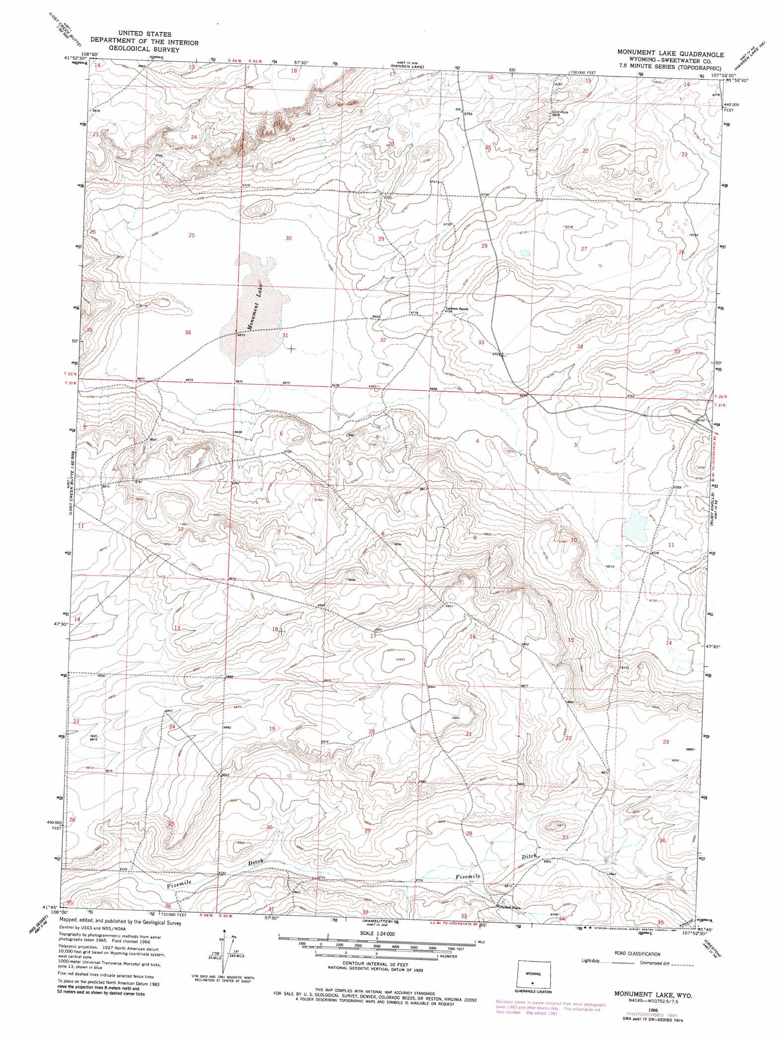
Monument Lake Topo Map Wyoming
To zoom in, hover over the map of Monument Lake
USGS Topo Quad 41107g8 - 1:24,000 scale
| Topo Map Name: | Monument Lake |
| USGS Topo Quad ID: | 41107g8 |
| Print Size: | ca. 21 1/4" wide x 27" high |
| Southeast Coordinates: | 41.75° N latitude / 107.875° W longitude |
| Map Center Coordinates: | 41.8125° N latitude / 107.9375° W longitude |
| U.S. State: | WY |
| Filename: | o41107g8.jpg |
| Download Map JPG Image: | Monument Lake topo map 1:24,000 scale |
| Map Type: | Topographic |
| Topo Series: | 7.5´ |
| Map Scale: | 1:24,000 |
| Source of Map Images: | United States Geological Survey (USGS) |
| Alternate Map Versions: |
Monument Lake WY 1966, updated 1969 Download PDF Buy paper map Monument Lake WY 1966, updated 1981 Download PDF Buy paper map Monument Lake WY 2012 Download PDF Buy paper map Monument Lake WY 2015 Download PDF Buy paper map |
1:24,000 Topo Quads surrounding Monument Lake
Lost Creek Lake |
Eagles Nest Draw |
Battle Spring |
Sooner Reservoir |
Chicken Spring |
Lost Creek Butte Nw |
Lost Creek Butte |
Hansen Lake |
Hansen Lake Ne |
Larsen Knoll |
Lost Creek Butte Sw |
Dennison Cap |
Monument Lake |
Ruby Knolls |
Jawbone Ranch |
Red Desert Nw |
Red Desert |
Wamsutter |
Creston |
Creston Junction |
Red Desert Sw |
Red Desert Se |
Eightmile Lake |
High Point |
Seaverson Reservoir |
> Back to 41107e1 at 1:100,000 scale
> Back to 41106a1 at 1:250,000 scale
> Back to U.S. Topo Maps home
Monument Lake topo map: Gazetteer
Monument Lake: Dams
Hadsell Dam elevation 2072m 6797′Monument Lake: Lakes
Monument Lake elevation 2035m 6676′Monument Lake: Mines
Five Mile Ditch Mine elevation 2092m 6863′Monument Lake: Reservoirs
Hadsell Reservoir elevation 2072m 6797′Monument Lake digital topo map on disk
Buy this Monument Lake topo map showing relief, roads, GPS coordinates and other geographical features, as a high-resolution digital map file on DVD:
Eastern Wyoming & Western South Dakota
Buy digital topo maps: Eastern Wyoming & Western South Dakota