Pine Butte Topo Map Wyoming
To zoom in, hover over the map of Pine Butte
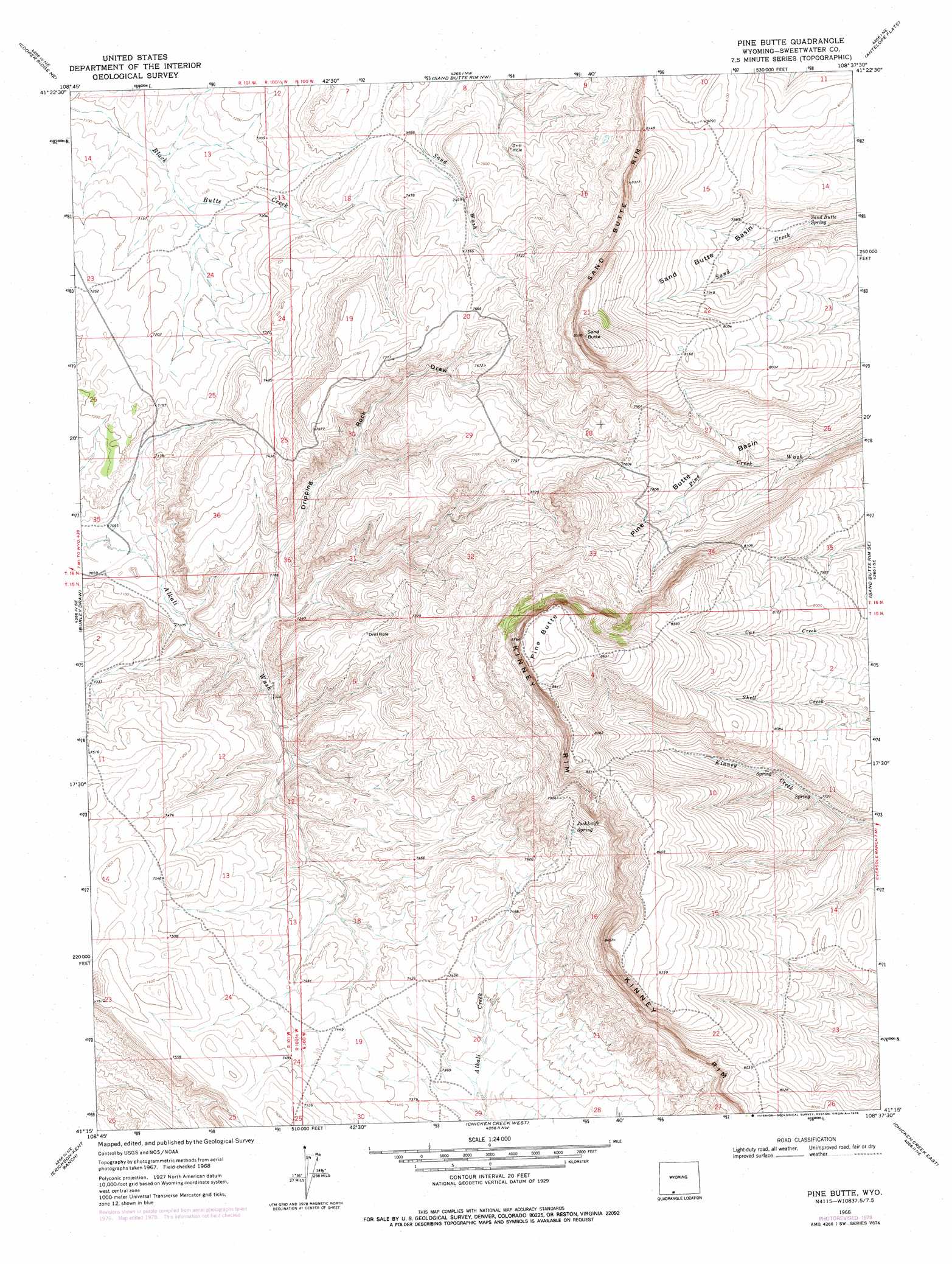
USGS Topo Quad 41108c6 - 1:24,000 scale
| Topo Map Name: | Pine Butte |
| USGS Topo Quad ID: | 41108c6 |
| Print Size: | ca. 21 1/4" wide x 27" high |
| Southeast Coordinates: | 41.25° N latitude / 108.625° W longitude |
| Map Center Coordinates: | 41.3125° N latitude / 108.6875° W longitude |
| U.S. State: | WY |
| Filename: | o41108c6.jpg |
| Download Map JPG Image: | Pine Butte topo map 1:24,000 scale |
| Map Type: | Topographic |
| Topo Series: | 7.5´ |
| Map Scale: | 1:24,000 |
| Source of Map Images: | United States Geological Survey (USGS) |
| Alternate Map Versions: |
Pine Butte WY 1968, updated 1972 Download PDF Buy paper map Pine Butte WY 1968, updated 1978 Download PDF Buy paper map Pine Butte WY 2012 Download PDF Buy paper map Pine Butte WY 2015 Download PDF Buy paper map |
1:24,000 Topo Quads surrounding Pine Butte
Point Of Rocks Sw |
Point Of Rocks Se |
Black Buttes |
Bitter Creek |
Table Rock |
Camel Rock |
Cooper Ridge Ne |
Sand Butte Rim Nw |
Antelope Flats |
Fort La Clede |
Mud Springs Ranch |
Burley Draw |
Pine Butte |
Sand Butte Rim Se |
Kinney Spring |
Potter Mountain |
Erickson-Kent Ranch |
Chicken Creek West |
Chicken Creek East |
Cow Creek Reservoir |
Four J Rim |
Scrivner Butte |
Chicken Creek Sw |
Chicken Creek Se |
Cow Creek Reservoir Sw |
> Back to 41108a1 at 1:100,000 scale
> Back to 41108a1 at 1:250,000 scale
> Back to U.S. Topo Maps home
Pine Butte topo map: Gazetteer
Pine Butte: Basins
Pine Butte Basin elevation 2343m 7687′Sand Butte Basin elevation 2410m 7906′
Pine Butte: Springs
Jackknife Spring elevation 2379m 7805′Sand Butte Spring elevation 2367m 7765′
Pine Butte: Summits
Pine Butte elevation 2665m 8743′Sand Butte elevation 2573m 8441′
Pine Butte: Valleys
Dripping Rock Draw elevation 2170m 7119′Pine Butte digital topo map on disk
Buy this Pine Butte topo map showing relief, roads, GPS coordinates and other geographical features, as a high-resolution digital map file on DVD: