Barrel Springs Topo Map Wyoming
To zoom in, hover over the map of Barrel Springs
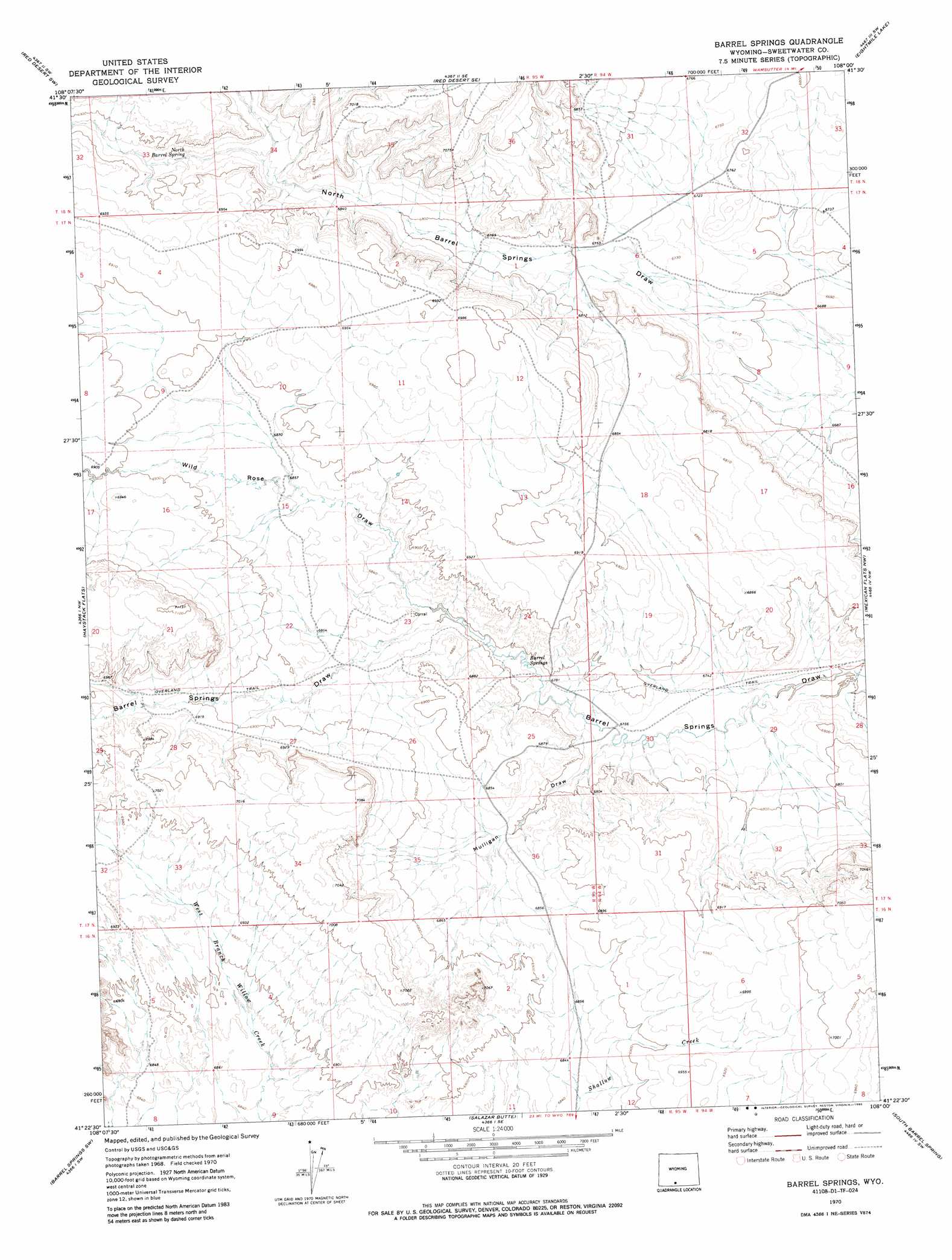
USGS Topo Quad 41108d1 - 1:24,000 scale
| Topo Map Name: | Barrel Springs |
| USGS Topo Quad ID: | 41108d1 |
| Print Size: | ca. 21 1/4" wide x 27" high |
| Southeast Coordinates: | 41.375° N latitude / 108° W longitude |
| Map Center Coordinates: | 41.4375° N latitude / 108.0625° W longitude |
| U.S. State: | WY |
| Filename: | o41108d1.jpg |
| Download Map JPG Image: | Barrel Springs topo map 1:24,000 scale |
| Map Type: | Topographic |
| Topo Series: | 7.5´ |
| Map Scale: | 1:24,000 |
| Source of Map Images: | United States Geological Survey (USGS) |
| Alternate Map Versions: |
Barrel Springs WY 1970, updated 1985 Download PDF Buy paper map Barrel Springs WY 2012 Download PDF Buy paper map Barrel Springs WY 2015 Download PDF Buy paper map |
1:24,000 Topo Quads surrounding Barrel Springs
Tipton |
Red Desert Nw |
Red Desert |
Wamsutter |
Creston |
J O Dugway |
Red Desert Sw |
Red Desert Se |
Eightmile Lake |
High Point |
Fort La Clede Ne |
Haystack Flats |
Barrel Springs |
Mexican Flats Nw |
Duck Lake |
Manuel Gap |
Barrel Springs Sw |
Salazar Butte |
South Barrel Spring |
Mexican Flats |
Monument Valley |
Prehistoric Rim |
Powder Mountain Ne |
Dripping Rock Spring |
Flat Top Mountain |
> Back to 41108a1 at 1:100,000 scale
> Back to 41108a1 at 1:250,000 scale
> Back to U.S. Topo Maps home
Barrel Springs topo map: Gazetteer
Barrel Springs: Springs
Barrel Springs elevation 2069m 6788′North Barrel Spring elevation 2086m 6843′
Barrel Springs: Valleys
Mulligan Draw elevation 2056m 6745′Wild Rose Draw elevation 2074m 6804′
Barrel Springs digital topo map on disk
Buy this Barrel Springs topo map showing relief, roads, GPS coordinates and other geographical features, as a high-resolution digital map file on DVD: