Camel Rock Topo Map Wyoming
To zoom in, hover over the map of Camel Rock
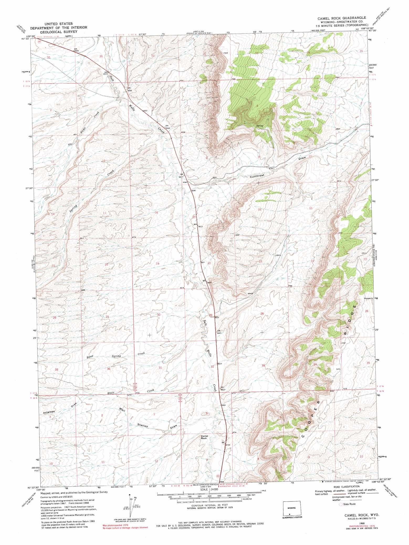
USGS Topo Quad 41108d8 - 1:24,000 scale
| Topo Map Name: | Camel Rock |
| USGS Topo Quad ID: | 41108d8 |
| Print Size: | ca. 21 1/4" wide x 27" high |
| Southeast Coordinates: | 41.375° N latitude / 108.875° W longitude |
| Map Center Coordinates: | 41.4375° N latitude / 108.9375° W longitude |
| U.S. State: | WY |
| Filename: | o41108d8.jpg |
| Download Map JPG Image: | Camel Rock topo map 1:24,000 scale |
| Map Type: | Topographic |
| Topo Series: | 7.5´ |
| Map Scale: | 1:24,000 |
| Source of Map Images: | United States Geological Survey (USGS) |
| Alternate Map Versions: |
Camel Rock WY 1968, updated 1972 Download PDF Buy paper map Camel Rock WY 1968, updated 1980 Download PDF Buy paper map Camel Rock WY 2012 Download PDF Buy paper map Camel Rock WY 2015 Download PDF Buy paper map |
1:24,000 Topo Quads surrounding Camel Rock
Reliance |
North Baxter |
Thayer Junction |
Point Of Rocks |
Bitter Creek Nw |
Rock Springs |
Baxter |
Point Of Rocks Sw |
Point Of Rocks Se |
Black Buttes |
Kappes Canyon |
Lion Bluffs |
Camel Rock |
Cooper Ridge Ne |
Sand Butte Rim Nw |
Earnest Butte |
South Baxter |
Mud Springs Ranch |
Burley Draw |
Pine Butte |
Maxon Ranch |
Titsworth Gap |
Potter Mountain |
Erickson-Kent Ranch |
Chicken Creek West |
> Back to 41108a1 at 1:100,000 scale
> Back to 41108a1 at 1:250,000 scale
> Back to U.S. Topo Maps home
Camel Rock topo map: Gazetteer
Camel Rock: Ridges
Cooper Ridge elevation 2292m 7519′Camel Rock: Streams
Blair Creek elevation 2016m 6614′No Name Creek elevation 1983m 6505′
Snow Spring Creek elevation 2013m 6604′
Spring Creek elevation 1995m 6545′
Camel Rock: Summits
Camel Rock elevation 2050m 6725′Camel Rock: Valleys
Antelope Draw elevation 2098m 6883′Cutthroat Draw elevation 2008m 6587′
Station Draw elevation 2019m 6624′
Camel Rock digital topo map on disk
Buy this Camel Rock topo map showing relief, roads, GPS coordinates and other geographical features, as a high-resolution digital map file on DVD: