Bitter Creek Nw Topo Map Wyoming
To zoom in, hover over the map of Bitter Creek Nw
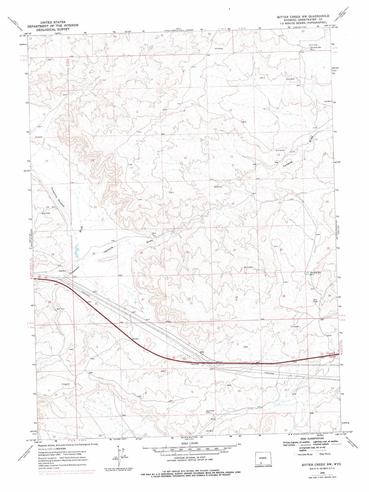
USGS Topo Quad 41108f6 - 1:24,000 scale
| Topo Map Name: | Bitter Creek Nw |
| USGS Topo Quad ID: | 41108f6 |
| Print Size: | ca. 21 1/4" wide x 27" high |
| Southeast Coordinates: | 41.625° N latitude / 108.625° W longitude |
| Map Center Coordinates: | 41.6875° N latitude / 108.6875° W longitude |
| U.S. State: | WY |
| Filename: | o41108f6.jpg |
| Download Map JPG Image: | Bitter Creek Nw topo map 1:24,000 scale |
| Map Type: | Topographic |
| Topo Series: | 7.5´ |
| Map Scale: | 1:24,000 |
| Source of Map Images: | United States Geological Survey (USGS) |
| Alternate Map Versions: |
Bitter Creek NW WY 1968, updated 1971 Download PDF Buy paper map Bitter Creek NW WY 1968, updated 1978 Download PDF Buy paper map Bitter Creek NW WY 2012 Download PDF Buy paper map Bitter Creek NW WY 2015 Download PDF Buy paper map |
1:24,000 Topo Quads surrounding Bitter Creek Nw
Steamboat Mountain |
Black Rock North |
Black Rock Flat West |
Black Rock Flat East |
Red Lake |
South Superior |
Black Rock South |
Tenmile Rim |
Twelvemile Well |
Red Lake Sw |
Thayer Junction |
Point Of Rocks |
Bitter Creek Nw |
Bitter Creek Ne |
Desert Springs |
Point Of Rocks Sw |
Point Of Rocks Se |
Black Buttes |
Bitter Creek |
Table Rock |
Camel Rock |
Cooper Ridge Ne |
Sand Butte Rim Nw |
Antelope Flats |
Fort La Clede |
> Back to 41108e1 at 1:100,000 scale
> Back to 41108a1 at 1:250,000 scale
> Back to U.S. Topo Maps home
Bitter Creek Nw topo map: Gazetteer
Bitter Creek Nw: Flats
Threemile Meadow elevation 2003m 6571′Bitter Creek Nw: Reservoirs
Tenmile Reservoir Number 3 elevation 2091m 6860′Tenmile Reservoir Number 4 elevation 2124m 6968′
Bitter Creek Nw: Valleys
Tenmile Draw elevation 1992m 6535′Bitter Creek Nw digital topo map on disk
Buy this Bitter Creek Nw topo map showing relief, roads, GPS coordinates and other geographical features, as a high-resolution digital map file on DVD: