Haystack Buttes South Topo Map Wyoming
To zoom in, hover over the map of Haystack Buttes South
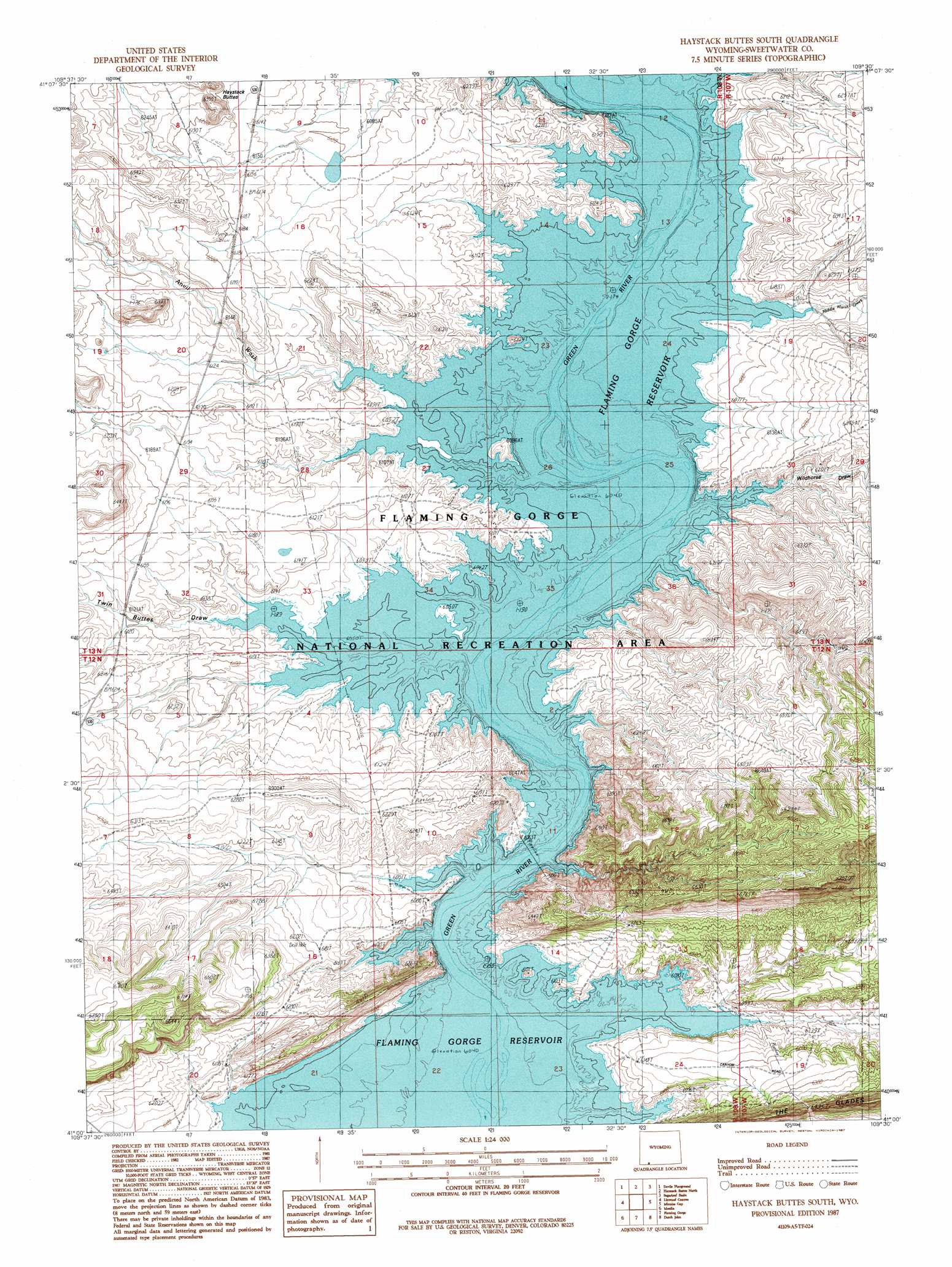
USGS Topo Quad 41109a5 - 1:24,000 scale
| Topo Map Name: | Haystack Buttes South |
| USGS Topo Quad ID: | 41109a5 |
| Print Size: | ca. 21 1/4" wide x 27" high |
| Southeast Coordinates: | 41° N latitude / 109.5° W longitude |
| Map Center Coordinates: | 41.0625° N latitude / 109.5625° W longitude |
| U.S. State: | WY |
| Filename: | o41109a5.jpg |
| Download Map JPG Image: | Haystack Buttes South topo map 1:24,000 scale |
| Map Type: | Topographic |
| Topo Series: | 7.5´ |
| Map Scale: | 1:24,000 |
| Source of Map Images: | United States Geological Survey (USGS) |
| Alternate Map Versions: |
Haystack Buttes South WY 1987, updated 1987 Download PDF Buy paper map Haystack Buttes South WY 1996, updated 1999 Download PDF Buy paper map Haystack Buttes South WY 2012 Download PDF Buy paper map Haystack Buttes South WY 2015 Download PDF Buy paper map |
| FStopo: | US Forest Service topo Haystack Buttes South is available: Download FStopo PDF Download FStopo TIF |
1:24,000 Topo Quads surrounding Haystack Buttes South
Winter Fat Reservoir |
Halfway Hollow West |
Halfway Hollow East |
Sage Creek Basin |
Firehole Basin |
Black Spring Reservoir |
Devils Playground |
Haystack Buttes North |
Sugarloaf Basin |
Big Ridge |
Antelope Wash |
Linwood Canyon |
Haystack Buttes South |
Minnies Gap |
Hawks Nest |
Jessen Butte |
Manila |
Flaming Gorge |
Dutch John |
Goslin Mountain |
Leidy Peak |
Elk Park |
East Park Reservoir |
Mount Lena |
Jackson Draw |
> Back to 41109a1 at 1:100,000 scale
> Back to 41108a1 at 1:250,000 scale
> Back to U.S. Topo Maps home
Haystack Buttes South topo map: Gazetteer
Haystack Buttes South: Mines
Green River Mine elevation 1868m 6128′Haystack Buttes South: Streams
Middle Marsh Creek elevation 1842m 6043′Haystack Buttes South: Valleys
Anvil Wash elevation 1842m 6043′Wildhorse Draw elevation 1842m 6043′
Haystack Buttes South digital topo map on disk
Buy this Haystack Buttes South topo map showing relief, roads, GPS coordinates and other geographical features, as a high-resolution digital map file on DVD: